
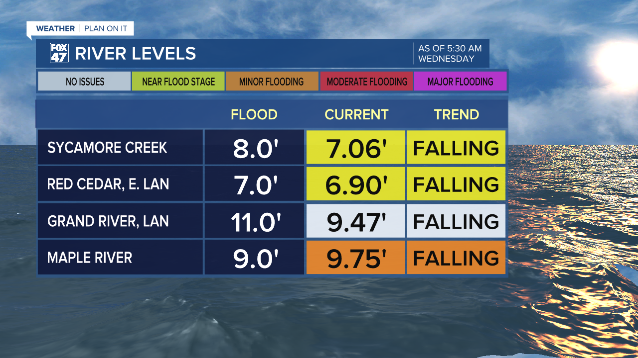
LANSING, Mich. — Following a dry and sunny Tuesday, local river sites impacted by flooding from this past weekend's showers and storms has improved as of this morning. The Red Cedar in East Lansing has dropped back into action stage last night with the Maple River still in minor flood stage as it gradually falls.
WATCH THE FULL FORECAST BELOW
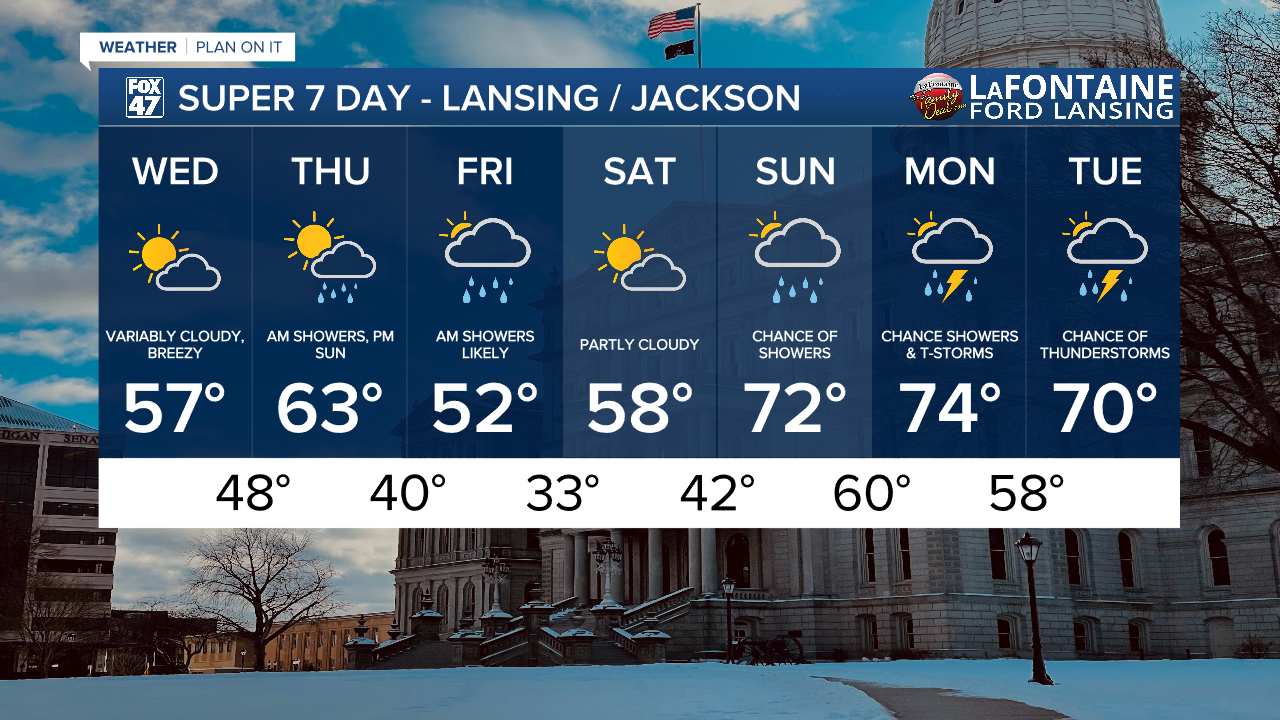
We will have another dry day today across our neighborhoods which will continue to aid in water receding at our local river sites. High temperatures today will warm back to normal in the mid to upper 50's as a warm front affiliated with our next system advances through our neighborhoods.
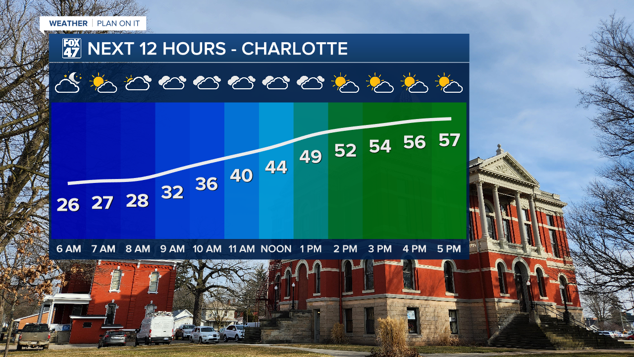
We can expected chilly conditions still for the morning hours with much better conditions in the afternoon with partly cloudy skies. Winds remain a bit strong today with gusts up to 30 mph.
Winds will remain strong ahead of the incoming cold front which will drive our next round of showers in the form of rain.
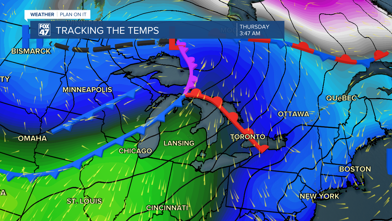
Occurring in the overnight hours, showers look to begin at around 3 AM Thursday morning and continue through the rest of the morning hours. No major impacts are expected with showers staying scattered during the event. Once the cold front passes, temperatures will fall with highs on Friday down to the mid to lower 50's.
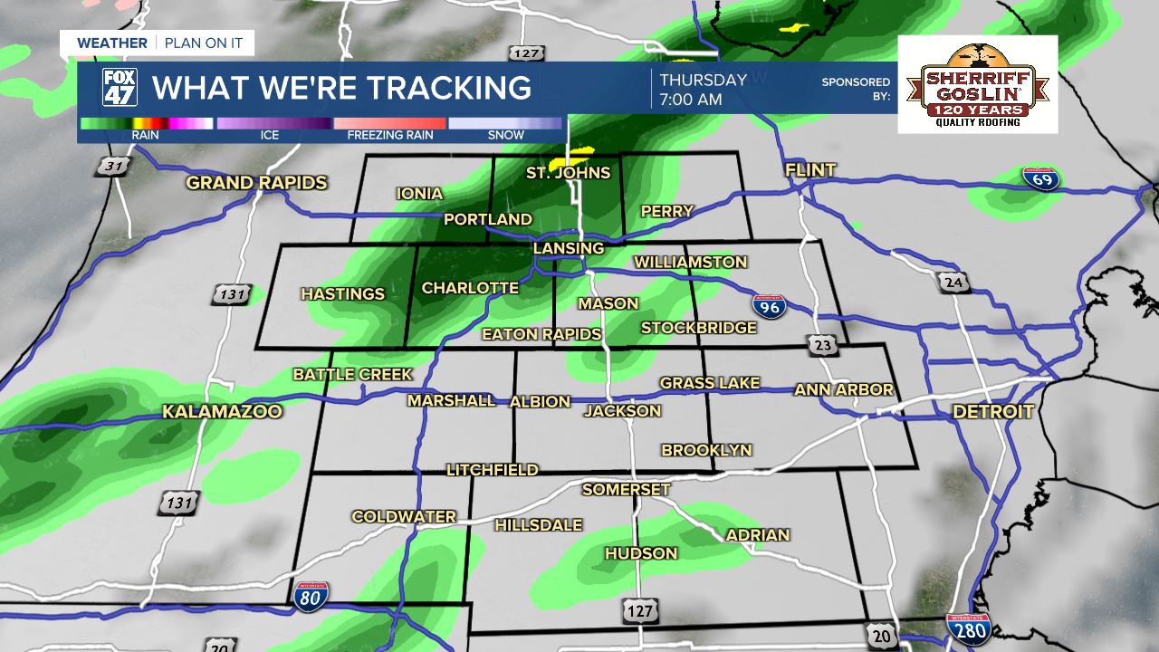
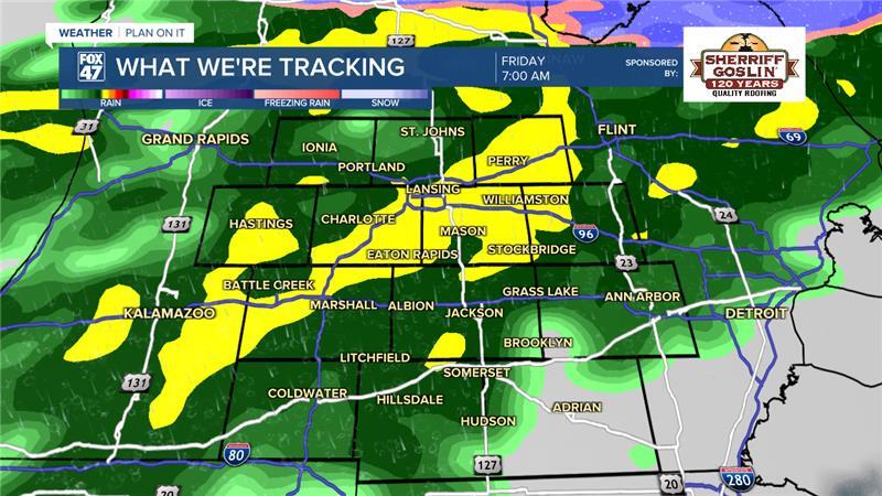
We are expecting a double header of rainfall with another disturbance driving more showers beginning overnight Thursday and into Friday morning. Showers begin around 11 PM at the state line in Hillsdale County. Showers track north and heavier rainfall rates are expected during the morning commute hours. No other major impacts are expected and we still aren't expecting any additional major flooding from these two rounds of showers. We could see .75 - 1" of rainfall across both days.
We will dry up heading into the weekend with highs in the upper 50's with more sunshine opportunities. Shower chances return Sunday as temperatures warm into the 70's. We can expected possible thunderstorms early next week on Monday and Tuesday. It is still a bit early to talk details with early next week's round of showers and storms, but we will be watching closely.
Have a great weather picture or video to share? Send it our way and we may feature it on-air or online!

