
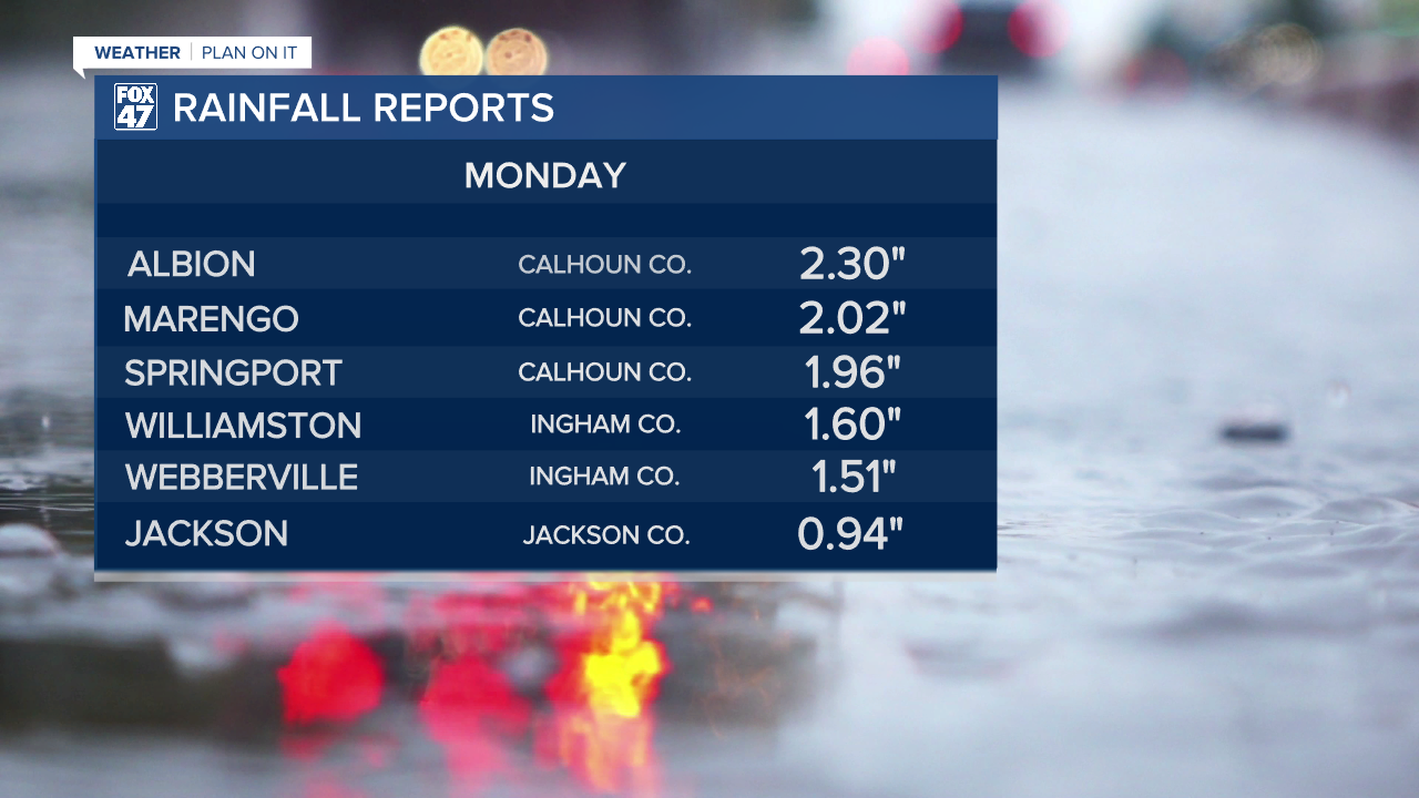
LANSING, Mich. — After a day with heavy rainfall across the state, we will be seeing more thunderstorm chances through Wednesday including our neighborhoods. Flooding occurred across portions of Metro Detroit and southeastern Michigan Monday. Portions of our neighborhoods also saw heavy rainfall Monday. Below are some rainfall totals across Mid-Michigan from Monday.
WATCH THE FULL FORECAST BELOW
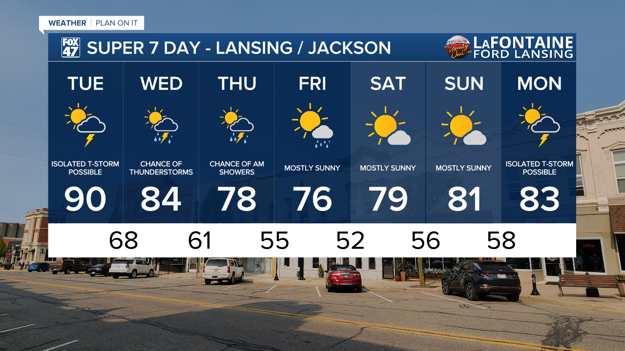
Heading into Tuesday, heat and humidity still dominate the forecast. However, comfortable conditions are on the way.
A Heat Advisory has been issued for Hillsdale County this morning. This advisory will go into effect at 12 PM and last through 9 PM Tuesday. Hillsdale could see air temps today in the lower 90's with heat index values into the mid 90's.

The rest of our neighborhoods today will also have a chance to see air temps reach 90 degrees with heat index values into the lower 90's. However, cloud cover today could hinder the arrival of this heat.
Late Tuesday night and into Wednesday a weakening frontal passage will sag south across our neighborhoods driving showers and storms. We could see storms producing damaging winds and heavy rainfall from 6 PM to 10 PM Wednesday evening with steady rainfall continuing through Thursday morning.
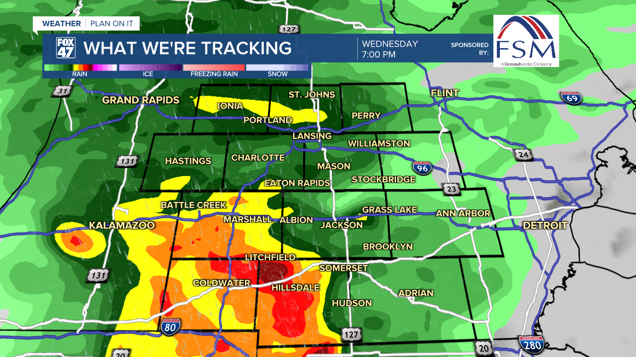
Once this frontal passage exits the region and takes the last of the showers out of the way, high pressure will build into our neighborhoods. This will allow for drier conditions and cooler temperatures. We will be getting into the upper 70's starting Thursday and lasting into the weekend with plenty of sunshine.
Want more FOX 47 News? Here's how you download our Roku app
You can also see the latest news from across our mid-Michigan neighborhoods by liking us on Facebook or following us on X.
