


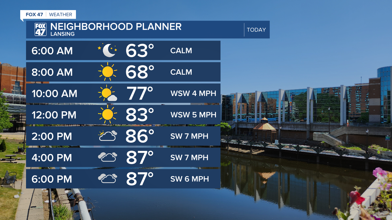
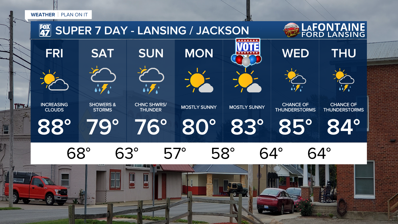
LANSING, Mich. — Temperatures soared into the upper 80's in Lansing Thursday with a few areas like Perry and Ionia reaching 90 degrees. We will see another day with high temperatures in the upper 80's. However, we will be lacking the sunshine seen all day Thursday.
An area of low pressure off to the west tracks east towards the region paired with an upper level shortwave and surface cold front that will drive returning showers and storms beginning Friday night. Throughout the daytime hours today, we will see gradually increasing cloud cover. By the time dinner arrives, it will looks a bit gloomy outside compared to what we've see over the past few days.
WATCH THE FULL FORECAST BELOW
Showers begin anytime after 9 PM Friday across our area and continues into Saturday and lasts all day and into Sunday. We are not working with a lot of shear or instability which really inhibits any severe impacts during this precipitation event. However, decent moisture could allow for heavier rainfall rates.
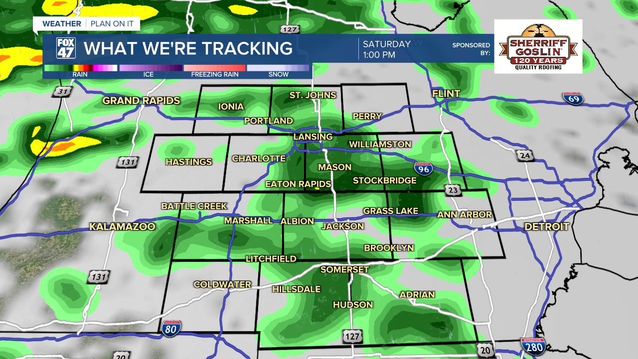
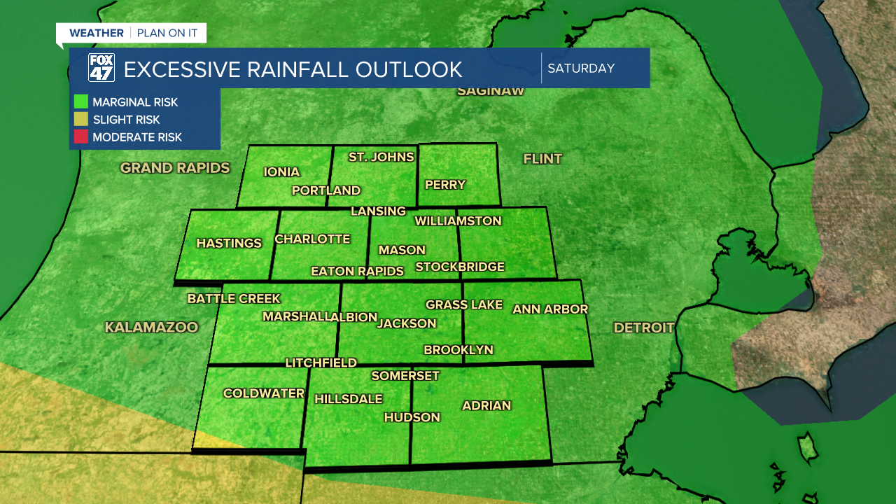
These heavy rainfall rates throughout the overnight hours and into the day Saturday could lead to localized ponding and flooding concerns across all of Mid-Michigan. The slight risk for excessive rainfall on Saturday inches closer to the most southern portions of Mid-Michigan at the state line. We will be monitoring closely for any updated as we head into the weekend. Be weather aware when heading out the door this weekend and remember not to drive through flooded roadways.
As the surface low weakens tracking east, the cold front out of the north will advance south through our area during the day Saturday with some stalling occurring once we reach Saturday evening and into Sunday with possibilities for showers and storms to linger into Sunday and possibly into Sunday afternoon. Similar impacts to Saturday would continue with cooler temperatures on the back end of the frontal passage.
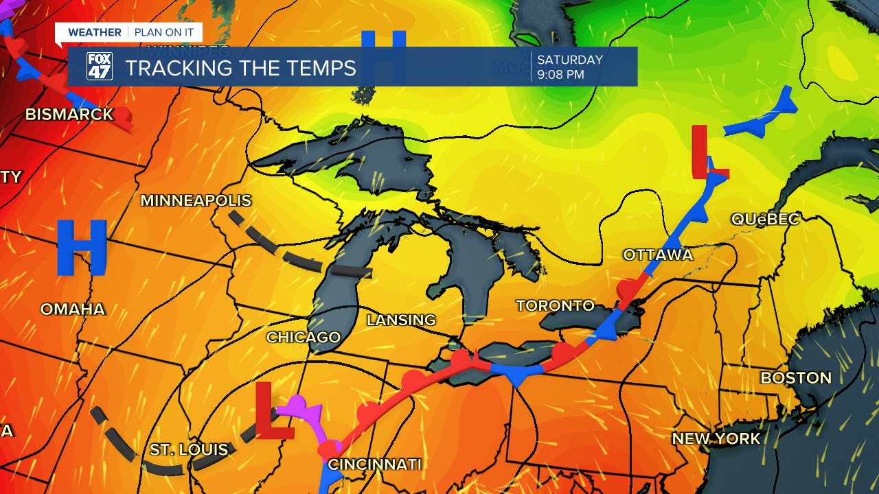
Temperatures fall after today into the 70's. Saturday brings highs in the upper 70's and Sunday continues to see a cooling trend into the mid 70's. These temperatures are below average for this time of year, however, we will quickly warm back into the 80's on Monday with returning sunshine that continues into Election Day. Returning chances for storms arrive midweek with some uncertainty to the timing and location of storms at the moment.
Have a great weather picture or video to share? Send it our way and we may feature it on-air or online!

