
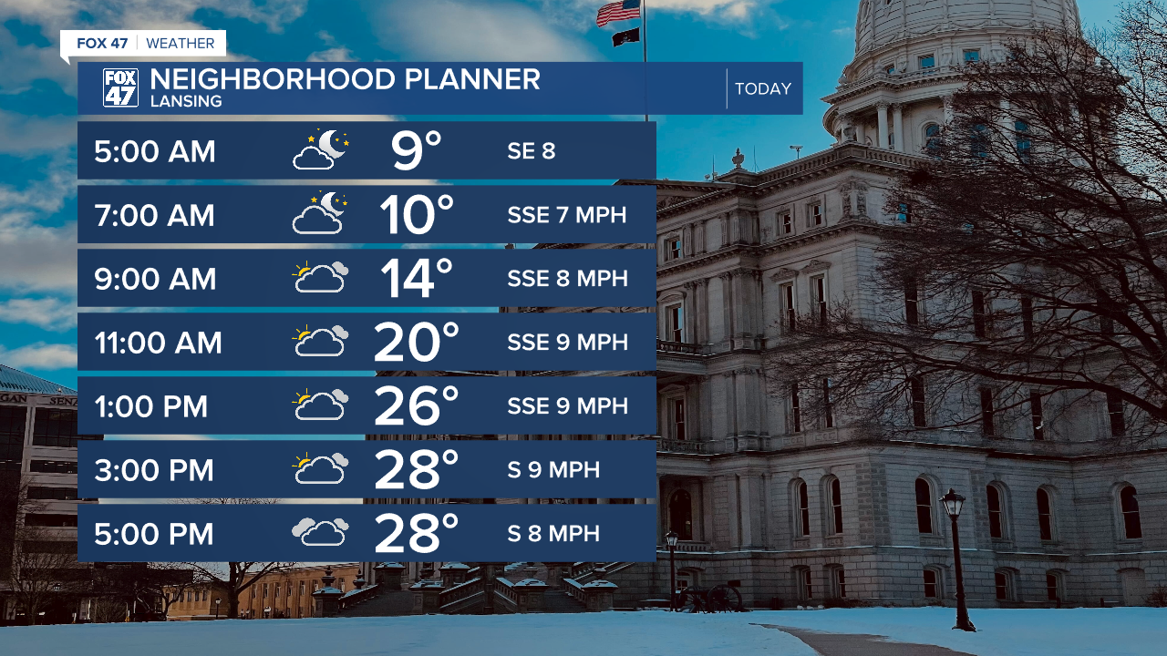
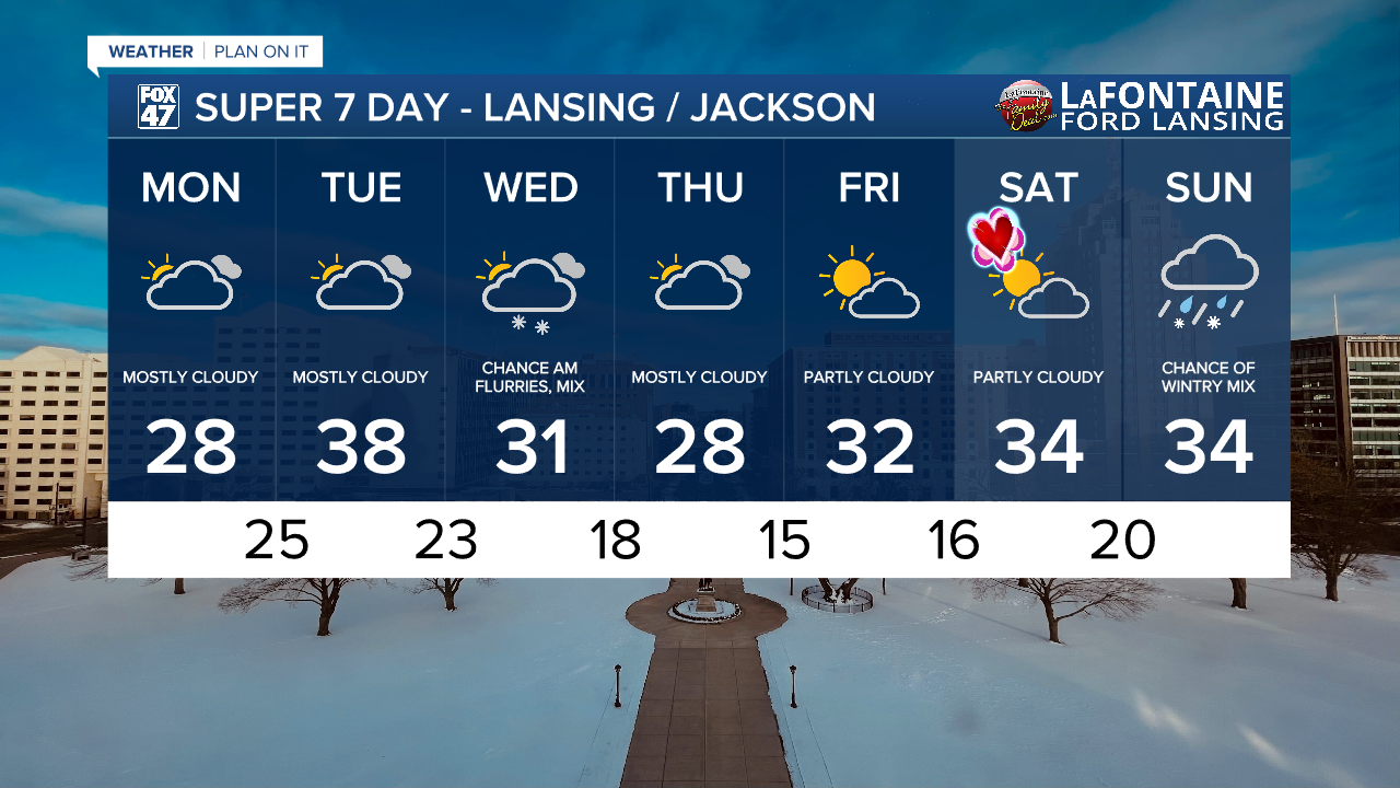
LANSING, Mich. — The weekend brought lots of sunshine to our neighborhoods, but as we start a new week, cloud cover will be returning to the forecast. Starting Monday, mostly cloudy skies will be favored across our neighborhoods with a few chances to see a peak of sun today. Temperatures will continue to warm with winds out of the south into the upper 20's.
WATCH THE FULL FORECAST BELOW
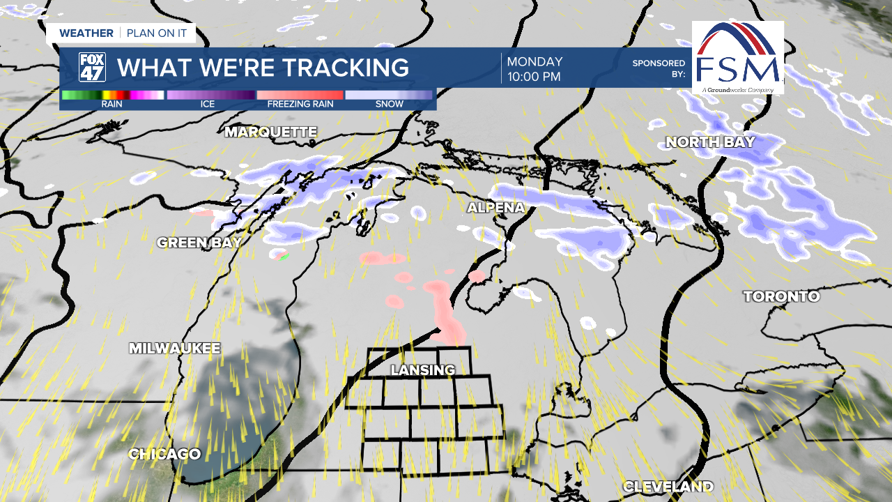
An incoming clipper system will bring snow and mixed precipitation in the form of freezing rain back to the state of Michigan. However, as this precipitation advances through late this evening and during the overnight hours, showers are focused primarily north of our neighborhoods.
There is a small chance that we could see some of the freezing rain clip our most northern neighborhoods north of I-96. However, this is a small chance where cloudy skies and dry conditions remain favored during the overnight hours. Temperatures overnight will continue to warm with winds out of the south and an incoming warm front. Temperatures on Tuesday are expected to warm back into the upper 30's. This is above average for this time of year.
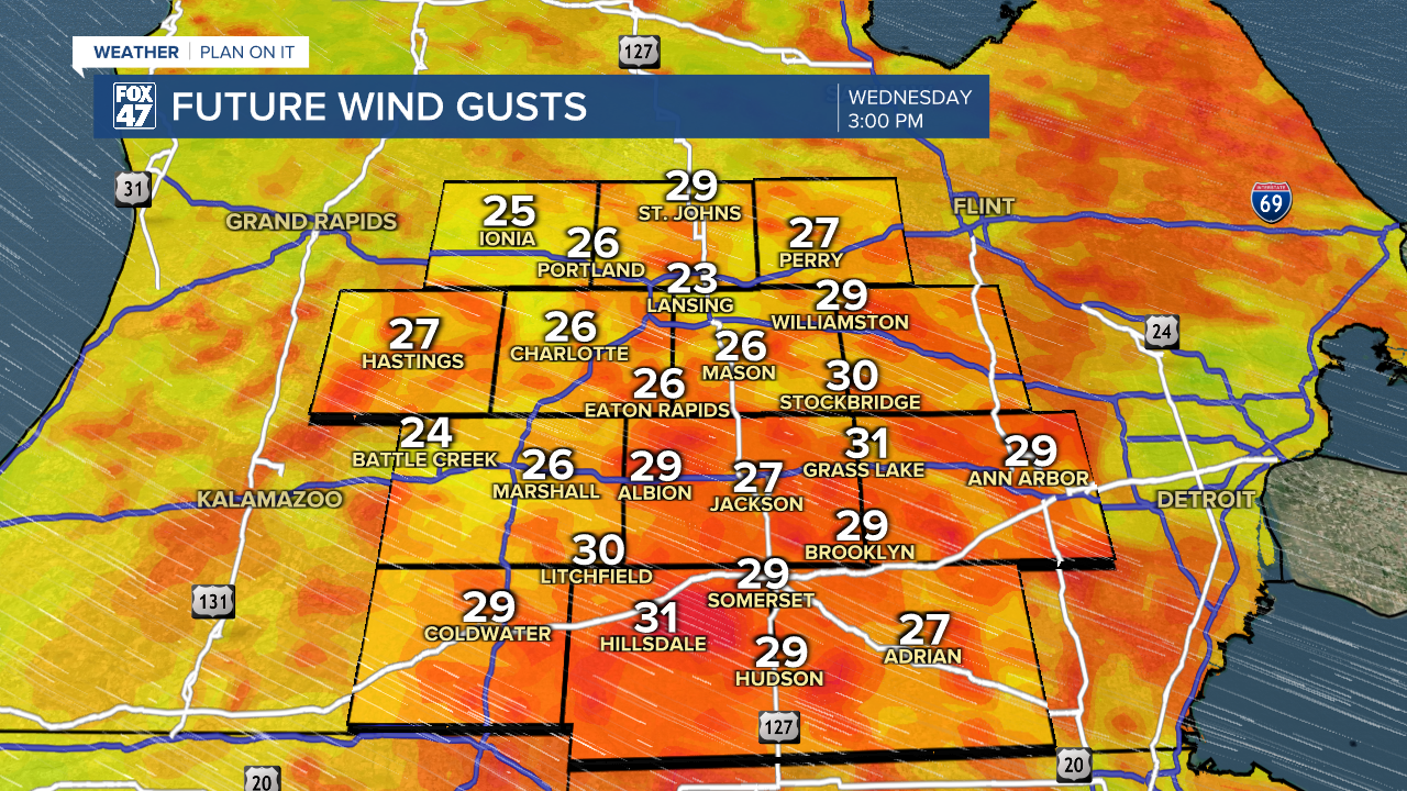
Once the clipper passes by Tuesday, winds will turn out of the northwest and pick up. Gusts could reach up to 30 mph during the daytime hours Wednesday. This isn't too crazy, however, we will see colder conditions with air temps back in the 20's for daytime highs during the mid to late week period.
At the same time, a few flurries and some potential freezing drizzle is possible during the Wednesday morning hours. Impacts to travel remain minuscule at the moment and we will continue to watch closely.

Temperatures will rebound heading into the weekend with partly cloudy skies favored Friday and Saturday (Valentine's Day). Temperature will warm back to freezing or just above freezing with some potential wintry mix arriving Sunday which could bring some more travel impacts. We will continue to monitor closely.
Want more FOX 47 News? Here's how you download our Roku app
You can also see the latest news from across our mid-Michigan neighborhoods by liking us on Facebook or following us on X.
