
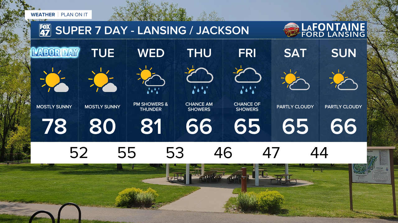
LANSING, Mich. — Following a pleasant weekend across our neighborhoods, sunshine and calm winds will continue for Labor Day today. High pressure continues to influence the forecast for the first half of this week. We can expect daytime highs today to reach the upper 70's.

WATCH THE FULL FORECAST BELOW
With winds continuing out of the southwest Tuesday and Wednesday, air temperatures have a better chance of reaching the lower 80's. We will stay comfortable, however, with humidity not being much of an issue.
Our pattern shifts late Wednesday as an incoming cold front drives our next best chance for showers. We could see precipitation begin as early as 8 PM on Wednesday evening and continue through the overnight hours and linger into Thursday morning.
We are not looking at any severe impacts at the moment. A few rumble of thunder do remain possible.

Once this frontal passage tracks east of Michigan, our winds will shift out of the north. This will allow for another cool down. Temperatures could possibly drop over 10 degrees between Wednesday's daytime high and Thursday's daytime high.
The trend of mid 60's daytime highs lasts through the rest of the week and throughout the weekend. There is a renewed chance for showers as we close the work week on Friday. We will continue to watch to see what impacts we could see closely.
Want more FOX 47 News? Here's how you download our Roku app
You can also see the latest news from across our mid-Michigan neighborhoods by liking us on Facebook or following us on X.
