
LANSING, Mich. — We have a pleasant day expected across our neighborhoods today as surface high pressure aids in keeping us dry with clear skies. We are starting the day cool with chances to step out and see some patchy frost as temps range in the mid to upper 30's this morning.
We will warm into the mid 60's this afternoon with weak winds beginning to turn out of the south. This pattern change will allow for a wet weekend.

WATCH THE FULL FORECAST BELOW
Starting overnight tonight, cloud cover will return as winds shift out of the south. Scattered showers could begin as early as 2 AM tonight and last through the Friday morning commute and into the mid to late morning hours. We are not expecting any major impacts as these showers advance through our neighborhoods. We will dry up for the afternoon hours with cloudy skies continuing on. We could see returning showers late Friday and into the overnight period.
Temperatures Friday will also ramp up ranging in the upper 60's. We will continue to warm into Saturday where we await an incoming cold front to drive showers and storms across the state. Wind gusts during the day could range up to 25 mph with showers and storms arriving as early as the evening period as early as 6 PM.
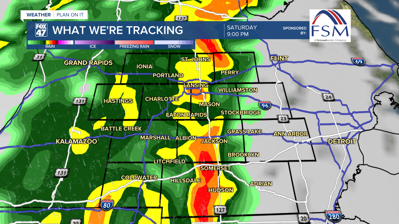
With southerly winds within this deep trough pattern, storms could produce heavy rainfall rates as well as wind gusts up to 45 mph. The timing for these impacts could last through the overnight hours and into Sunday morning as the cold frontal passage moves through and a secondary low tracks through the region.

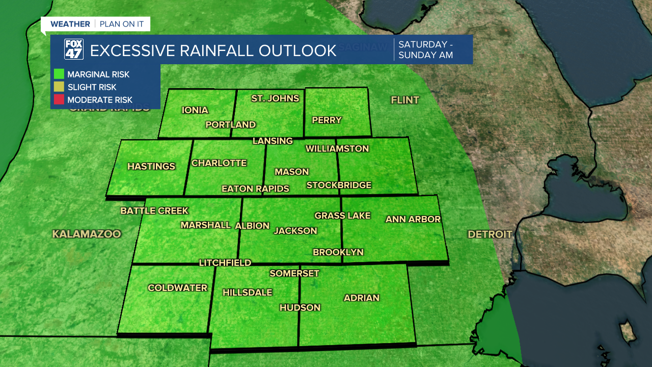
There is a marginal risk for excessive rainfall across our neighborhoods for some possible localized flooding in low lying areas and possible ponding on roadways. With conditions across the state being dry over the past two months, we aren't expecting river levels to be impacted too much by this heavy rainfall. We will continue to monitor for any changes as we dry up heading into a new week.
Monday brings chances to see some sunshine again with temperatures cooling into the lower 60's and possibly upper 50's as we continue through the week. We do have returning chances for precipitation midweek next week, but it is too early to talk details. We will keep an eye on it as our neighborhoods could really use the rainfall.

Want more FOX 47 News? Here's how you download our Roku app
You can also see the latest news from across our mid-Michigan neighborhoods by liking us on Facebook or following us on X.
