
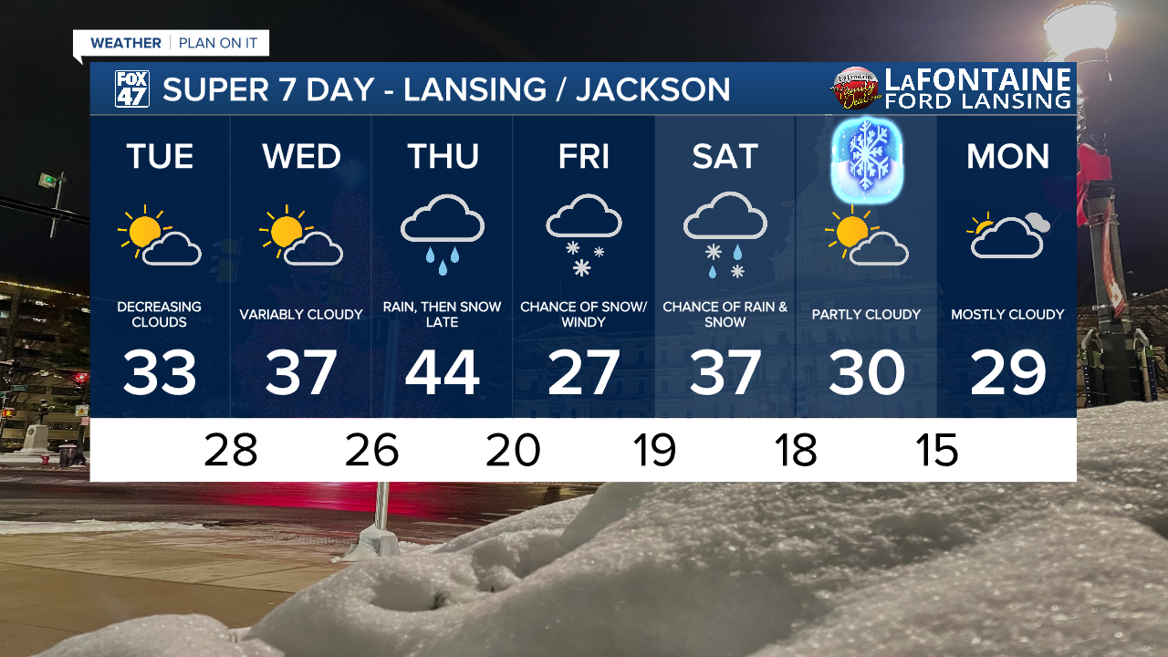
LANSING, Mich. — A gradual warm-up in our temperatures commences today across Mid-Michigan as winds continue out of the south Tuesday. We will see high temperatures warm around freezing today. This is much closer to where our average high is at for this time of year in the mid 30's.
Clouds will decrease throughout the morning hours with opportunities to see the sun this afternoon as well as Wednesday. Today is a much better day if needing to head outside. However, we will still remain chilly due to present winds dropping feels like temperatures into the mid to lower 20's.

WATCH THE FULL FORECAST BELOW
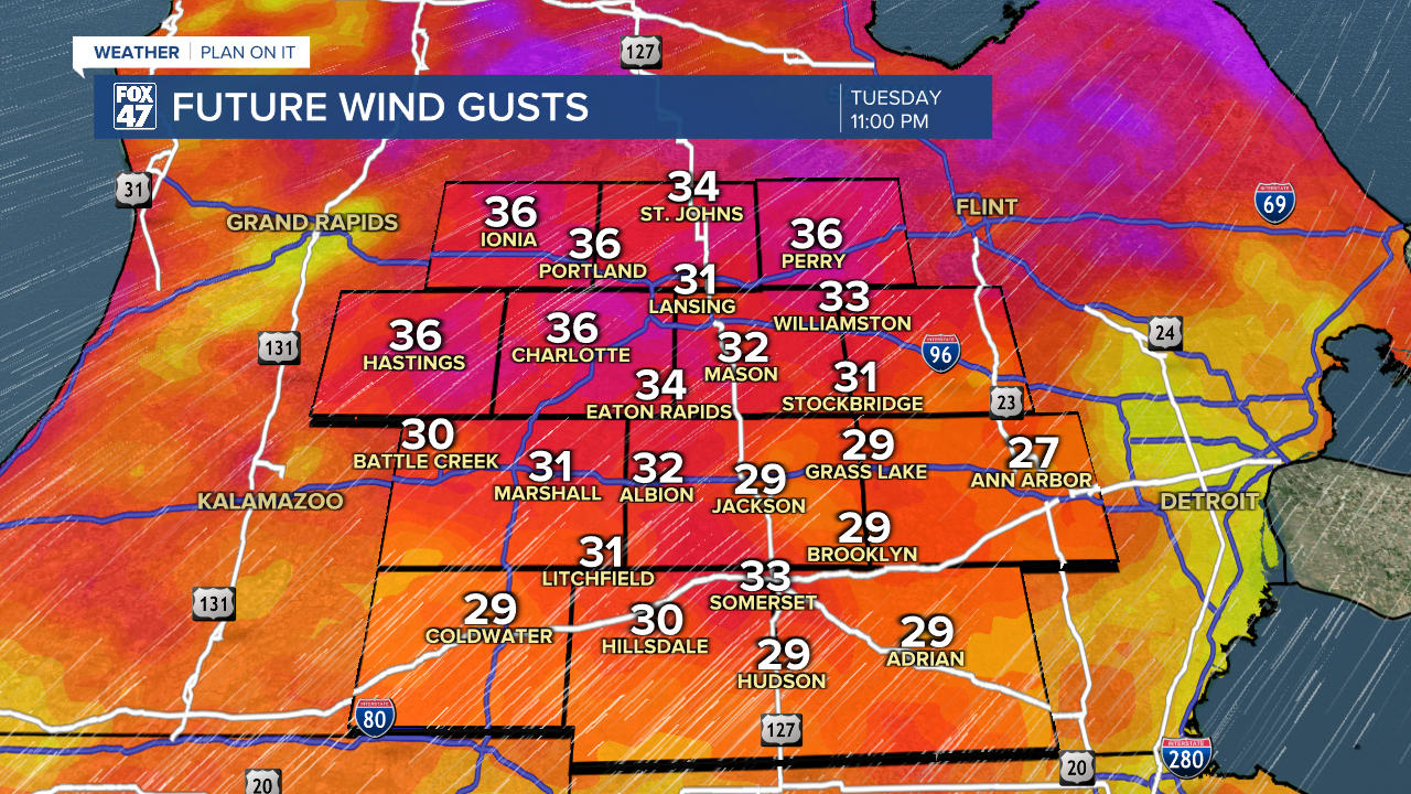
During the daytime hours, we could see winds gust from 20-25 mph. As we get further into the evening hours, winds will pick up ahead of an incoming cold front. Winds by around 11 PM this evening could range from 35-40 mph. This trend will weaken more into the overnight hours, but we could still breezy conditions as we start the day Wednesday.
The cold frontal passage will advance through our neighborhoods Wednesday morning. Our environment is quite dry and we are not expecting any precipitation as this system advances through. We will be dealing with mostly cloudy skies Wednesday morning with some clearing and weakening winds into the afternoon hours.
We will not have to wait too long, however, to see precipitation return to our neighborhoods. After a brief reprieve, with high pressure taking over the forecast Wednesday afternoon, our next system will bring scattered rain showers back to our neighborhoods Thursday with temperatures expected to warm into the 40's.
Rain begins as early as 7 AM in our neighborhoods scattered and lasts through the afternoon. Thursday evening brings a better chance to see widespread rain showers out ahead of an incoming cold front. Strong winds will be paired with this system making our temperatures feel more like the 30's rather than the 40's.

On the back end of this cold front, winds will shift back out of the north which will aid in cooling us down. Lake effect snow is possible overnight Thursday and into the first half of the day Friday with light accumulations. It is still a bit too early to talk about this snow in detail and we will continue to monitor closely.
Temperatures will rebound Saturday into the upper 30's with renewed potential for rain and snow. We will dry up and cool back down heading into Sunday as we begin Astronomical Winter.
Want more FOX 47 News? Here's how you download our Roku app
You can also see the latest news from across our mid-Michigan neighborhoods by liking us on Facebook or following us on X.
