
LANSING, Mich. — The Cold Weather Advisory continues through 9 AM in Hillsdale County as we are observing feels like temperatures 15 degrees below zero. If you are headed out the door in Hillsdale, make sure you are covering as much skin as possible and limit your time outdoors.
Daytime highs today will only reach the mid teens. This is well below average for this time of year. We are tracking potential lake effect snow through noon today with dry conditions favored this afternoon across all of our neighborhoods.

WATCH THE FULL FORECAST BELOW
Slick spots on untreated roads remain possible throughout the day today as we await our next system tracking in from the southwest, bringing warmer air back to our neighborhoods. Snowfall will accompany this system and arrive as early as 1 AM overnight tonight. Widespread snowfall continues through the mid morning hours including during the morning commute.
We can expect impacts such as slick spots, limited visibility, and with winds strengthening, blowing snow. Make sure to leave extra time when heading out the door Wednesday morning as our main impact will be snow. Feels like temperatures will warm along with temperatures above zero degrees.

Accumulations range from 2-3" through the day Wednesday for all of our neighborhoods with heavier accumulations off to the west. Scattered snow remains possible during the daytime hours following the main brunt of accumulations during the morning hours.

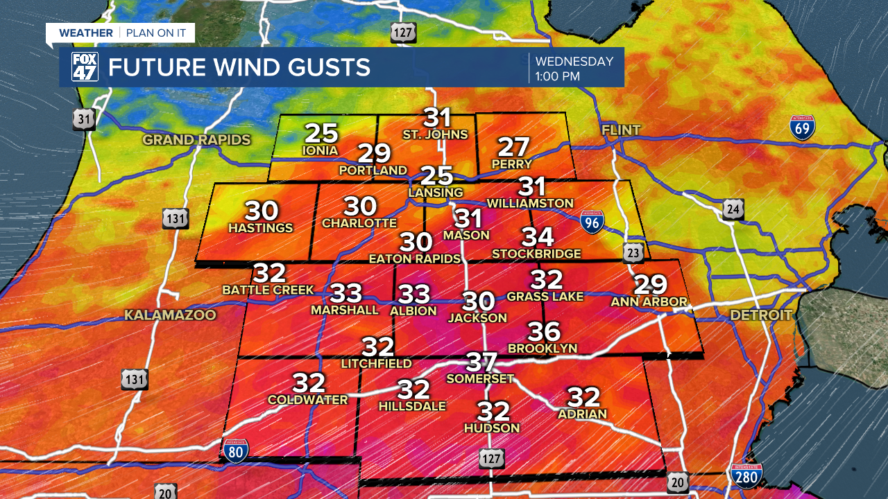
Winds will strengthen with gusts ranging from 35-40 mph Wednesday afternoon. This will aid in dropping feels like temperatures gradually through the rest of the day Wednesday.
Another round of snow will move through overnight Wednesday into Thursday, possibly bringing more hazardous travel to our neighborhoods as temperatures drop.
Snow showers continue through Friday with falling temperatures to the lower teens. This weekend, extreme cold returns to our neighborhoods with air temperatures below zero degrees Friday night and Saturday night. Frostbite concerns remain possible as well as frozen pipe concerns. Limit time outside during those AM hours this weekend.

Want more FOX 47 News? Here's how you download our Roku app
You can also see the latest news from across our mid-Michigan neighborhoods by liking us on Facebook or following us on X.
