
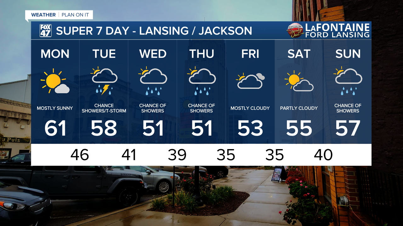
LANSING, Mich. — This past weekend brought soggy conditions across our neighborhoods with showers and storms. Some areas including Lansing observed over 2" of rainfall with the most rainfall in our neighborhoods falling in portions of Ingham and Eaton counties. This rainfall was much needed given how dry we have been across the southern portion of the state. We have more chances for showers throughout the week, but Monday brings dry conditions.
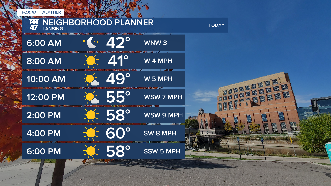
Daytime highs today will warm into the lower 60's. This is right around where we should be for this time of year. We will see mostly sunny skies through the afternoon hours allowing for a pleasant, fall like, start to the week.
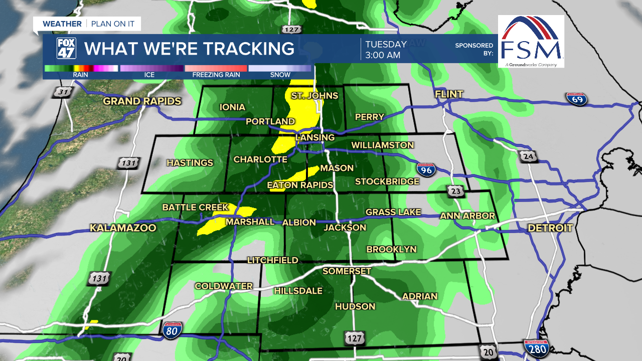
This break from the rain will be short lived as our next system arrives overnight tonight. an upper level trough with a weakening low pressure system at the surface tracks east across our neighborhoods with a warm front advancing through with showers affiliated as early as 2 AM Tuesday morning.
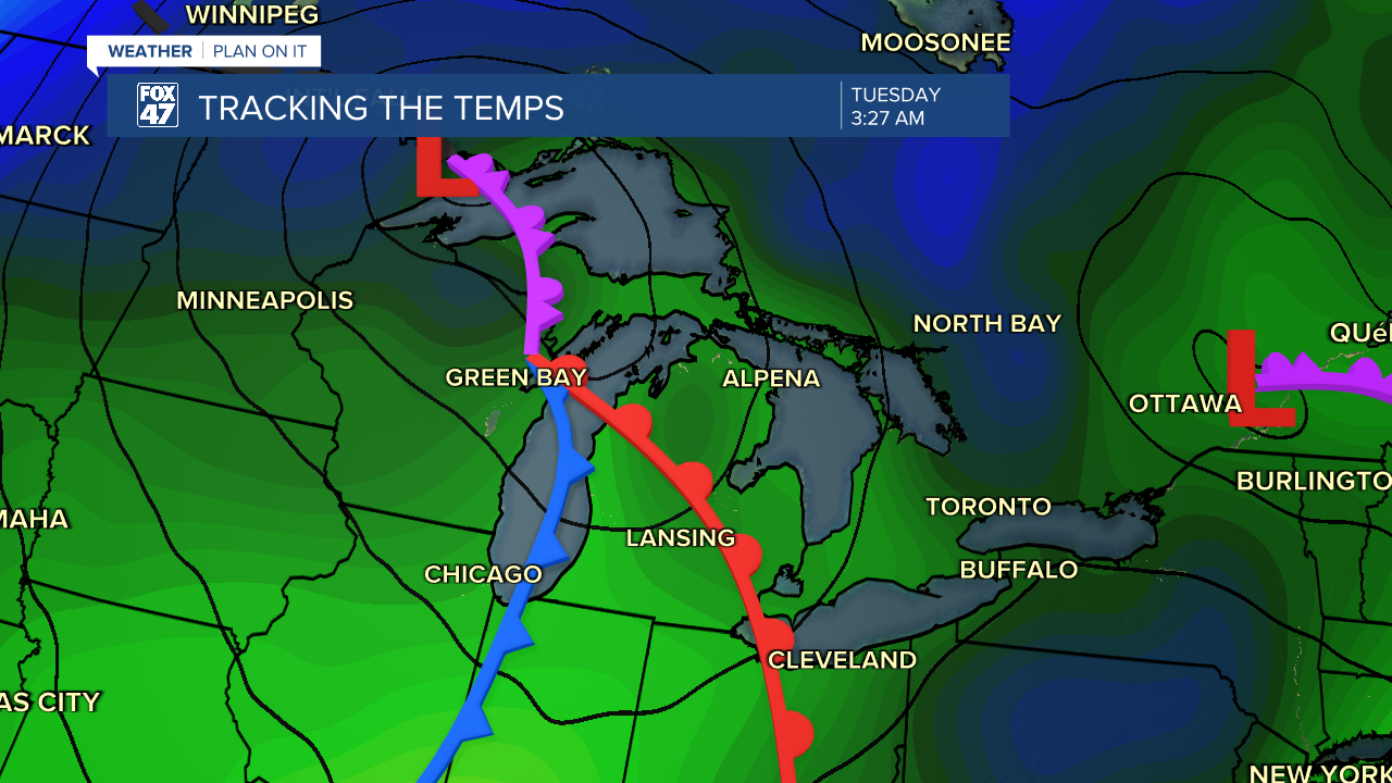
This first round of showers will continue through the morning commute hours of 6 AM/7 AM and come to an end once the cold front advances through. We are not expecting any major impacts with these showers as this system won't be carrying as much moisture as what we saw over the weekend.
On the back end of the passing cold front, winds out of the northwest will allow for a lake effect rain setup into Tuesday afternoon. With lake effect instability possible, scattered showers and a possible tame thunderstorms could move through during the afternoon/evening hours Tuesday. This trend will continue with chances for tame showers through Thursday.
Impacts we could see with a potential storm on Tuesday includes isolated wind gusts up to 40 mph. However, we can expect breezy conditions through the week with gusts up to 20 mph Monday and continued breezy conditions with gusts up to 35 mph Wednesday.

We will dry up by the end of the week Friday with mostly cloudy skies continuing. We have another chance for showers returing late in the weekend Sunday, but it is still too far out to talk details. Make sure to have the umbrellas ready when heading out the door this morning.
Want more FOX 47 News? Here's how you download our Roku app
You can also see the latest news from across our mid-Michigan neighborhoods by liking us on Facebook or following us on X.
