
LANSING, Mich. — Heaviest rainfall rates from yesterday's showers and storms were focused right along the state line in the far south row of counties in Michigan. Other areas seeing a lot of rain were a bit further north than our area. We have a chance to see a few remnant showers this morning now that the system is exiting the area, but no major impacts are expected.
Highs today will struggle to reach the 70's with a trend favored in the upper 60's. far southern areas could potentially reach the lower 70's, but with sunshine not forecast until later in the day, it will definitely be difficult.

WATCH THE FULL FORECAST BELOW
Remnant showers will be more focused in the morning hours as the progression of the secondary cold front stalls out a bit further northwest of the area. However, cloud cover across the area will continue through much of the afternoon with sunshine possibly making an appearance late in the day around dinner time.

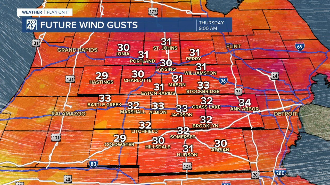
We will also be observing strong winds this morning post cold frontal passage with gusts potentially up to 30 mph through noon. During the afternoon hours, winds will gradually weaken. Overnight, we should stay clear with calm winds with temperatures dropping into the mid 50's. If you like it chilly, it would be nice to open the window and start the fan.
Friday brings dry conditions with lots of sunshine. This is a nice way to end a wet week across Mid-Michigan as we will remain breezy with isolated wind gust still possibly reaching 30 mph.
Saturday brings an isolated thunderstorm chance with sunshine still expected as our next system arrives late Sunday and overnight into Monday morning. Timing on these storms could still change, but storm that develop could bring some flooding concerns to far southern areas like Hillsdale County who already saw lots of rainfall from last night's storms.

You might still need that umbrella for any Father's Day plans late in the day Sunday and taking us into Monday. We have more shower and storm potential as we enter the new week with below average temperatures continuing.

Have a great weather picture or video to share? Send it our way and we may feature it on-air or online!

