
LANSING, Mich. — Tame weather conditions continue today as high pressure takes control of the forecast. High temps will remain in the mid to lower 80's today with humidity not much of an issue today, similar to what we saw Wednesday afternoon. Once we enter the afternoon hours, we will see some clouds develop, but we should stay dry across all of our neighborhoods with weak winds out of the east.

WATCH THE FULL FORECAST BELOW
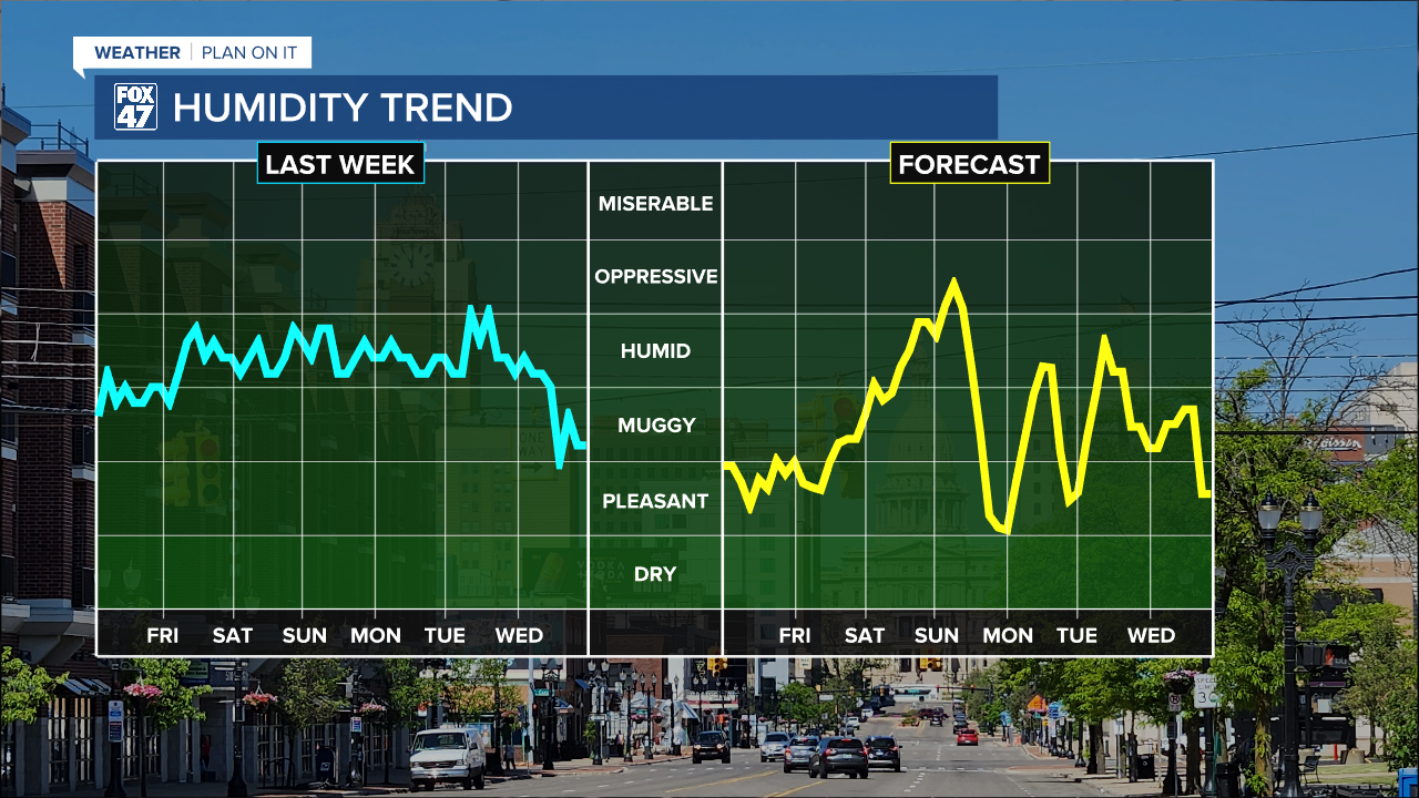
Present moisture has allowed for elevated humidity across our neighborhoods for the majority of this past week not including Wednesday afternoon. Today, conditions will remain comfortable. There is plenty of opportunity to get outside today to either get summer chores done or have some summer fun.
Winds shifting out of the south on Friday will bring moisture back to our neighborhoods as we enter another humid weekend with shower and storm potential.
Saturday morning is expected to stay dry with some sunshine possible. We will gradually increase cloud cover across our neighborhoods as we enter the Saturday afternoon hours. Any precipitation from the first half of the day should remain north of our neighborhoods as precipitation tracks south. We could see an isolated shower and storm late Saturday afternoon. However, we are not tracking any severe impacts if we do see some precipitation develop.

Sunday and Monday bring the better chances for uniform showers and storms where an umbrella will definitely need to be on hand. Temps this weekend gradually cool beginning Sunday. High will drop from the mid to upper 80's Sunday to lower 80's by midweek next week. We will be watching our shower and storm potential closely.

Want more FOX 47 News? Here's how you download our Roku app
You can also see the latest news from across our mid-Michigan neighborhoods by liking us on Facebook or following us on X.
