
LANSING, Mich. — Continued northwesterly winds and present low level moisture allowed lake effect snowfall to continue falling across our neighborhoods New Year's Day.
We saw up to 2.5" of snow in neighborhoods such as Williamston and Bellevue. See more snowfall reports below.

WATCH THE FULL FORECAST BELOW
Lake effect snowfall tracks south gradually Friday morning as we begin to lose low level moisture. We could continue to see some flurries through the late morning hours, however, the heavier snowfall rates are currently moving out of the area.
Snow that we did see this morning impacted our northern neighborhoods of Clinton, Eaton, and Ingham counties. Untreated roadways could remain slick for the morning commute. Make sure to stay weather aware when heading out on the roads and leave some extra time to brush off snow from your vehicle.
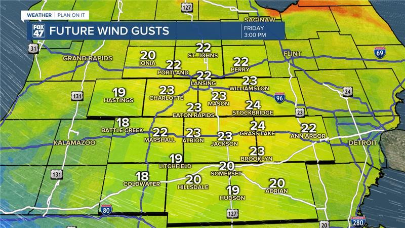
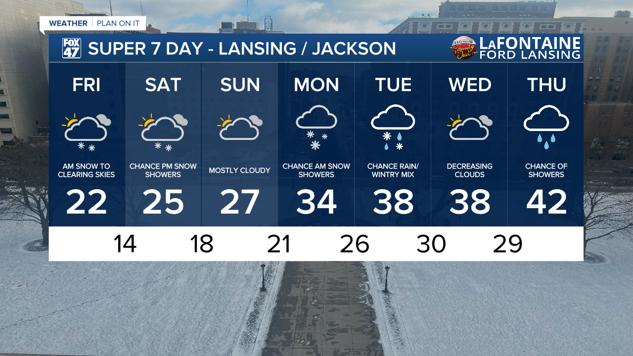
High temperatures today will warm into the lower 20's. However, wind gusts up to 25 mph this afternoon could allow feels like temperatures to remain in the single digits through the daytime hours. Stay bundled up when heading out the door. Winds will weaken into the overnight hours and stay weak through the weekend.
The break in snowfall will only be short lived as a shortwave trough tracks southeast through the region during the second half of the day Saturday. We could see snowfall move across our northern neighborhoods as early as 11 AM and into the afternoon/evening hours as low level moisture returns.

Only light accumulations in northern neighborhoods such as Clinton, Eaton, and Ingham counties are possible. We could see up to an inch of snowfall in these areas.
We will dry up during the daytime hours Sunday as temperatures continue to warm. By the time we reach the new week, temps will range in the mid 30's with chances for snow and wintry mix. Late next week, temperatures could reach the lower 40's with chances for showers. We will continue to monitor closely.
Want more FOX 47 News? Here's how you download our Roku app
You can also see the latest news from across our mid-Michigan neighborhoods by liking us on Facebook or following us on X.
