
10:30 AM UPDATE
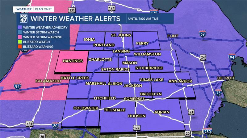
The Winter Weather Advisory has been extended in area to include Hillsdale Co. This advisory is set to expire at 1 AM Tuesday while our other neighborhoods will still see that advisory expire at 7 AM Tuesday.
We will continue to track lake effect snow bands that could lead to blowing snow and limited visibility. Slick spots will be possible across all of our neighborhoods today on roads that are untreated. Keep it slow out there as we will take a break from the snow starting Tuesday afternoon.
We have already seen 1-2" of snow fall across our neighborhoods from the overnight hours into this morning. Light additional accumulations remain possible wherever lake effect snow bands setup.
ORIGINAL POST
We are waking up to some school closings across our neighborhoods as winter weather brings impacts to the start of the week. Lake effect snow showers have brought snow accumulations across the state. These snow showers will continue throughout the day today as our last system exits the region and comes to an end during the first half of the day Tuesday.
If you are heading out the door this morning, make sure to leave extra time as slick spots remain possible on untreated roadways.
A Winter Weather Advisory is still in effect for all of our neighborhoods minus Hillsdale Co.. This advisory is set to expire at 7 AM Tuesday morning.

WATCH THE FULL FORECAST BELOW
Additional snow accumulations from 7 AM Monday to Tuesday range from 1-2" across all of our neighborhoods. Untreated roadways could remain slick as temperatures today gradually cool into the lower teens. Temperatures below 20 F makes rock salt less effective on snowed over roadways.

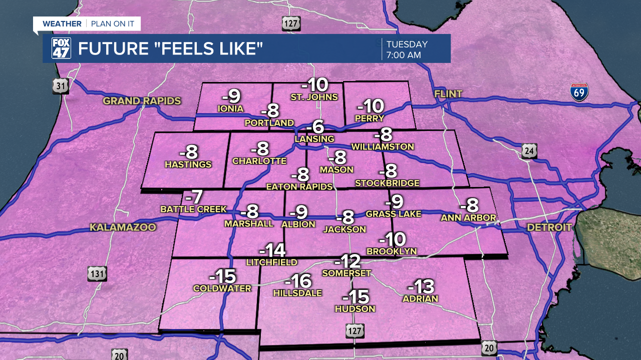
A Cold Weather Advisory has been issued for Hillsdale County which will go into effect at 1 PM Monday afternoon and last through 9 AM Tuesday morning as feels like temperatures could drop 15 degrees below zero by the time we reach 6 AM Tuesday. This could lead to concerns of hypothermia if not taking proper precautions. Make sure to bundle up and have all parts of your skin covered as you can to escape from this extreme cold. Limit your time outdoors as well.

Other neighborhoods to the north could see feels like temperatures range from 5 -10 degrees below zero. Make sure to bundle up and stay warm as we will continue to see more impacts possible from cold as we head into the weekend as air temperatures could potentially drop below zero.
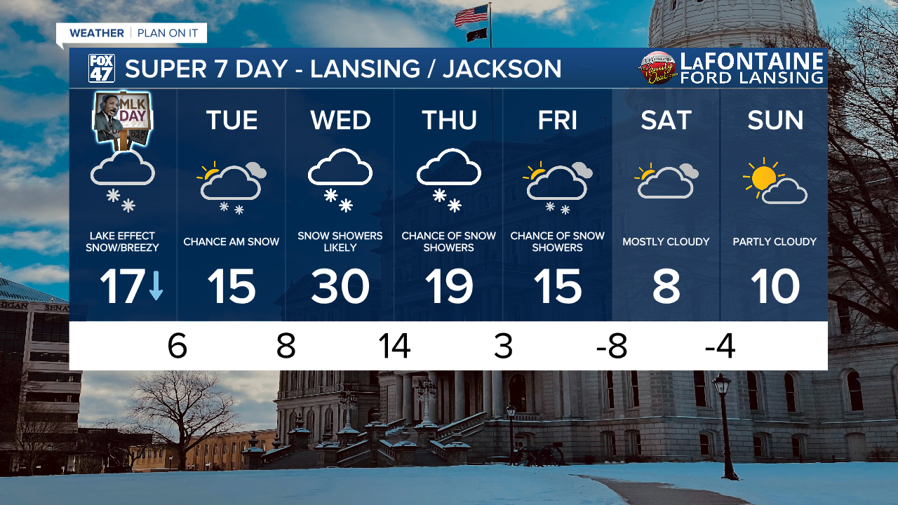
Tuesday afternoon and evening brings a break from impactful winter weather as temperatures will begin to warm ahead of our next round of snow arriving overnight Tuesday into Wednesday morning. As of now, we could see 2-4" of snowfall across our neighborhoods Wednesday with this next snowfall tracking in from the southwest. We could still see some tweaks to this snow forecast, but expect dicey road conditions for the Wednesday morning commute.
Renewed snowfall is expected Thursday morning with remnants lasting through Friday as we dry up for our weekend. Overnight lows this weekend drop below zero degrees and without factoring in winds, we could potentially see even colder conditions.
Want more FOX 47 News? Here's how you download our Roku app
You can also see the latest news from across our mid-Michigan neighborhoods by liking us on Facebook or following us on X.
