
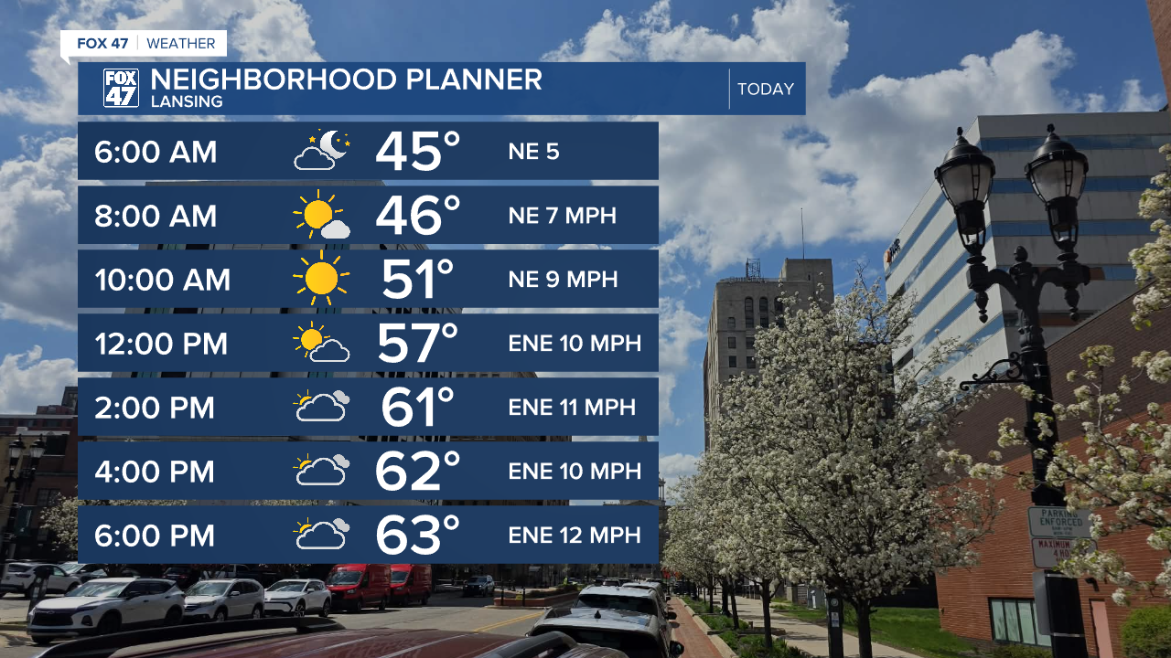
LANSING, Mich. — High pressure continues to influence the forecast today as we start the morning with partly cloudy skies across our neighborhoods. Temperatures are sitting in the lower 40's for most so a jacket might be necessary when heading out the door.
We will be staying dry today with winds shifting out of the east. We could see wind gusts from 20 to 25 mph today with highs reaching the mid to lower 60's, similar to what we saw Wednesday.
WATCH THE FULL FORECAST BELOW
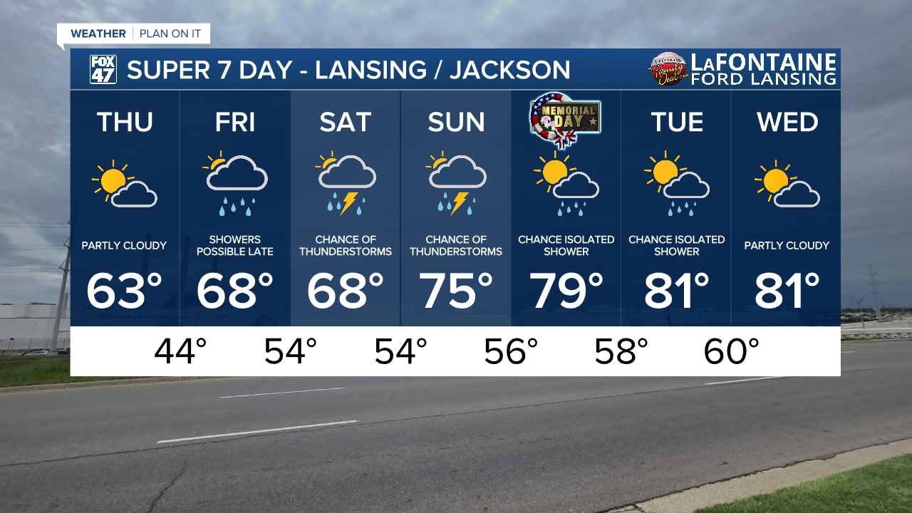
We will see increasing cloud cover throughout the day Friday with breezy conditions out of the east with gusts up to 30 mph. We will stay dry for most of the daytime hours, but once the sun sets, our next system will bring rain showers back to lower Michigan. The track of low pressure focuses heavier showers over the Metro Detroit area overnight Friday and into Saturday during the daytime hours where we could also see a thunderstorm develop. In central Mid-Michigan, we could see more scattered showers and a possible storm during this time.

Rainfall totals from Friday night through Saturday night could exceed an inch from both the period of overnight heavier rainfall as well as the thunderstorm chance Saturday during the day. However, if the area of low pressure can track northeast through a more western portion of the Sate of Michigan, areas like Lansing and Jackson could see some larger rainfall accumulations exceeding an inch.
Below are two separate scenarios of rainfall accumulation from Friday night through Saturday night. Both remain possible depending on the track of the low.


We will have renewed chances for thunderstorms Sunday across Mid-Michigan as a shortwave advances through the region. Temperatures will warm back into the 70's Sunday.
Early next week brings a trickier setup. A ridging pattern builds in the upper atmosphere which will allow for warming temperatures in the upper 70's/lower 80's for the first half of next week including Memorial Day. However, an isolated shower chance still remains as zonal pattern of winds exists across southern Michigan aloft, meaning winds from west to east. In this flow we could see a few disturbances that kick off a pop up tame showers during the daytime hours Monday and Tuesday.

We can still expect some sunshine for Memorial Day, however, and showers shouldn't bring too much in the way of impacts. Wednesday looks to dry up with partly cloudy skies and continuing highs in the lower 80's.
Have a great weather picture or video to share? Send it our way and we may feature it on-air or online!

