


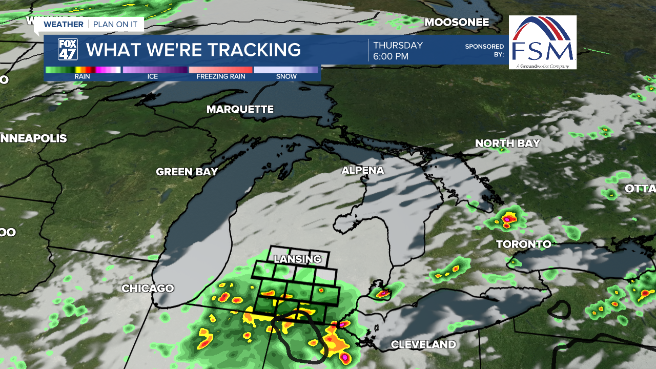
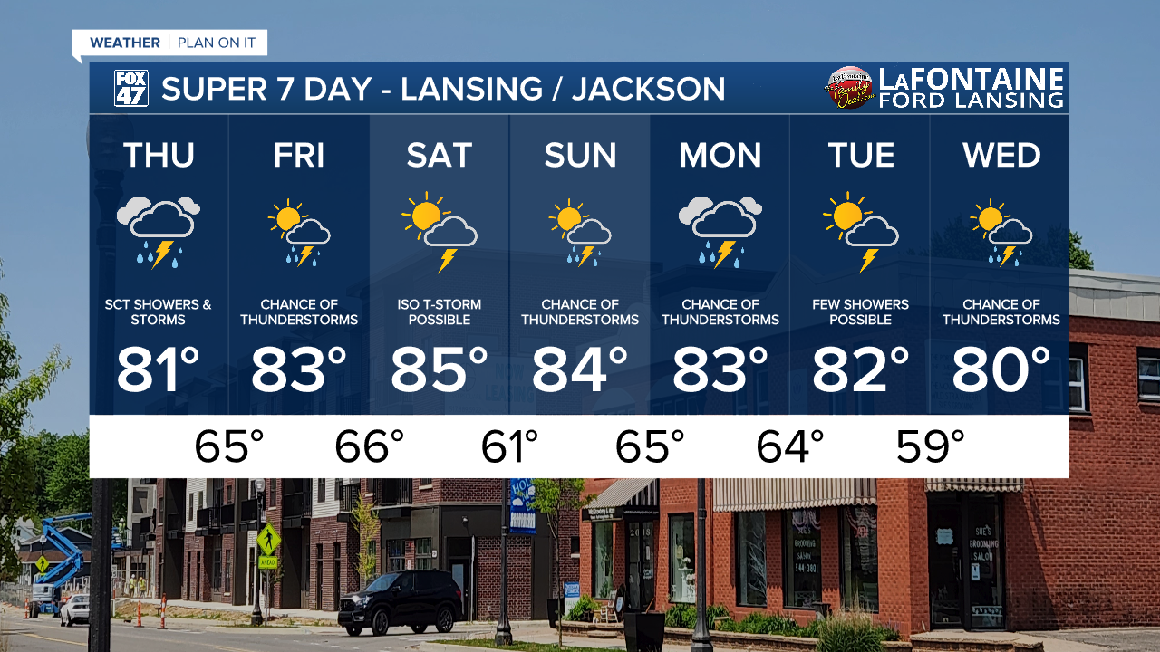
LANSING, Mich. — Temperatures will stay cooler than average today only reaching the lower 80's as we continue to track cloudy skies across Mid-Michigan and returning showers and storms later this afternoon and evening.
Due to present moisture, we will also see some limited visibility following exiting showers for the drive in to work. Visibility as of 5:30 AM Thursday is low as 2 miles. Stay weather aware when headed out on the roads.
WATCH THE FULL FORECAST BELOW
The slow moving frontal passage meanders across the state of Michigan through the rest of the week and into the weekend with potential showers and storms continuing Friday and even lingering into Saturday with a more isolated chance of showers and storms.
For today's round, we are mainly watching the peak heating hours and into the evening from 3 PM to 9 PM for showers and storms to move through the area. At the moment, all of our area could see storms produce heavy rainfall rates and stronger winds, isolated gusts up to 30 mph.
Present moisture due to this meandering frontal passage will keep conditions humid through the majority of the 7-Day. We could see a break from the humid conditions Saturday once we finally see a shift in our weather pattern. If stepping out the door, make sure to grab the umbrella and be prepared for stickier conditions.

Looking 8 to 14 days ahead, temperatures are trending a bit towards the cooler side with cooler than average temperatures favored across the majority of the state. This will be a change from what we are seeing this week with temperatures near normal in the mid to lower 80's.

Beginning this weekend, we enter a pattern where we could see more showers and storms from smaller scale features with more uncertainty on timing and location of these storms. We will be monitoring closely, but have the umbrella handy when headed out the door through the rest of the 7-Day.
Have a great weather picture or video to share? Send it our way and we may feature it on-air or online!

