


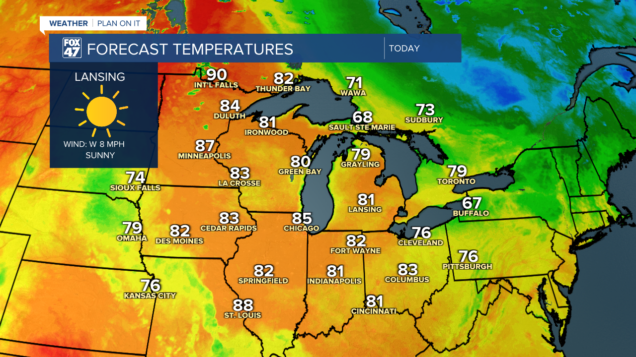
LANSING, Mich. — We have a bit of a warm up on our hands to end the week across Mid-Michigan with highs expected in the upper 70's and possibly lower 80's due to the abundance of sunshine we will see today. Winds at the surface will remain out of the southwest during the first half of the day with wind gusts potentially reaching 20 mph during the late afternoon hours.
WATCH THE FULL FORECAST BELOW
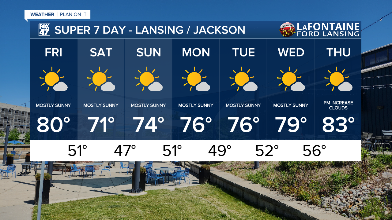
The omega block pattern continues with Michigan on the leading edge of upper level high pressure which is bringing us this long stretch of mostly sunny skies in our 7-Day forecast. A few upper level clouds remain possible for the majority of the week due to upper level winds being out of the northwest. This pattern stretches through the weekend and into the majority of next week.

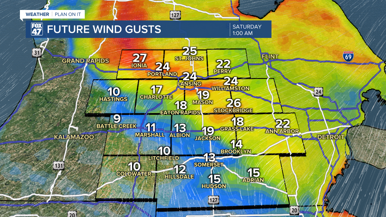
During the overnight hours tonight, a weak frontal passage will sag south through Mid-Michigan. We are lacking moisture due to this omega block pattern meaning rainfall will not be an impact and we will remain dry. However, we could see isolated wind gusts of 25-30 mph in areas north of I-94. These won't bring much in the way of impacts to our area and we will see winds weaken gradually during the day Saturday.
We could potentially see the omega block pattern break late next week during the late Thursday and overnight into Friday hours with returning showers across Mid-Michigan. We could still see changes to the forecast and are still expecting lots of sunshine during the day on Thursday. We will continue to monitor through the weekend.
Overnight lows remain comfortable during the 7-Day period ranging from the upper 40's/lower 50's. This will be comfortable to leave the AC off and turn on the fan and leave a window open. Enjoy the sun and heat while it's here across southern Michigan and be aware of localized fire risks with the dry air. What we have going for us this weekend is weak winds, but be extra careful if burning.
Have a great weather picture or video to share? Send it our way and we may feature it on-air or online!

