
LANSING, Mich. — Waking up across Mid-Michigan, we are watching an area of showers and storms rolling through areas such as portions of Ingham, Jackson, and Eaton counties with wind gusts in excess of 40 mph being the main impact. These storms are weakening as they track east and should wrap up by the time we start the 8 AM hour. Stay weather aware if heading out on the road this morning.
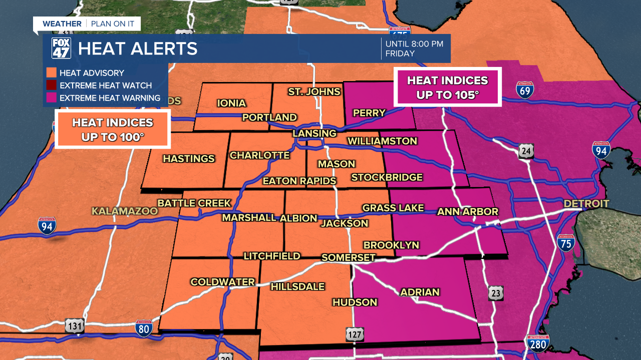
We will dry up for the rest of the morning hours and into the early afternoon hours. Partly cloudy skies are expected as we still deal with hot conditions. The Heat Advisory and Extreme Heat Warning across southern Michigan will expire at 8 PM this evening as we are tracking high temperatures in the lower 90's today.
WATCH THE FULL FORECAST BELOW
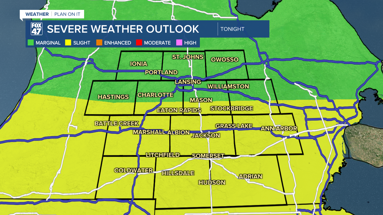
We are still tracking thunderstorms for later on this evening with a start time of around 4 PM and taking us into the overnight hours. Severe impacts remain possible as a slight risk of scattered severe storms has been issued for Hillsdale and Jackson counties as well as the southern portions of Eaton and Ingham counties. Main impacts include damaging wind gusts up to 60 mph, heavy rainfall rates, and lightning.
Timing of showers and storms for the weekend are dependent on smaller features in the atmosphere that can bring rapid changes to arrival and locations of stronger storms. Again, we are going to be watching for anywhere between 4 PM and into the overnight hours today.

The same trend can be said for Saturday where we will see a bit more cloud cover to start the day with high temperatures falling into the upper 80's with continued humid conditions. We will be watching time frames of 2 PM to 10 PM Saturday with continued changes possible. At the moment, the Storm Prediction Center has dropped the potential for severe storms both Saturday and Sunday across Mid-Michigan. However, impacts such as strong winds and heavy rainfall rates still persist. There is a chance that fireworks shows could see some storm potential as we head into the evening hours.

Isolated thunderstorm chances takes us into Monday as temperatures remain in the mid 80's. We will hold onto humid conditions through the weekend with improving conditions early next week. We remain dry Tuesday and Wednesday with returning chances for storms on Thursday.

Have a great weather picture or video to share? Send it our way and we may feature it on-air or online!

