
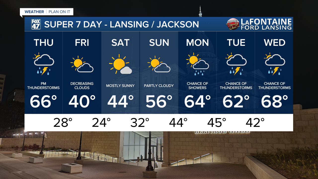
LANSING, Mich. — Partly to mostly cloudy skies will continue tonight as an unseasonably mild air settles over the region. After starting in the evening in the low 60s, temperatures will only fall to the upper 40s and low 50s by morning with SSW winds holding at 6-12 mph.
Temperatures continue to climb on Thursday, courtesy of a secondary warm front lifting into the region. Highs will reach the mid 60s in the afternoon for most neighborhoods, with dry conditions in the morning eventually giving way to storms.

Hit-or-miss showers and thunderstorms will begin to break out after 3:00 PM across our neighborhoods as a cold front begins to sink south across the state. Rain will become increasingly steady by the evening commute, with periods of heavy rain and embedded thunderstorms continuing through 10:00 PM. Activity will taper off after midnight, but a few snowflakes could actually mix in before that happens.

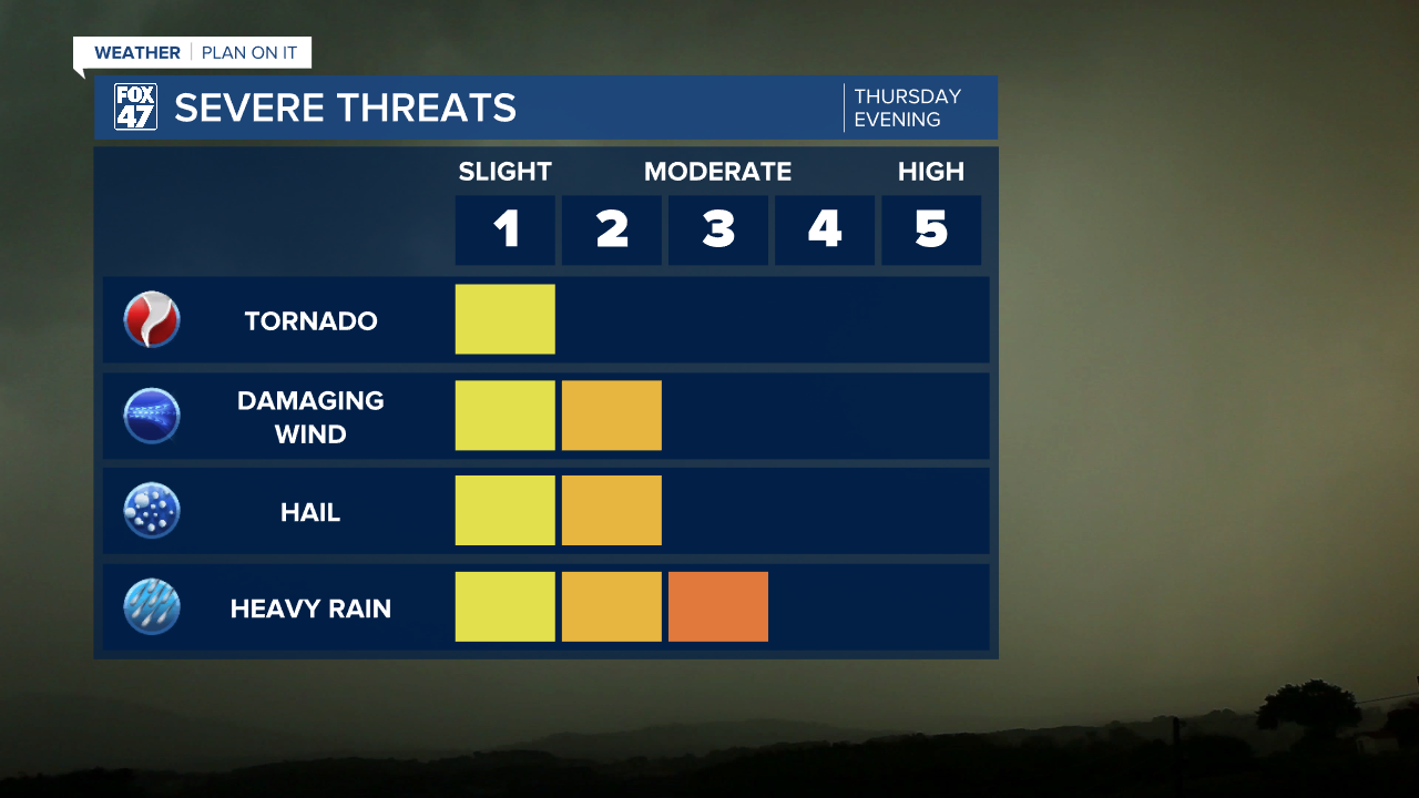
The chance for severe weather remains in place for Thursday evening. Isolated tornadoes and damaging winds are possible, with a greater concern for large hail thanks to sharp cooling aloft. Localized flooding may also occur thanks to persistent heavy downpours.
GET YOUR FOX 47 FORECAST HERE
With the passage of the cold front Thursday night, another sharply cooler air mass will settle in for Friday. Highs will take a dive back toward the low 40s, but clouds will decrease as the front passes farther east. This sets us up or a beautiful weekend with plentiful sunshine, but some chill will linger into Saturday. Highs will hold in the mid 40s for the first half of the weekend, before returning to the mid 50s on Sunday.
Want more FOX 47 News? Here's how you download our Roku app
You can also see the latest news from across our mid-Michigan neighborhoods by liking us on Facebook or following us on X.
