

LANSING, Mich. — High pressure will remain in control over the Great Lakes and much of the central United States tonight, keeping skies generally clear. Lows will take a cold dip below average once again, falling to around 30 degrees by daybreak. With winds turning calm though, we at least will not need to worry about any wind chills.

Thursday ups the ante on Wednesday's beautiful weather, bringing us another round of sunshine and warmer temperatures. Highs will climb into the low and mid 60s on Thursday afternoon, with just a gradual increase in clouds expected to begin around the evening commute.

Clouds will continue to build on Thursday night ahead of an approaching warm front. The front will bring some spotty showers and possibly a thunderstorm to some of our neighborhoods overnight, with lows only dipping slightly to the low 50s. Winds will increase out of southeast to 10-20 mph, and could gust up to 30 mph at times.
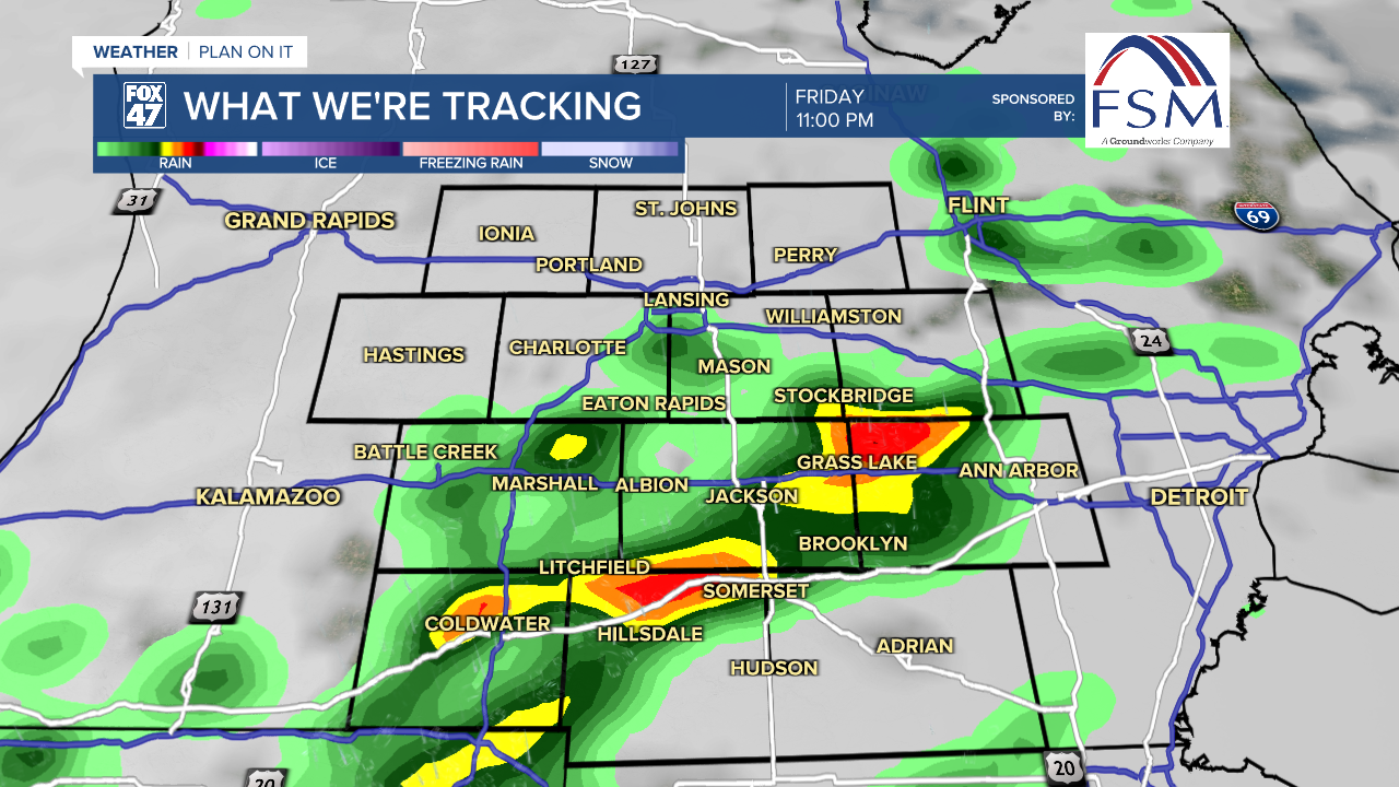
Behind that warm front, Friday's high temperatures will surge into the mid 70s, with much of the daytime period looking dry after any leftover morning showers. With some breaks of sun developing in the afternoon, the atmosphere will become increasingly unstable in advance of a cold front. That front will give rise to a wave of showers and thunderstorms, arriving in our neighborhoods between 9pm and midnight.

Scattered severe storms will be possible during this time, with our main concern coming in the form of damaging winds. Some storms could also produce large hail, along with a low potential for tornadoes. Make sure to stay weather aware, especially if you have plans to be out on Friday evening.

Temperatures will cool off for Easter weekend, with highs returning to the 50s. Both days will bring the chance for a few showers, but neither day looks like a washout. Just make sure to factor in some rain gear for your Easter plans.
Want to learn more about the Weather? Visit the FOX47News Website.
Stay in touch with us anytime, anywhere.
Sign up for newsletters emailed to your inbox.
Select from these options: Breaking News, Severe Weather, School Closings, Daily Headlines and Daily Forecasts.
