
LANSING, Mich. — Another round of chilly, Fall-like temperatures are on the way for tonight. Lingering clouds in the evening will give way to clear skies again overnight, allowing temperatures to take a steep dive into the mid 40s once again. Northwesterly winds at 5-10 mph early will become calm.

High pressure sliding south of Michigan on Wednesday will allow a more southerly wind to take over, allowing temperatures to warm slightly for the day. We'll keep conditions dry with a mix of sun and clouds, as highs head for the mid 70s.
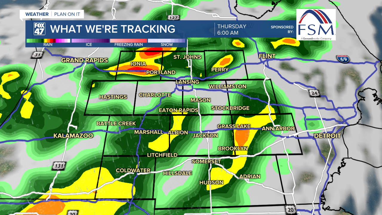
A cold front sweeping into the region on Thursday will bring mostly cloudy skies and widespread showers with it. Temperatures will be slightly cooler, as highs fall back to the upper 60s thanks to the clouds and wet weather. A few rumbles of thunder will also be possible, so dress for wet weather and keep and eye to the sky throughout the day.
GET YOUR FOX 47 FORECAST HERE
Our weather improves just in time for Labor Day weekend! Friday brings back partly cloudy skies, and keeps temperatures Fall-like in the upper 60s. High pressure dominates the rest of the holiday weekend with partly to mostly sunny skies expected Saturday through Monday, with highs gradually warming into the middle and upper 70s. Whatever you have planned for the unofficial end of Summer, the weather's looking great!

Want more FOX 47 News? Here's how you download our Roku app
You can also see the latest news from across our mid-Michigan neighborhoods by liking us on Facebook or following us on X.
