


LANSING, Mich. — Clouds will break up for a few hours as we move into our Monday night. Clear to partly cloudy skies will hold from around 8:00 PM until 3:00 AM, followed by increasing clouds before sunrise. Lows will remain unseasonably chilly around 40 degrees, with ENE winds at 6-12 mph.
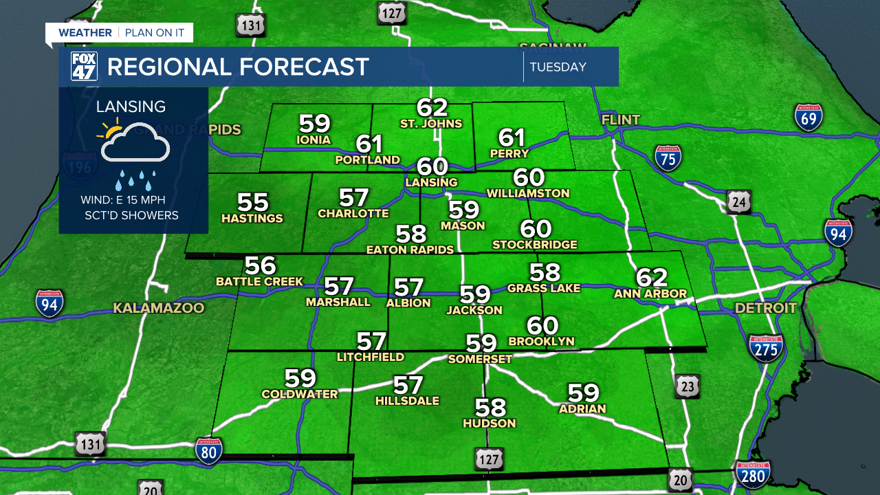
We add rain back to the cooler-than-normal conditions on Tuesday, as an area of low pressure tracks out of the central Plains. This will keep a steady fetch of easterly winds in place throughout the day, dragging cool air inland off of Lake Huron. Highs will be help to the upper 50s to around 60 degrees.

Showers will gradually develop across our neighborhoods over the course of Tuesday morning, becoming more persistent and widespread throughout the afternoon and well into Tuesday night. The rain will generally be light, so flooding is not expected to be an issue. Expect increasingly slick travel conditions and keep an umbrella close by.

Showers will continue throughout the day on Wednesday and into Thursday as low pressure continues its slow track across northern Indiana and Ohio. The persistent showers will further limit high temperatures to the middle and upper 50s both day, lending to more of a mid-April feeling rather than mid-May.

Our weather does start to turn around in time for Memorial Day weekend. As low pressure finally departs east of the region Thursday night, we'll see an end to the showers for Friday. Highs will stay in the upper 50s, but it will be a notable step in the right direction. Partly cloudy skies take over Saturday through Memorial Day, and while temperatures will remain cooler than average, we'll gradually warm into the middle and upper 60s. All told, things look they'll be in good shape for holiday weekend plans.
Want to learn more about the Weather? Visit the FOX47News Website.
Stay in touch with us anytime, anywhere.
Sign up for newsletters emailed to your inbox.
Select from these options: Breaking News, Severe Weather, School Closings, Daily Headlines and Daily Forecasts.
