

Cloudy skies this evening will continue into the overnight hours as a weak frontal system sweeps through the Great Lakes. Due to the passage of a warm front with this system, most of our lows for tonight will be reached in the low 30s this evening, with temperatures then climbing into the middle and upper 30s overnight. This in turn could lead to a stray rain or snow shower after 2:00 AM, but the overwhelming majority of our neighborhoods will stay dry.

Our weather pattern begins to stabilize in the wake of this frontal system on Wednesday. Skies will start the day cloudy, giving way to gradual clearing during the afternoon. Temperatures will begin an upward trend, but it will still be a rather chilly day as highs return to the low 40s. Add in westerly winds at 10-20 mph and it will feel more like the 30s throughout the day.
GET YOUR FOX 47 FORECAST HERE
Thursday and Friday remain the nicest days of the week. High pressure settling over the region will bring mostly sunny skies back to the region, and we'll get a bigger bump in temperatures along with it. Highs will return to the low 50s, and will remain at those levels into the weekend.
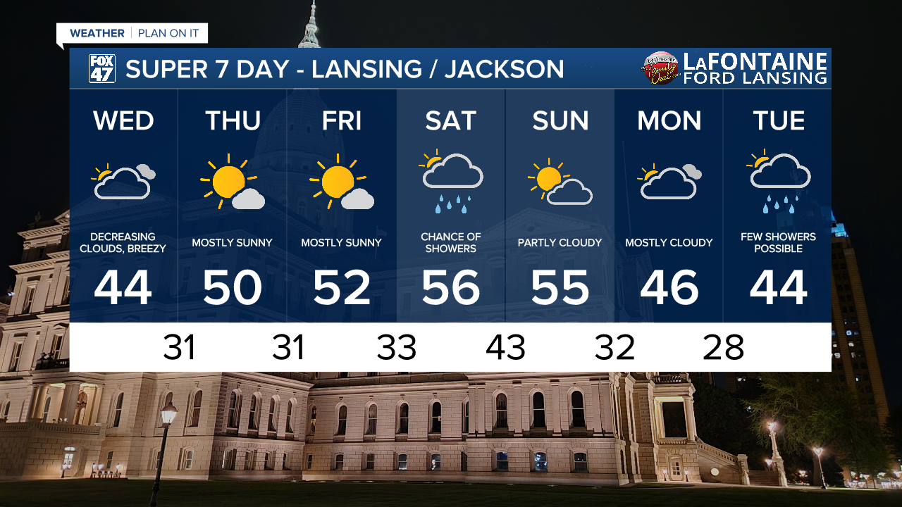
A new disturbance moving through the Great Lakes on Saturday, set to bring a round of plain rain showers with it. We'll follow that up with partly cloudy skies for the second half of the weekend, with high continuing to hold in the mid 50s. A chillier turn back toward the 40s is expected early next week, with a small chance for a few showers returning on Tuesday.
Want more FOX 47 News? Here's how you download our Roku app
You can also see the latest news from across our mid-Michigan neighborhoods by liking us on Facebook or following us on X.
