

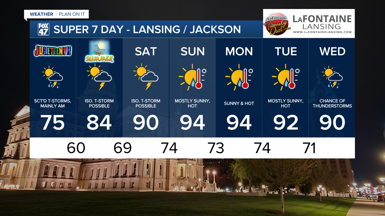
With Wednesday evening's severe storms behind us, scattered showers and non-severe thunderstorms are likely to linger overnight in the wake of low pressure moving east of the region. Lows will begin to take a cooler turn, dipping toward the low 60s by morning.

Scattered showers and a few possible thunderstorms will persist on the back side of low pressure through the first half of Juneteenth on Thursday. Wet weather will come to an end by mid-afternoon, followed by some returning sunshine in the evening. Well get a break from the heat and humidity too, with highs holding in the mid 70s.

Friday marks the arrival of Summer, and even though the solstice doesn't officially occur until 10:42 PM, the day will start to feel a bit more like it. Partly to mostly sunny skies may bring an isolated shower or thunderstorm in the afternoon, with highs returning to the mid 80s.
We really lean into Summer starting this weekend, though. A massive ridge of high pressure will begin to spread east out of the United States on Saturday, bringing a surge of heat with it. Highs will climb to around 90 to start the weekend with the possibility for an isolated thunderstorm to cool us off in the afternoon. From there, we just bake under mostly sunny skies Sunday through Tuesday as highs climb to the low and mid 90s across our neighborhoods. Be ready to keep cool and hydrated!
Want to learn more about the Weather? Visit the FOX47News Website.
Stay in touch with us anytime, anywhere.
Sign up for newsletters emailed to your inbox.
Select from these options: Breaking News, Severe Weather, School Closings, Daily Headlines and Daily Forecasts.
