
LANSING, Mich. — Another clipper system pushing into the region is leading to widespread accumulating snow. A WINTER WEATHER ADVISORY is in effect through 11 p.m. tonight for Muskegon and Oceana Counties, plus a WINTER WEATHER ADVISORY for Allegan, Ottawa and Van Buren Counties through 7 p.m. Tuesday. Berrien and Cass Counties are also under advisories. Lake effect snow continues into Tuesday, especially south/west of Grand Rapids. Travel conditions will be slick for the start of the work week with low visibility possible. By Thursday we expect another clipper system to move in with lingering lake effect snow behind it for Friday. Bundle up, stay safe and warm. Drive safely!
TODAY: Widespread snow showers will last through early afternoon. Highs in the middle 20s. South/west winds at 7 to 14 mph.
TONIGHT: Partly cloudy inland, mostly cloudy with lake effect snow from Holland southward. Lows in the single digits inland, 10 to 12 at the lakeshore. Winds northwest at 6 to 12 mph.
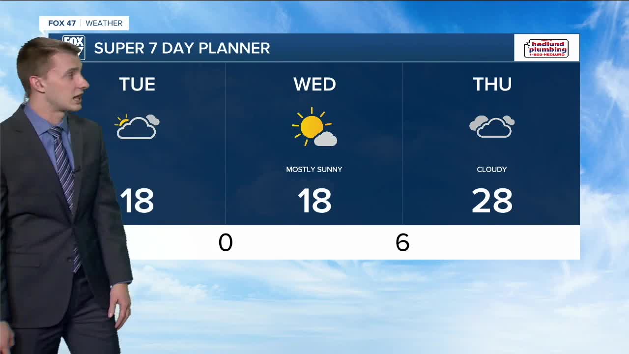
TUESDAY: Mostly cloudy with lake-effect snow west of U.S.-131. Highs near 20. Winds west at 7 to 14 mph.
WEDNESDAY: Partly cloudy and cold. Highs in the middle to upper teens.
THURSDAY: Mostly cloudy with the chance for more widespread snow with another clipper system. Highs in the upper 20s.
Want to learn more about the Weather? Visit the FOX47News Website.
Stay in touch with us anytime, anywhere.
Sign up for newsletters emailed to your inbox.
Select from these options: Breaking News, Severe Weather, School Closings, Daily Headlines and Daily Forecasts.
