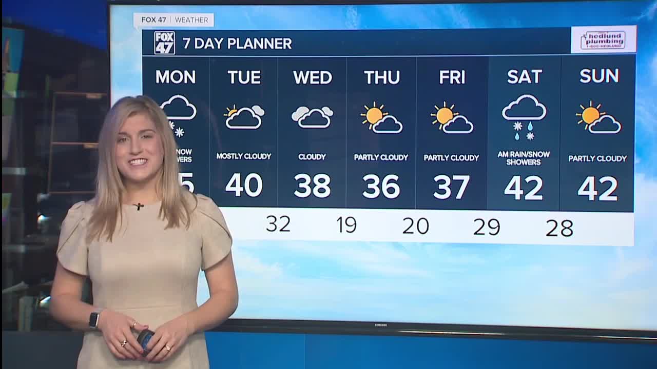

LANSING, Mich. — Another round of snow continues this morning, with the heaviest snow done and gone as the system wraps up. We expect 2-3" locally 4" of snow around the region. The snow will be heavy and wet this time around so watch your driving early Monday morning and give yourself extra time today. Yet another burst of snow showers may occur late Monday evening into early Tuesday morning with light, sloppy accumulations possible. By the afternoon Tuesday, some sunshine returns along with milder temperatures near 40 degrees! A much milder type of a week is anticipated right on into next weekend with plenty of afternoon highs in the 40s.
TODAY: Light snow/mix early, then drying out. Mostly cloudy. Snow showers return later in the evening. Additional light accumulations possible. Highs in the low to mid 30s. Breezy west to southwest winds at 15-20 mph, gusts to near 30 mph at times.
TONIGHT: Light snow with minor accumulations possible. Lows in the lower 30s. Breezy with southwest winds 15-20 mph.
TUESDAY: Early morning snow showers, perhaps even a mix of rain and snow. Becoming partly sunny and pleasant. Highs around 40 to the low 40s. West northwest winds shift to the southwest at 10-20 mph.
WEDNESDAY: Mostly cloudy. Highs in the lower 40s.
THURSDAY: Mostly cloudy with possible flurries. A bit colder with highs in the middle 30s.
FRIDAY: Mostly to partly cloudy. Still a bit colder temperatures with highs in the mid to upper 30s.
Want to learn more about the Weather? Visit the FOX47News Website.
Stay in touch with us anytime, anywhere.
Sign up for newsletters emailed to your inbox.
Select from these options: Breaking News, Severe Weather, School Closings, Daily Headlines and Daily Forecasts.
