
LANSING, Mich. — Scattered thunderstorms that developed south of Lansing on Tuesday afternoon will track out of the region this evening. A cold front sweeping in from the west could bring in a few showers closer to 8:00 - 10:00 PM, but mostly cloudy skies will take over as temperatures drop overnight. Lows will wind up around 50 degrees by daybreak with NW winds at 5-15 mph.

The cold front will usher in a sharply cooler air mass for the midweek period, holding high temperatures to just the low 60s on Wednesday. That will be a 20-degree drop from Tuesday, and will put highs back to around 10 degrees below average. Still, it should be a refreshing change, and we'll look for increasingly sunny skies as high pressure settles over the state. Similar weather will remain in place on Thursday.
GET YOUR FOX 47 FORECAST HERE
Friday begins with a mix of sun and clouds during the morning, followed by increasing clouds in the afternoon as a warm front approaches from the south. Most of the day will remain dry before scattered showers arrive around sunset. Highs will inch a little higher into the mid 60s.
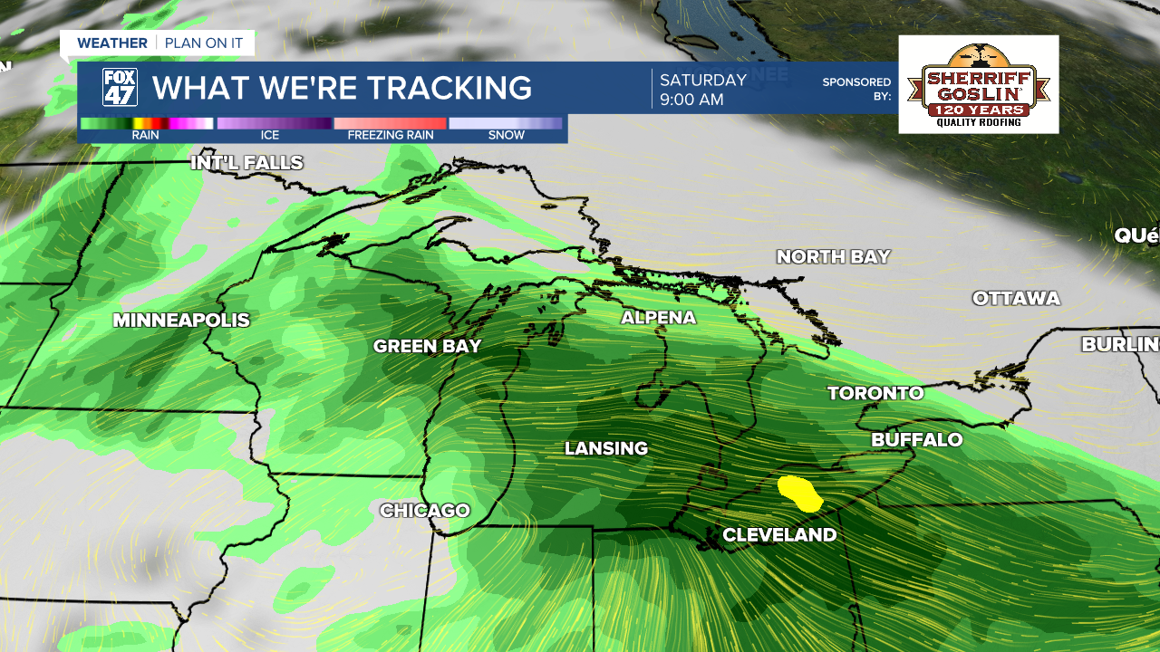
Scattered showers and thunderstorms will continue on Saturday as the warm front continues to track northward. Wet weather will be most widespread during the morning, gradually trending drier in the afternoon. Highs will top the upper 60s to around 70.
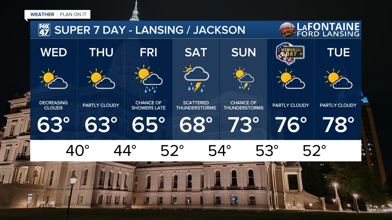
A few more hit-or-miss showers and thunderstorms will be possible on Sunday, but the day is looking sunnier overall. Warmer too, with highs set for the low 70s as a southerly wind develops. This set us up nicely for Memorial Day, with partly cloudy skies expected for the holiday. Highs will close out the long weekend in the mid 70s.
Have a great weather picture or video to share? Send it our way and we may feature it on-air or online!

