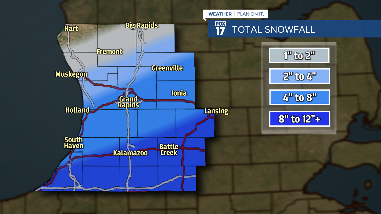
WEST MICHIGAN — We're keeping a close eye on and tracking an approaching winter storm system today. This system will will drop significant snow in many areas, but the heaviest may approach a foot along/south of the I-94 corridor.
Rain has transitioned to snow and temperatures will drop into the mid 20s and eventually colder as Arctic air filters in. Locations along/south of the I-94 corridor and east toward Jackson, Ann Arbor, and Detroit are likely to see the highest snowfall totals which could approach a foot or more!
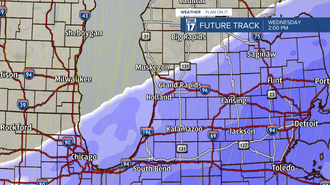
This morning we will be behind a cold front giving way to colder temperatures and Arctic air as well as steady snow. Again, the heaviest snow is still expected mainly south and east of the Grand Rapids area and will continue through tonight.
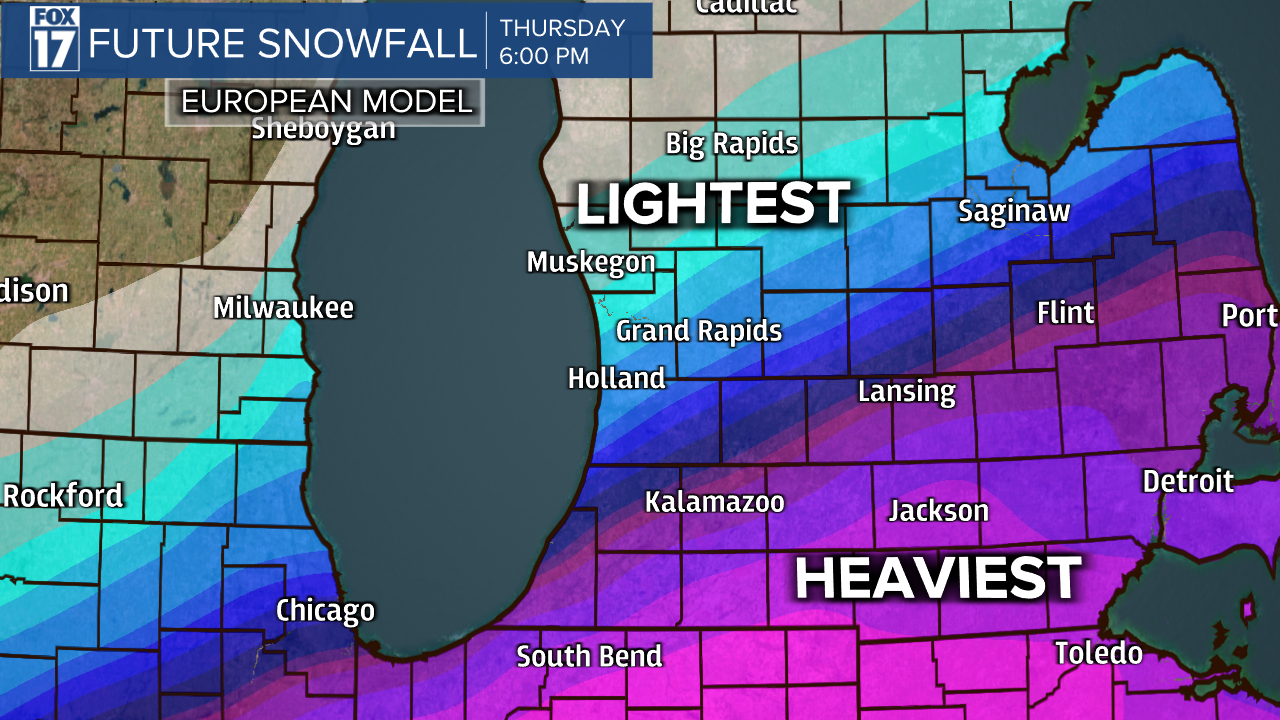
A Winter Storm Warning (shaded in pink below) is in effect through 11 P.M. Thursday for Barry, Eaton, Van Buren, Calhoun, Kalamazoo, Berrien, Cass, St. Joseph, and Branch Counties. The heaviest snow will fall in these areas. A Winter Weather Advisory (shaded in purple) is in effect through 11 P.M. Thursday for Ottawa, Kent, Ionia, Allegan, and Montcalm Counties. Lighter amounts will fall in these counties. See image below.

Areas could possibly see a foot or more of snow along and south of the I-94 corridor, with much lighter amounts as you travel north and west of Grand Rapids across our extreme northern counties like Oceana and northern Newaygo.