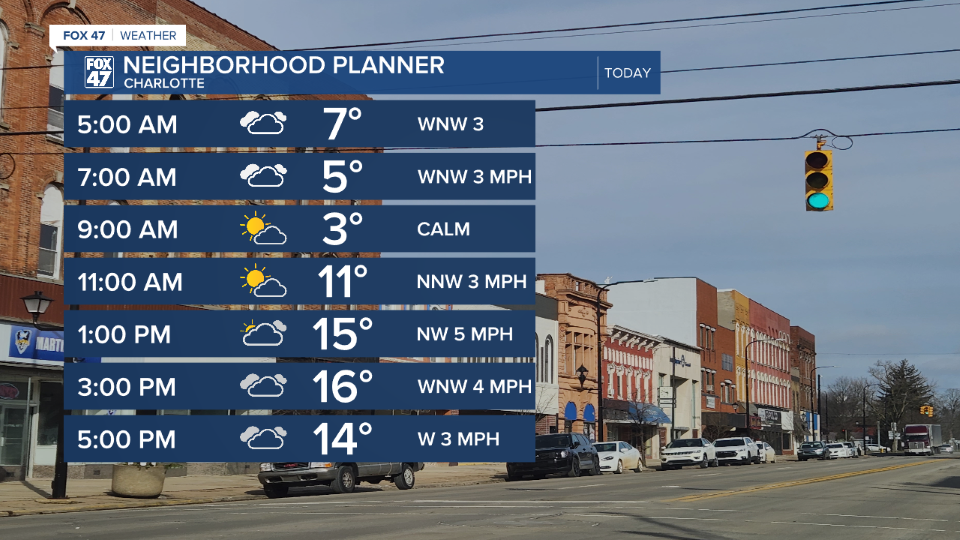
LANSING, Mich. — Snow continues to dwindle today as lake effect snow continues on for neighborhoods along the lake shore due to winds turning out of the north. Our neighborhoods still are observing winds out of the northwest with a chance to see some flurries still primarily in the afternoon/evening hours. Impacts and snow totals should be lessened compared to what we've seen over the past week and a half.
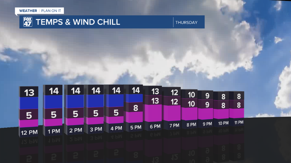
High temperatures today only reach the mid teens with feels like temperatures continuing in the single digits and a bit warmer than yesterday due to weaker winds as high pressure continues to inch closer to Michigan.
WATCH THE FULL FORECAST BELOW
Winds will become calm in the overnight hours, hindering wind chills from reaching the dangerously cold 20 below zero threshold for frostbite. However, wind chills could still reach 15 below zero overnight tonight into tomorrow morning which is still well below average and could become dangerous for those not following correct precautions.
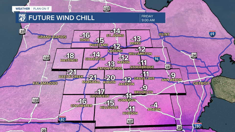
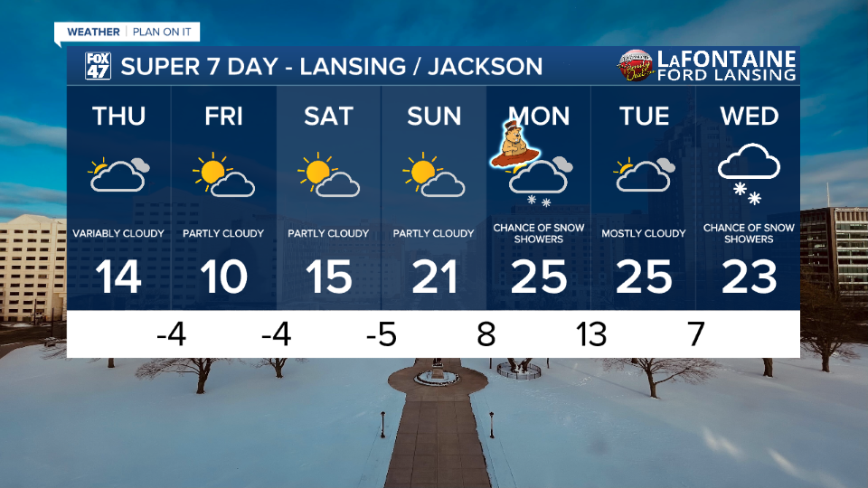
Similar impacts are expected overnight Friday into Saturday morning with air temps around 5 below zero. Temperatures will warm again heading into a new week with highs back in the mid 20's. We have chances for snow Monday and Wednesday. With these temperatures above 20 degrees, salt will be effective in treating snow covered roads, conditions that were unfavorable for the majority of the last week.
Want more FOX 47 News? Here's how you download our Roku app
You can also see the latest news from across our mid-Michigan neighborhoods by liking us on Facebook or following us on X.
