
LANSING, Mich. — We are still under the influence of high pressure at the surface that will keep us dry with sunshine today. High temperatures will continue to climb following highs in the mid to upper 60's yesterday. We are looking to see highs range in the mid to lower 70's today. Cloud cover will increase this afternoon, but the sunshine we do see could bump our high temperatures up a few degrees today.
Winds will strengthen as we head throughout the day as well. Gusts could near 30 mph this afternoon as we will see winds strengthen heading into the overnight hours as well. With elevated winds and low moisture content today, there is an elevated fire risk today throughout our neighborhoods. Make sure to check for possible burn restrictions in your area if you are planning to burn today.

The nice start to our week will come to an end tonight as showers and storms enter our neighborhoods. Winds overnight will ramp up with gusts possible exceeding 40 mph. This is all ahead of a low pressure system that is driving a cold front easterly through our neighborhoods.
There has been some discrepancies on the timing and evolution of these storms with some severe potential possible.

For tonight, the Storm Prediction Center has put the most northwestern portions of Eaton and Clinton counties in a marginal risk for severe weather. A warm front advancing through overnight will keep our temperatures warm with some remaining instability.
The brunt of this system looks to be focused more to the north, but we could still see a line of showers and storms clip these northern neighborhoods. As we head more into the overnight hours, we tend to lose our heat and instability which is a key ingredient for thunderstorm development.

The advancing cold front looks to arrive earlier from higher resolution data with showers and storms moving through before 7 AM on Tuesday with a possible stronger isolated storm on the back end at around 10 AM. The afternoon looks to stay dry.

However, the severe weather outlook for Tuesday places Hillsdale, portions of Jackson, and portions of Ingham counties in a level 2 slight risk of severe weather with the advancing cold front more timed out in the afternoon hours.

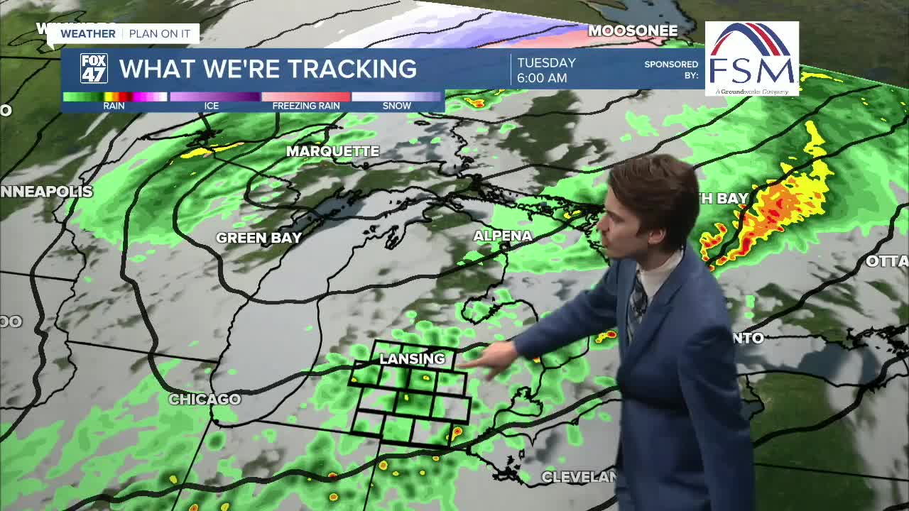
The above satellite and radar image shows the line of showers and storms developing over our neighborhoods in the afternoon hours.
We are noticing a trend of this line moving more southeast than our neighborhoods, leaving us dry other than the AM shower and storm chance.
Impacts for all storms look mainly to be winds as high as 60 mph and hail up to an inch in diameter. We can't rule out a chance for a tornado as well. However, this is still an evolving forecast and we could still see some changes throughout the day today.
Make sure you know how to get your weather alerts and where your safe space in case severe weather does strike.
Want to learn more about the Weather? Visit the FOX47News Website.
Stay in touch with us anytime, anywhere.
Sign up for newsletters emailed to your inbox.
Select from these options: Breaking News, Severe Weather, School Closings, Daily Headlines and Daily Forecasts.
