
LANSING, Mich. — A refreshing change is moving into Mid-Michigan today, with much drier air settling in behind an early morning front.
After several muggy days with dew points in the lower 70s, humidity will drop noticeably today and Saturday. Dew points will hold in the middle to upper 50s, making for a much more comfortable feel. Highs today will stay in the 70s under plenty of sunshine.
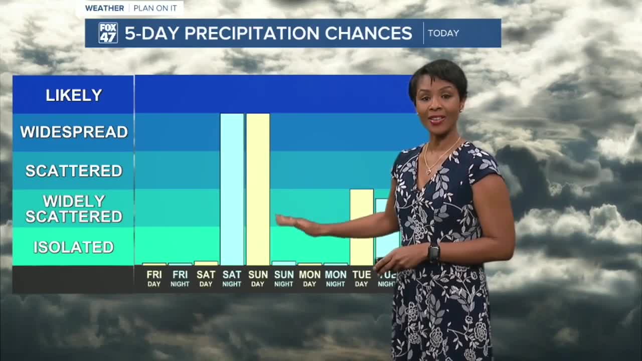
Saturday starts mainly dry, sunny, and warmer, with highs climbing into the lower to middle 80s. By Saturday night, a reinforcing cold front will bring the next chance for showers and thunderstorms. A few storms could be strong Saturday night, with damaging wind the main concern. The overall severe threat appears low, but the Storm Prediction Center has the area under a marginal risk.
Some rain and thunderstorm chances linger into Sunday morning across southern Lower Michigan before drier air returns.
Early next week looks cooler and comfortable, with highs mainly in the 70s and overnight lows in the 50s. Another round of showers or thunderstorms may arrive Tuesday into Wednesday as upper-level energy moves through the region.
Bottom line: Enjoy the sunshine and lower humidity today, keep an eye on storms Saturday evening, then get ready for a cooler and quieter start to next week.
7-Day Forecast
☀️ Friday: Sunny and comfortable. High 78°, Low 60°
⛈️ Saturday: Partly sunny with late-day thunderstorms possible. High 84°, Low 61°
⛈️ Sunday: Chance of morning thunderstorms, then improving. High 72°, Low 52°
🌤️ Monday: Mostly sunny and pleasant. High 73°, Low 53°
⛈️ Tuesday: Chance of thunderstorms. High 75°, Low 55°
⛈️ Wednesday: Scattered thunderstorms possible. High 77°, Low 59°
⛈️ Thursday: A few thunderstorms possible with partial sunshine. High 75°, Low 59°
Have a great weather picture or video to share? Send it our way and we may feature it on-air or online!

