
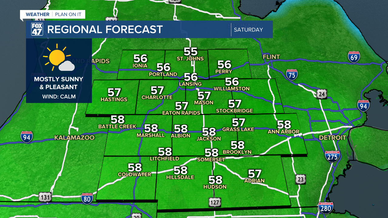
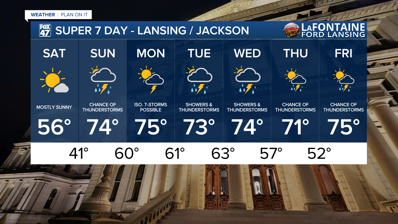
With high pressure passing over the state today, we'll look forward to mostly sunny skies to kick off the weekend. With highs holding around average in the mid 50s and calm winds, it will be a gorgeous day to get out and about. Clouds will begin to increase during the evening, well in advance of a warm front that will be bringing some changes our way on Sunday.
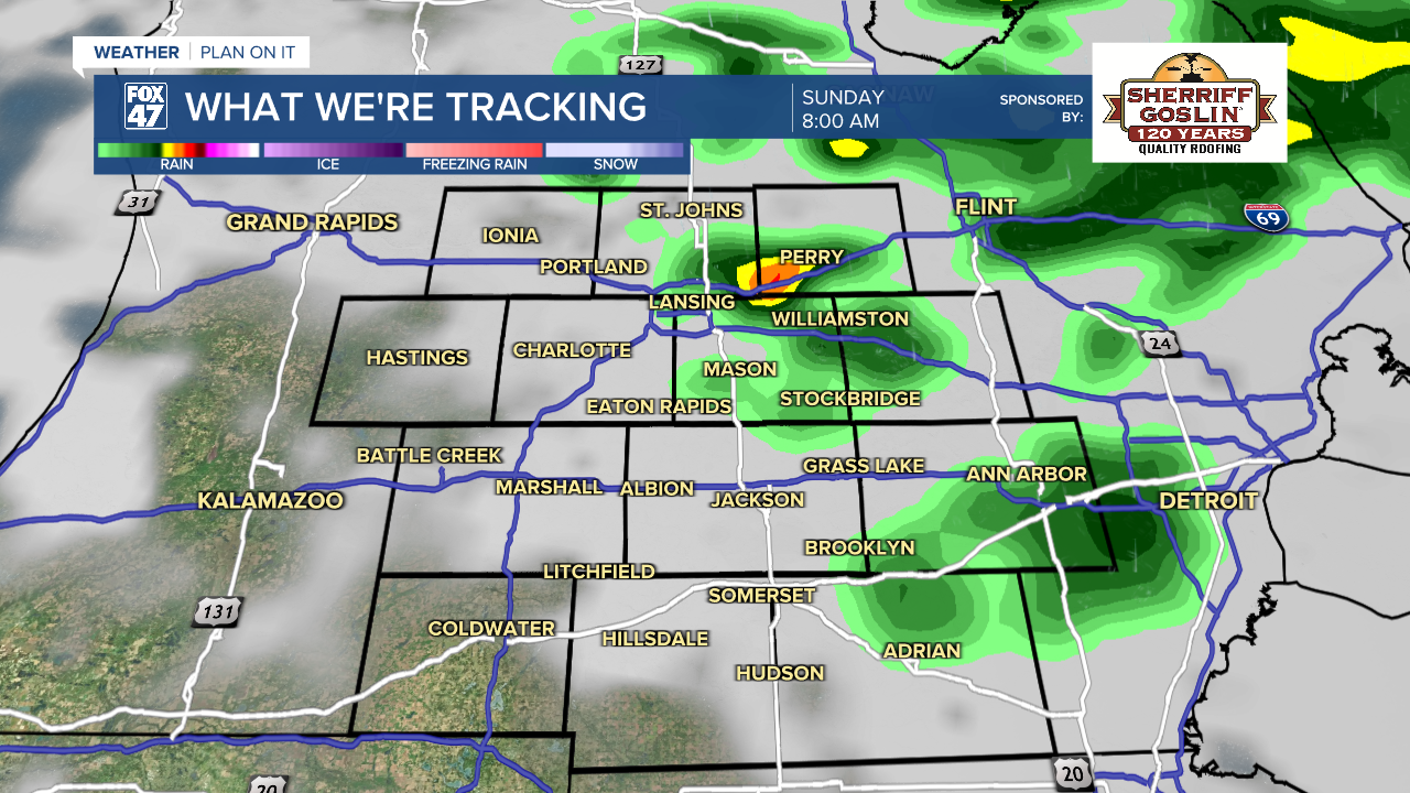
The biggest change will be a surge of late-Spring warmth, taking highs all the way up to the mid 70s for the second half of the weekend. Scattered showers and possibly a few thunderstorms will precede the front early Sunday morning, with the potential for additional hit-or-miss showers and storms in the afternoon. All told, it should still be a good day to get outside, but make sure to keep an eye on the sky.
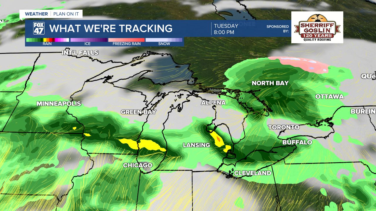
We level out on a course of unseasonably warm temperatures for the majority of next week. Highs will remain in the low to mid 70s Monday through Friday, starting the week with an isolated chance for a few storms. Tuesday and Wednesday bring a greater likelihood for more widespread storms, along with a chance for severe weather on Tuesday. We will monitor forecast trends closely over the next few days, so stay tuned for updates.
GET YOUR FOX 47 FORECAST HERE
Have a great weather picture or video to share? Send it our way and we may feature it on-air or online!

