

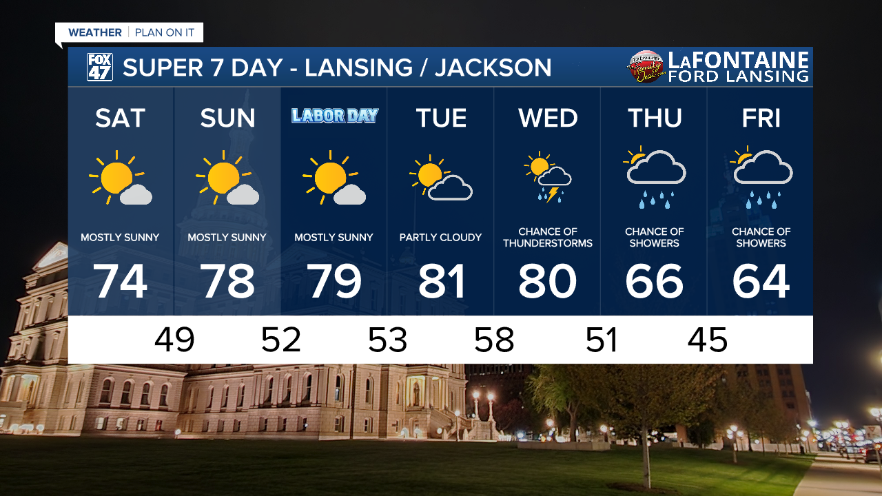
High pressure lingering over the Great Lakes will produce mostly sunny skies today through Monday, with temperatures gradually warming as winds shift more toward the southwest. We'll start with highs in the low 70s this afternoon, and climb to the upper 70s to around 80 on Labor Day. Whether you're staying local or traveling around the state, expect the weather to be fully cooperative for your plans.

Getting back into the normal routine next week will start quietly with partly cloudy skies on Tuesday. Summer will show it still has a little left in the tank as highs return to the low 80s. That warmth will continue into Wednesday as a new cold front brings the possibility for showers and storms later in the day.
GET YOUR FOX 47 FORECAST HERE
Another cooldown follows the cold front on Thursday and Friday, ushering in another Fall-like slate of temperatures. Highs will will fall back to the mid 60s, with mostly cloudy skies and occasional showers likely both days.
Want more FOX 47 News? Here's how you download our Roku app
You can also see the latest news from across our mid-Michigan neighborhoods by liking us on Facebook or following us on X.
