
LANSING, Mich. — Scattered rain and snow showers will continue this evening as a cold front sweeps across Michigan. Expect slippery conditions on the roads over the next few hours, but the rain will not be heavy enough to re-aggravate any of the flooding we are still experiencing from last weekend.
Showers will end after 8:00 PM, leaving us with decreasing clouds for the remainder of the night. Temperatures will take a steep dive into the low 20s by daybreak, with enough of a breeze left to make it feel more like the teens going into Tuesday morning.
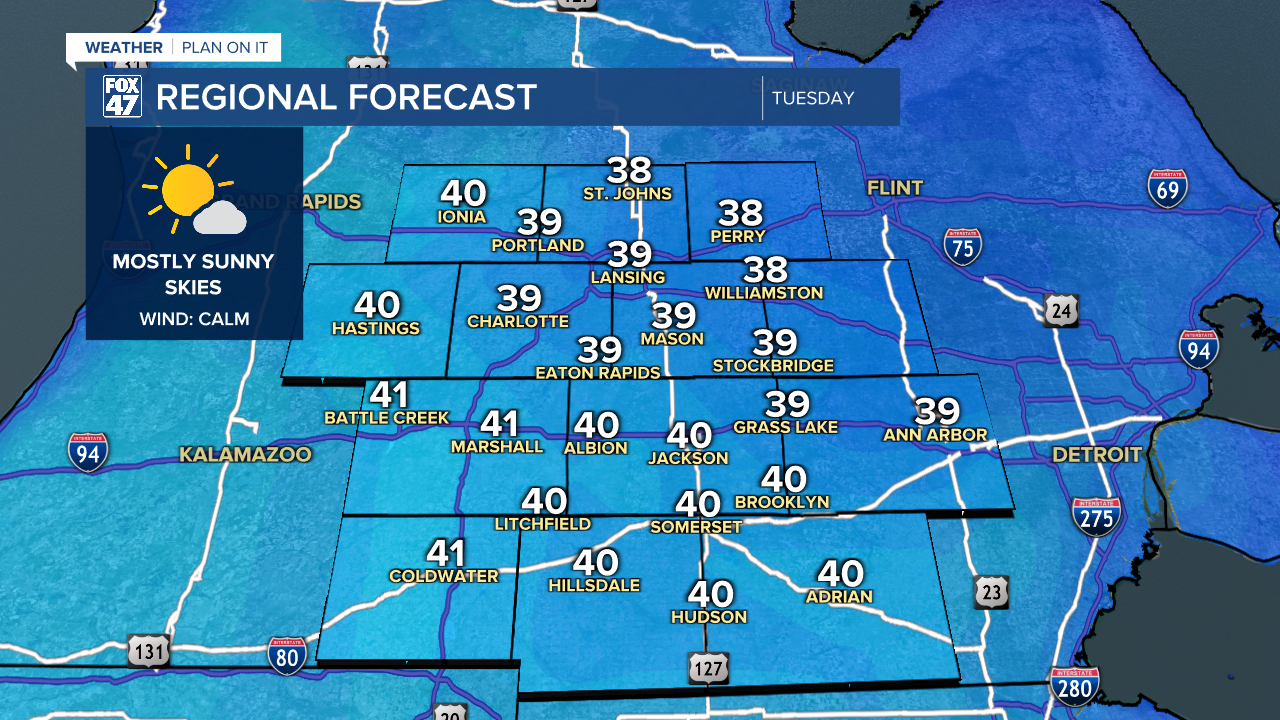
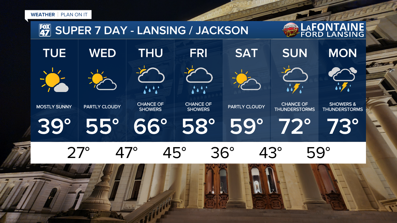
High pressure settles over the state on Tuesday, giving us a very welcome break from wet weather of any kind. Mostly sunny skies are expected, but that Spring sunshine will be deceptive if you're just looking out your window. Highs will only reach the upper 30s to around 40 degrees, but winds are at least expected to turn calm as high pressure settles overhead.
GET YOUR FOX 47 FORECAST HERE
A small disturbance passes just north of our neighborhoods on Wednesday, leading to more of a blend of clouds and sunshine throughout the day. Showers will stay north of us, and we'll even get a nice bump in temperatures out of the deal. Highs will return to the mid 50s, making for a much more comfortable day to get outside.
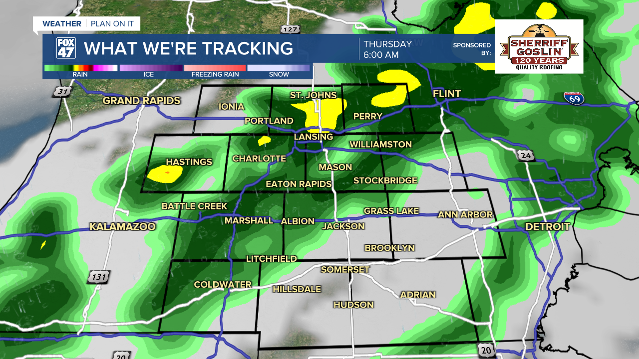
Given some of our ongoing flooding issues from this past weekend, rain is the last thing we want to hear about right now. Unfortunately, scattered showers are expected to return on Thursday and Friday, but these currently do not look likely to cause new issues with flooding. Highs in the upper 50s to mid 60s are expected to round out the work week.
Have a great weather picture or video to share? Send it our way and we may feature it on-air or online!

