
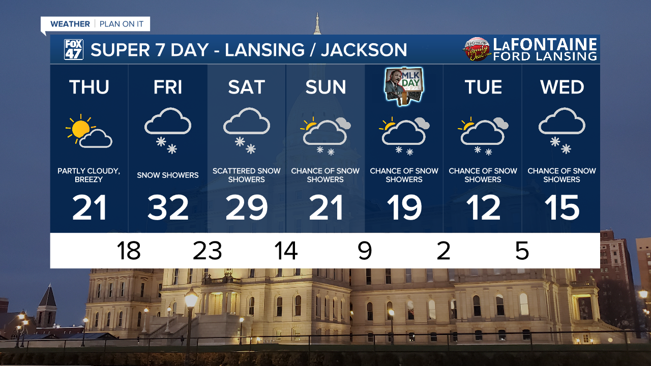
LANSING, Mich. — Snow will continue to gradually taper off this evening as an Arctic cold front moves away to the east. The steadiest snow will wrap up by 8:00 PM, with the chance for a leftover snow showers until about midnight. Mostly cloudy skies will linger into the overnight period, but some clearing will start to develop closer to sunrise.
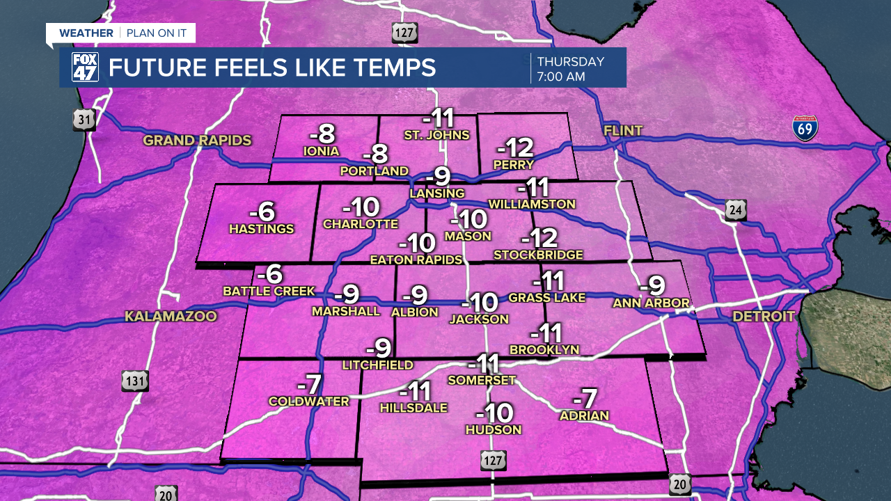
All of this will be accompanied by continued bitterly cold conditions. Lows tonight will wind up around 10 degrees in most neighborhoods, with NNW winds holding at 10-15 mph with higher gusts. This will force wind chills below zero, anywhere from -5 to -10 degree as we're heading out the door in the morning. Dress warmly and stay alert for leftover slick areas on the roads.
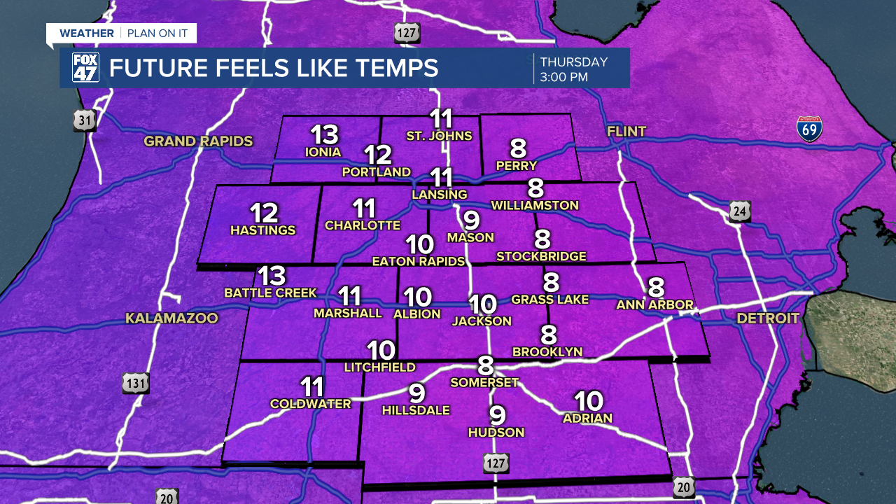
The cold won't loosen its grip on Thursday, but we will at least get some sunshine. Partly to mostly sunny skies are expected for most of the day, followed by increasing clouds later in the evening. Highs will only reach the low 20s, with NNW winds still holding firm at 10-15 mph. That will mean wind chills in the low teens at best in the afternoon.

Our next round of snow will arrive after midnight Thursday ahead of our next storm system. Snow showers will become increasingly widespread in time for the morning commute on Friday, and will persist throughout the day. Expect slick and snow-covered roads for your Friday travels, and be sure to give yourself plenty of extra driving time. Highs will at least get a small bump out of the system on Friday, briefly returning to the low 30s.
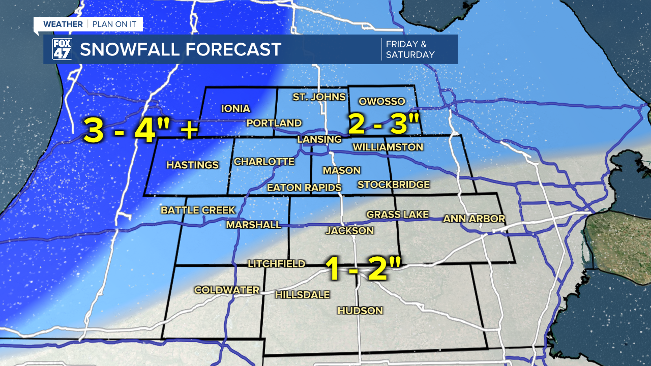
Snow showers will linger on Saturday as the system departs, gradually tapering off in the afternoon. Highs will hover in the upper 20s, with returning breezy conditions adding some extra chill again. Snowfall amounts combined across Friday and Saturday, will range from 2-3" across our northern neighborhoods. Locations from Jackson south will pick up 1-2" of new snow, with 3-4" or more west of I-69.
GET YOUR FOX 47 FORECAST HERE
A new wave of Arctic air arrives in the wake of Saturday's system, dragging highs back to around 20 degrees for the second half of the weekend. The chance for snow showers will linger as well, and will continue through Tuesday as temperatures continue on a downward trend. Highs Monday and Tuesday will be limited to the middle and upper teens.
Want more FOX 47 News? Here's how you download our Roku app
You can also see the latest news from across our mid-Michigan neighborhoods by liking us on Facebook or following us on X.
