
LANSING, Mich. — A warm front slowly approaching from the south had brought increased cloud cover back to our neighborhoods this evening, along with warmer temperatures and increasing humidity. This will set the stage for isolated showers and thunderstorms later this evening and into the overnight hours.

Although isolated, storms could produce very heavy downpours, so stay alert for the possibility of localized flooding through the Tuesday morning commute. Temperatures will not drop much overnight thanks to the added humidity. Lows will only fall to the upper 60s with southeasterly winds at 6-12 mph.
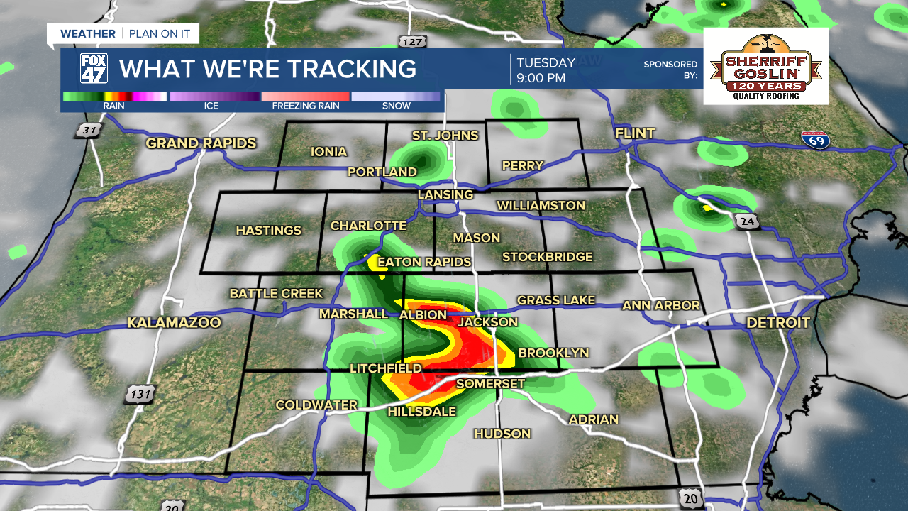
Spotty showers and thunderstorms will continue at times throughout the day on Tuesday as the warm front continues to slowly drift northward into lower Michigan. Storms may turn a bit heavier in the afternoon and evening thanks to daytime heating, but severe weather is not expected on Tuesday. Highs will be held back by the lingering cloud cover and occasional rain, staying in the low 80s.

The midweek period will bring the hottest weather of the year so far, with highs headed for the low 90s on both Wednesday and Thursday. Humidity levels will border on oppressive with dew points surging into the upper 60s and low 70s. This will leave us sweltering under heat indices in the middle to upper 90s. On Wednesday in particular, we could even close in on a real feel near 100 degrees. Be prepared to keep cool and hydrated, especially if you have to spend time or work outdoors!

The high heat will also bring the risk of strong to severe storms with it. Pop-up showers and thunderstorms will be possible both days, but we will be paying especially close attention to the evening hours. Severe thunderstorms are expected to develop over parts of Wisconsin and Illinois and then track toward Michigan with the potential for damaging winds, large hail, and isolated tornadoes. Stay tuned over the next couple of days for updates.
GET YOUR FOX 47 FORECAST HERE
High heat and humidity take a break behind a passing cold front on Friday. We'll close out the work week with mostly sunny skies, highs in the low 80s, and a substantial drop in the humidity. That will continue into the weekend, just with the chance for isolated thunderstorms on Saturday. Highs will hover in the upper 70s to low 80s through Sunday.

Have a great weather picture or video to share? Send it our way and we may feature it on-air or online!

