
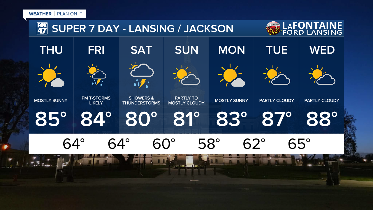
LANSING, Mich. — High pressure over the Great Lakes is set to hang on for one more day, but some changes will start to appear over the next 24 hours. For tonight, partly cloudy skies are expected, with lows holding a bit milder in the middle to upper 50s.

Thursday's going to be a hot one. High pressure will maintain enough control to keep mostly sunny skies in place, but as it moves slightly east, we'll develop stronger southwesterly winds. This will help to push highs in the mid 80s in the afternoon, with a subtle increase in humidity.

We'll feel the increasing humidity much more on Friday as a slow-moving cold front begins to approach the region. After a mix of sun and clouds in the morning, scattered showers and thunderstorms are likely in the afternoon and evening. Storms will roll in after 4:00 PM, continuing into the first part of the overnight period. Severe weather potential is low in our neighborhoods, but we'll be keeping a close eye on forecast trends.

Occasional showers and thunderstorms are expected to continue on Saturday as the cold front tracks through the region. Severe weather potential is also low, but will depend on whether we break into any significant sunshine between storms. Highs will hold around 80 degrees.
GET YOUR FOX 47 FORECAST HERE
Dry weather returns on Sunday in the wake of Saturday's cold front. Cloudier skies in the morning will become increasingly sunny during the afternoon, with highs holding in the low 80s. High pressure replacing the cold front will linger through the first half of next week, with a surge of summer heat coming our way. Partly to mostly sunny skies are expected Monday through Wednesday, with highs starting to aim toward the upper 80s!
Have a great weather picture or video to share? Send it our way and we may feature it on-air or online!

