
LANSING, Mich. — A line of strong thunderstorms approaches Mid-Michigan this evening, preparing to unleash gusty winds, heavy rain and frequent cloud-to-ground lightning.
This storm system, known as a derecho--a storm with prolonged intensity for several hours over a path spanning at least 400 miles in length--produced a 112mph wind gust near Cedar Rapids, Iowa. It will brings winds between 60-70mph to parts of our area early tonight.
Although the system will be weakening after crossing Lake Michigan, it still brings concern for scattered power outages tonight, so making sure your devices are charged and having a plan will be important.
As of 7:50PM, Severe Thunderstorm Watches were still in effect for almost all of the viewing area. As previously stated, high winds with these storms will be the primary threat.
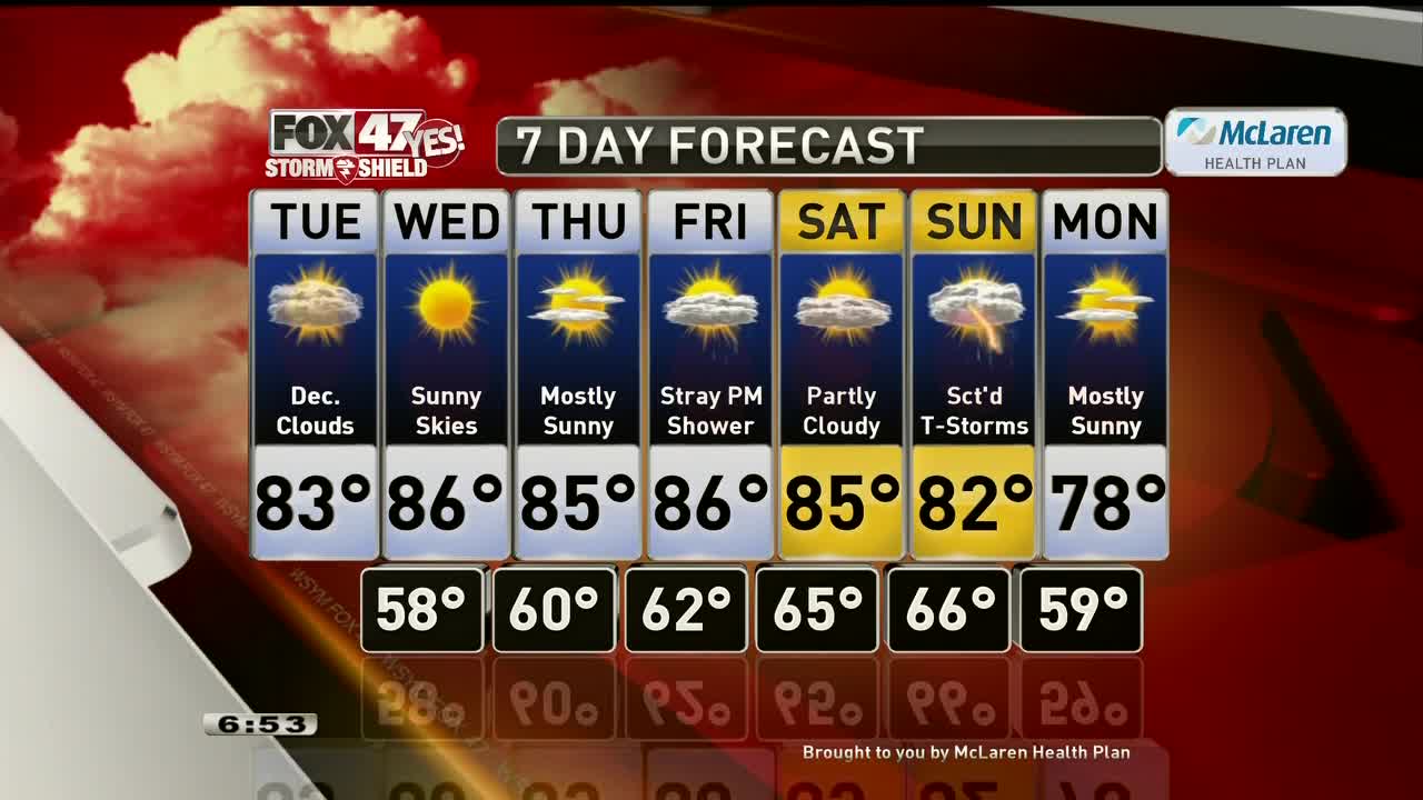
Most of the workweek looks quiet with highs in the middle 80s, with better chances for rain and storms returning by the tail end of the weekend.
Want to learn more about the Weather? Visit the FOX47News Website.
Stay in touch with us anytime, anywhere.
Download our free app for Apple and Android
and
Sign up for newsletters emailed to your inbox.
Select from these options: Breaking News, Severe Weather, School Closings, Daily Headlines and Daily Forecasts.
