
LANSING, Mich. — Thursday's rain has moved out of our neighborhoods, but our weather won't improve a whole lot heading into tonight. A combination of patchy fog and drizzle will continue throughout the night, leading to pockets of poor visibility and keeping roads slippery. Temperatures will take a small dip toward the upper 30s with light and variable winds.

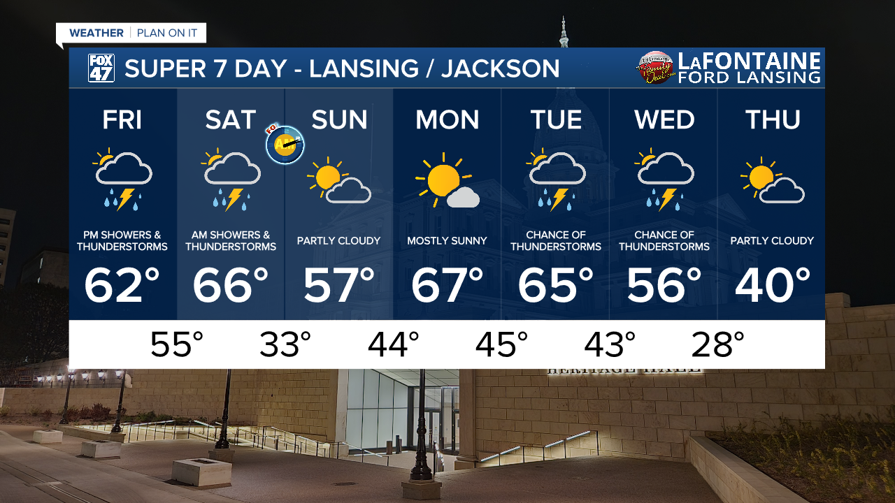
Friday, our attention shifts to the potential for isolated severe storms in the evening. Leftover fog in the morning will thin out as winds out of the SSE pick up to 5-15 mph. Mostly cloudy skies may allow a few break of sun through, but isolated showers and possible thunderstorms will begin to develop as early as 1:00 PM in some areas.

The greater concern comes in between 6:00 PM and 11:00 PM as a warm front begins to lift north through the region. This will help to elevate temperatures to the low 60s, with that added warmth helping to destabilize the atmosphere. A wave of showers and thunderstorms will quickly track through the region, and could become severe. Main threats will concern damaging winds and large hail, but a low chance for isolated tornadoes does exist. Make sure to stay weather aware, and be prepared to head for shelter when storms head your way.

Friday evening's storms will depart by 11:00 PM, leaving mostly cloudy skies and breezy conditions behind overnight. An additional stray shower will be possible, but the next significant wave of showers and storms will arrive closer to daybreak Saturday. 5:00 AM to 10:00 AM will be the timeframe of concern ahead of an approaching cold front. Isolated severe weather will also be possible with this round of activity, with temperatures well into the middle and upper 60s early Saturday.

Some additional spotty showers or storms will be possible just after midday Saturday as the cold front moves through, but will give way to dry but breezy conditions for the afternoon.
GET YOUR FOX 47 FORECAST HERE
We spring forward on Sunday as Daylight Saving Time begins, but we also get back to some more pleasant weather. Partly cloudy skies are expected with highs only slipping back to the upper 50s behind the cold front. We'll get to enjoy that sunshine a little later too, since sunset will shift an hour later to 7:36 PM.
Want more FOX 47 News? Here's how you download our Roku app
You can also see the latest news from across our mid-Michigan neighborhoods by liking us on Facebook or following us on X.
