
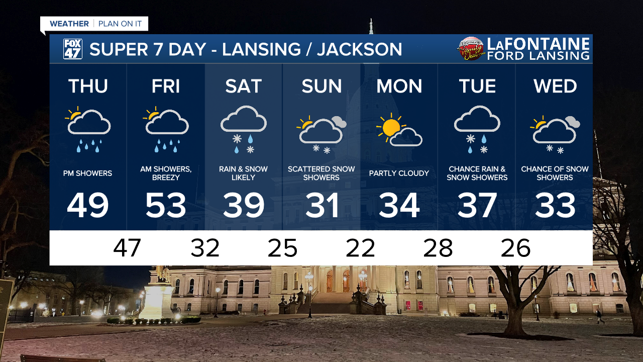
LANSING, Mich. — Stubborn clouds will finally clear out for many of our neighborhoods overnight, but some patchy fog could develop in its place as temperatures take a dip toward the low 30s.
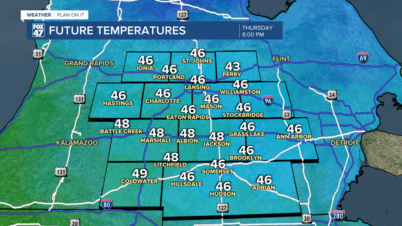
A warm front will lift through Mid-Michigan on Thursday, opening the door to brief visit from some Spring-like air. Temperatures will climb into the upper 40s by afternoon, and could even take a run at 50 in some neighborhoods. Mostly cloudy skies and a bit of sunshine in the morning will quickly give way to increasing clouds after midday as an area of low pressure begins to track out of the central Plains.
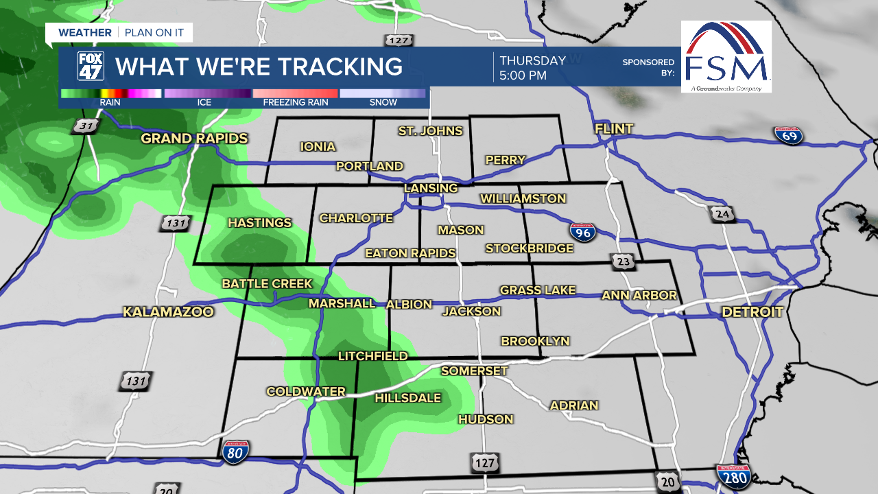
This new storm system will push some showers into our neighborhoods just in time for the Thursday evening commute, although the rain will be light at first. Heavier showers and periods of steadier rain will arrive around 10:00 PM, and could even be accompanied by a few rumbles of thunder overnight. Temperatures will also continue to climb on Thursday night, with most of us waking up to low 50s on Friday morning. Winds will also increase, picking up to 10-20 mph out of the SSE.

Lingering showers will continue to make for some wet roads on the Friday morning commute, but will taper off before midday. Clouds cover will start to break up in the afternoon, but temperatures will also begin to drop. We'll fall from the low 50s in the morning to low 40s and upper 30s by evening. The break from wet weather will be short-lived for Friday night though, because another storm system will be moving into the Great Lakes on Saturday.
GET YOUR FOX 47 FORECAST HERE
Saturday's storm system will also track in from the southwest like Thursday night's, but we'll be working with cooler temperatures this time around. Highs Saturday will hold in the middle to upper 30s. That will be warm enough during the day to keep most of the precipitation in our neighborhoods as rain, but some mixing with snow will be possible at times.
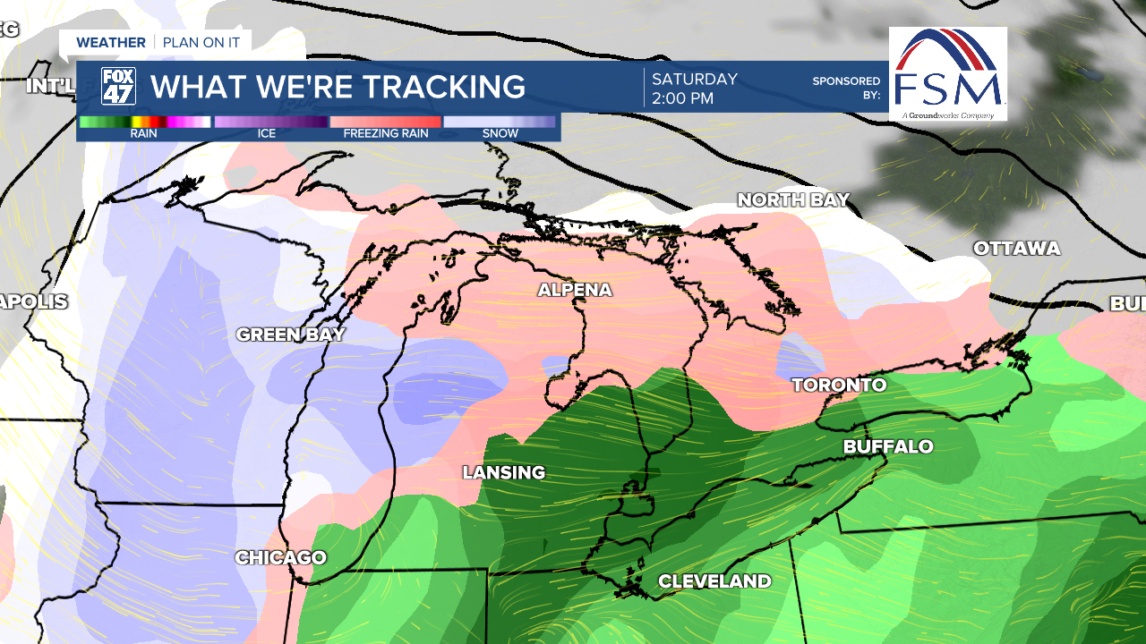
An eventual change to snow showers will take shape Saturday night into Sunday as the system begins to head east. Colder air and breezy conditions will keep lake effect snow showers going throughout most of the day, with highs held to the low 30s.
Want more FOX 47 News? Here's how you download our Roku app
You can also see the latest news from across our mid-Michigan neighborhoods by liking us on Facebook or following us on X.
