


LANSING, Mich. — An Air Quality Alert is in effect until 6:00 AM Saturday across our neighborhoods. Smoke from wildfires in central Canada is being swept south over the Great Lakes by a cold front. The smoke could create unhealthy conditions for those with respiratory conditions, so limit time outdoors and be sure to close windows around your home.

That same cold front will stir up a few hit-or-miss showers and thunderstorms this evening as it makes its way south. Severe weather is not expected, but isolated heavy downpours and gusty winds cannot be ruled out. Wet weather will wrap up by 11:00 PM, leaving partly cloudy skies behind overnight. Lows will take a chilly turn toward the mid 40s by morning.

A ridge of high pressure begins to spread into the Great Lakes on Saturday behind the cold front. This will mean mostly sunny skies, but the passing front will leave a cooler air mass and breezy conditions in place for the time being. Highs will dip back to the mid 60s on Saturday, with NNW winds at 10-15 mph. That said, it will still be a great day for outdoor plans, but you may want to opt for a sweatshirt or light jacket. Sunday lives up to its name with sunny skies, as highs return to around 70 degrees.
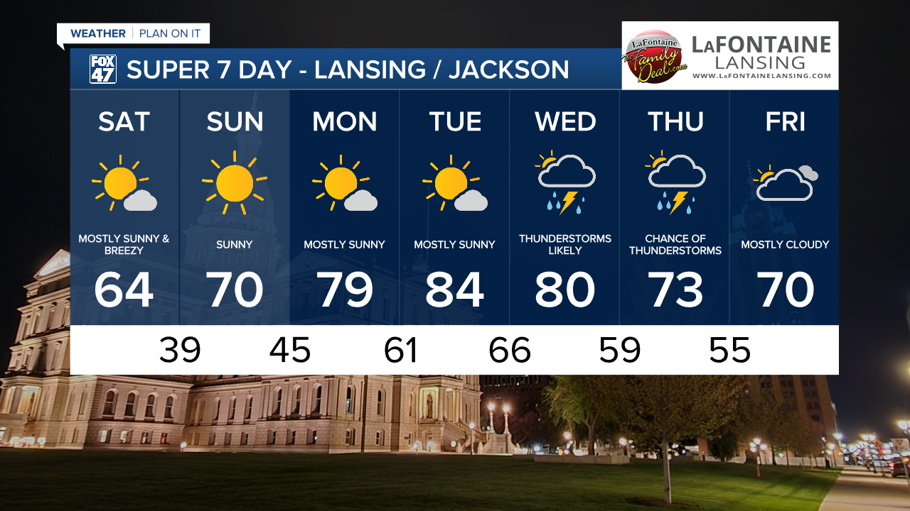
More sunshine is on tap for Monday and Tuesday, but winds pivoting toward the southwest will push our temperatures into more summerlike territory. Highs will climb to the upper 70s on Monday, then head for the mid 80s on Tuesday. That warmth will set up up for returning showers and thunderstorms on Wednesday as a new disturbance rolls over the state.
Want to learn more about the Weather? Visit the FOX47News Website.
Stay in touch with us anytime, anywhere.
Sign up for newsletters emailed to your inbox.
Select from these options: Breaking News, Severe Weather, School Closings, Daily Headlines and Daily Forecasts.
