
LANSING, Mich. — Scattered snow showers will become more isolated this evening as a initial round of energy moves east of the region. Roads will remain slick, especially where additional snow showers occur, but patchy freezing drizzle will also be possible. This could lead to a glaze of ice on already-slick roads, so use extra caution if traveling this evening or overnight. Temperatures will start the night in the low 20s, then climb toward the middle and upper 20s by daybreak as a warm front sweeps through the region.
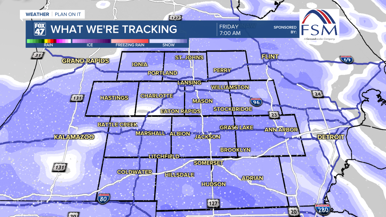
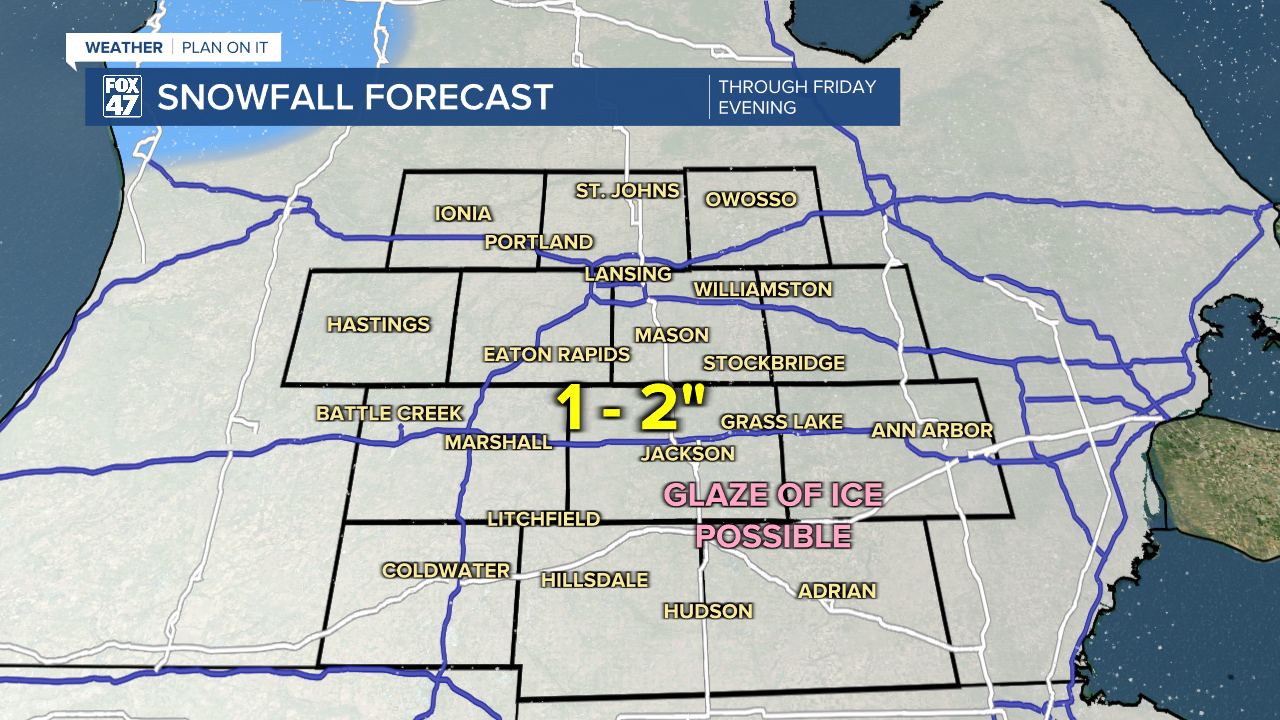
Another round of widespread snow arrives early Friday, beginning around 5:00 AM in neighborhoods around Lansing. The snow will spread out regionwide throughout the morning commute, and could be heavy at times. Give yourself plenty of extra commute time, and be prepared to take it slow. Snow will wind down between 10:00 AM and Noon, followed by some hit-or-miss snow showers into early Friday evening. An additional 1-2" of snow is expected across our neighborhoods through early Friday evening.
Friday will also come with a notable upswing in our temperatures. We expect to see highs reach the low and possibly mid 30s for the first time in nearly three weeks. It may also be our first time above freezing in that same stretch. Temperatures will begin to fall back into the 20s in the afternoon thanks to an Arctic cold front, all while NNW winds increase to 15-25 mph. Gusts up to 35 mph will be possible, meaning wind chills will quickly plummet back toward the teens and single-digits.
GET YOUR FOX 47 FORECAST HERE
Partly cloudy skies take over on Friday night, with lows falling to around zero. With the winds, we will likely see wind chills well below zero, possibly as low as -10° going into Saturday morning. Partly cloudy skies continue on Saturday, with highs only reaching the middle teens. Snow showers return Sunday with a small disturbance, bringing highs back to the low 20s.

Temperatures bounce back early next week with a stretch of low to mid 30s coming Monday through Wednesday. Mostly cloudy skies and dry conditions are expected Monday and Tuesday, followed by the chance for returning rain and snow showers on Wednesday.
Want more FOX 47 News? Here's how you download our Roku app
You can also see the latest news from across our mid-Michigan neighborhoods by liking us on Facebook or following us on X.
