
LANSING, Mich. — Scattered snow showers will continue to track through our neighborhoods on this first night of 2026. Roads will be slick for much of the night as a result, but accumulation will be insignificant compared to Wednesday evening. Most neighborhoods will pick up little more than a dusting, with up to 0.5" possible. Snow showers will end by daybreak, with lows only falling a few degrees into the middle and upper teens.
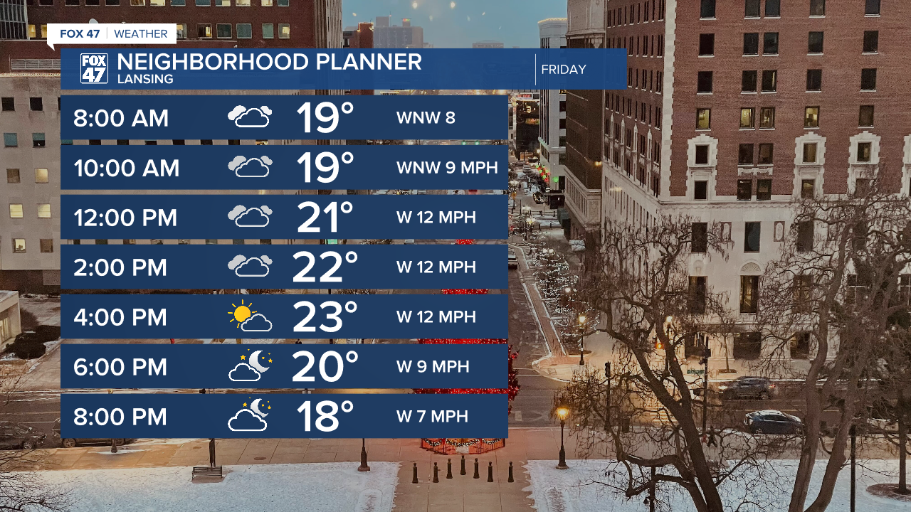
Mostly cloudy skies will continue on Friday, but will give way to some brief sunshine later in the afternoon. Highs will head for the mid 20s, with light westerly winds at 6-12 mph.
GET YOUR FOX 47 FORECAST HERE
We'll remain on the same course for Saturday and Sunday, settling in for a quiet first weekend of 2026. Highs will remain in the middle to upper 20s, with lighter winds taking over as well.
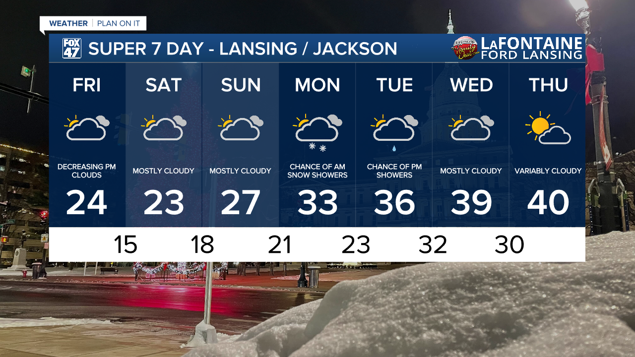
Temperatures are expected to trend a bit milder going into next week. Highs jump to the low 30s on Monday in the wake of a disturbance that could bring a few morning snow showers to our neighborhoods. We climb into the middle and upper 30s on Tuesday and Wednesday with another disturbance possibly bringing around of plain rain showers with it. A run toward 40 degrees is possible by Thursday, and it may even come with a bit more in the way of sunshine.
Want more FOX 47 News? Here's how you download our Roku app
You can also see the latest news from across our mid-Michigan neighborhoods by liking us on Facebook or following us on X.
