
LANSING, Mich. — Spotty snow showers will linger for the first part of this evening, keeping roads messy in many neighborhoods. Diminishing winds will lead the snow showers to wind down by midnight in most locations, followed by a bit of clearing overnight. Although the snow may be taking a break, the bitter cold will not. Lows will fall below zero with westerly wind at 5-10 mph still able to produce wind chills close to -10 degrees.
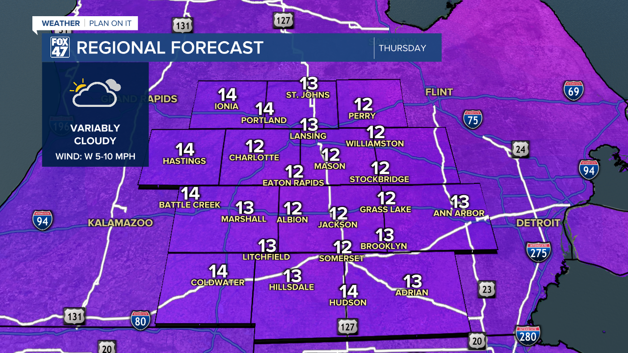
Variable clouds and sunshine take over on Thursday, with very light northwesterly winds limiting any lake effect snow showers to the immediate Lake Michigan shoreline. That means a dry, snow-free day for us, but the bitter cold won't be easing up. Highs will remain locked in the middle teens, but with minimal wind chill for a change.
More Arctic air pours in from southern Canada Thursday night, forcing lows below zero across our neighborhoods. Variable cloud cover will lead to a wide range of lows, anywhere from as low as -5° in cloudier locations, to -10° or lower where skies are clearer. Winds will turn calm, so we will not be adding any wind chill to the equation.
GET YOUR FOX 47 FORECAST HERE
Highs remain in the single-digits on Friday following the bitterly cold start, but a gradual and slight warming trend will take hold over the weekend. With partly to mostly sunny skies expected through Sunday, highs will return to the middle teens to start the weekend, then top 20° for the first time in nearly ten days on Sunday.

Groundhog Day brings our next chance for snow showers, but highs will inch a little higher toward the mid 20s.
Want more FOX 47 News? Here's how you download our Roku app
You can also see the latest news from across our mid-Michigan neighborhoods by liking us on Facebook or following us on X.
