

EXTREME COLD WATCH in effect from late Thursday night through Saturday morning. Wind chills as low as -25 degrees are expected, making frostbite possible on exposed skin in as little as 30 minutes. Limit time outdoors, including for your pets.
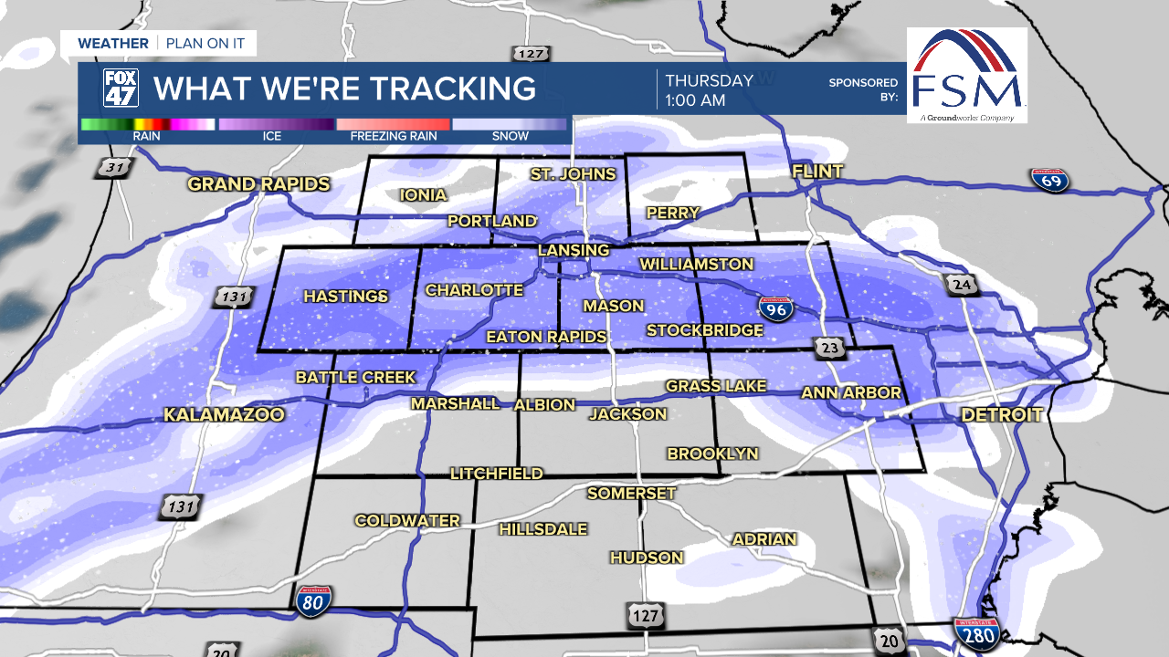
Lake effect snow showers have broken out across the region this evening, following in the wake of a cold front that brought light snow Wednesday morning. A second cold front sweeping through the region around midnight will lead to a brief burst of steadier snow overnight, before switching back to lake effect snow showers by daybreak.
The end result will be continued messy travel, and up to 1" of new snow in most neighborhoods by sunrise. Lows will fall to the middle teens, with wind chills near zero thanks to westerly winds at 10-15 mph.

After a brief break in the morning, possibly with a bit of sunshine, lake effect snow showers will continue on Thursday . Stay alert for more slick spots on the roads and rapid changes in visibility. Snow showers will eventually come to an end by Friday morning, with most neighborhoods picking up as much as 1-3" by then. Heavier amounts of 2-5" are possible west of I-69.

Following highs back in the teens on Thursday afternoon, a potent Arctic cold front will sweep through the region Thursday night. This will open the door for this weekend's extreme cold, starting with lows falling below zero. With northwesterly winds at 10-15 mph expected, wind chills by daybreak Friday will fall to -20 to -25 degrees.

Snow showers will come to an end on Friday morning as the brutal cold continues to dig in. Despite the chance for a bit of afternoon sunshine, highs Friday will only reach the single-digits. Wind chills will also hover between -15 to -25 throughout the day, meaning frostbite will be possible on exposed skin in as little as 30 minutes. All of this will be followed by widespread low temperatures in the negative teens Friday night. Fortunately, winds will turn calm, cutting off wind chills for a bit.
GET YOUR FOX 47 FORECAST HERE
Highs remain in the single-digits on Saturday, with a mix of sun and clouds expected. Lows will fall below zero again overnight, followed by highs in the low teens Sunday as a few snow showers return to the region.

Want more FOX 47 News? Here's how you download our Roku app
You can also see the latest news from across our mid-Michigan neighborhoods by liking us on Facebook or following us on X.
