
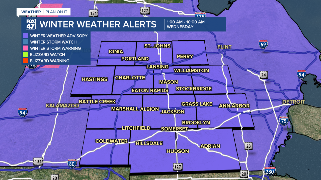
WINTER WEATHER ADVISORY in effect from 1:00 AM to 10:00 AM Wednesday. Heavy snow is expected overnight through the Wednesday morning commute, making for hazardous travel conditions.
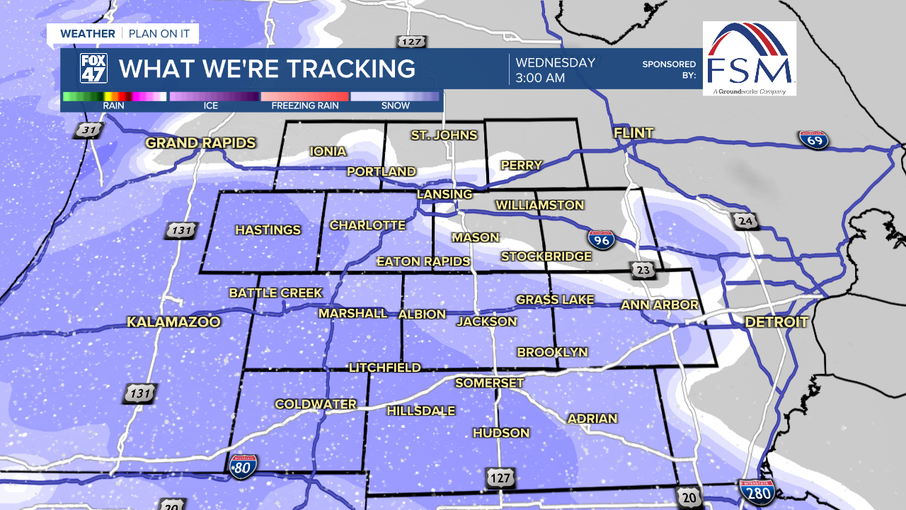
Our next round of snow is on the way tonight as a new disturbance moves out of the northern Plains. Mostly cloudy skies during the evening will give way to widespread snow between midnight and 3:00 AM. The snow is likely to be heavy at times and will persist into Wednesday morning, along with breezy conditions.
Expect roads to quickly become snow-covered overnight, and be plan on plenty of extra commute time in the morning. Temperatures will dip to lows in the low teens before midnight, then slowly climb toward the upper teens by daybreak.
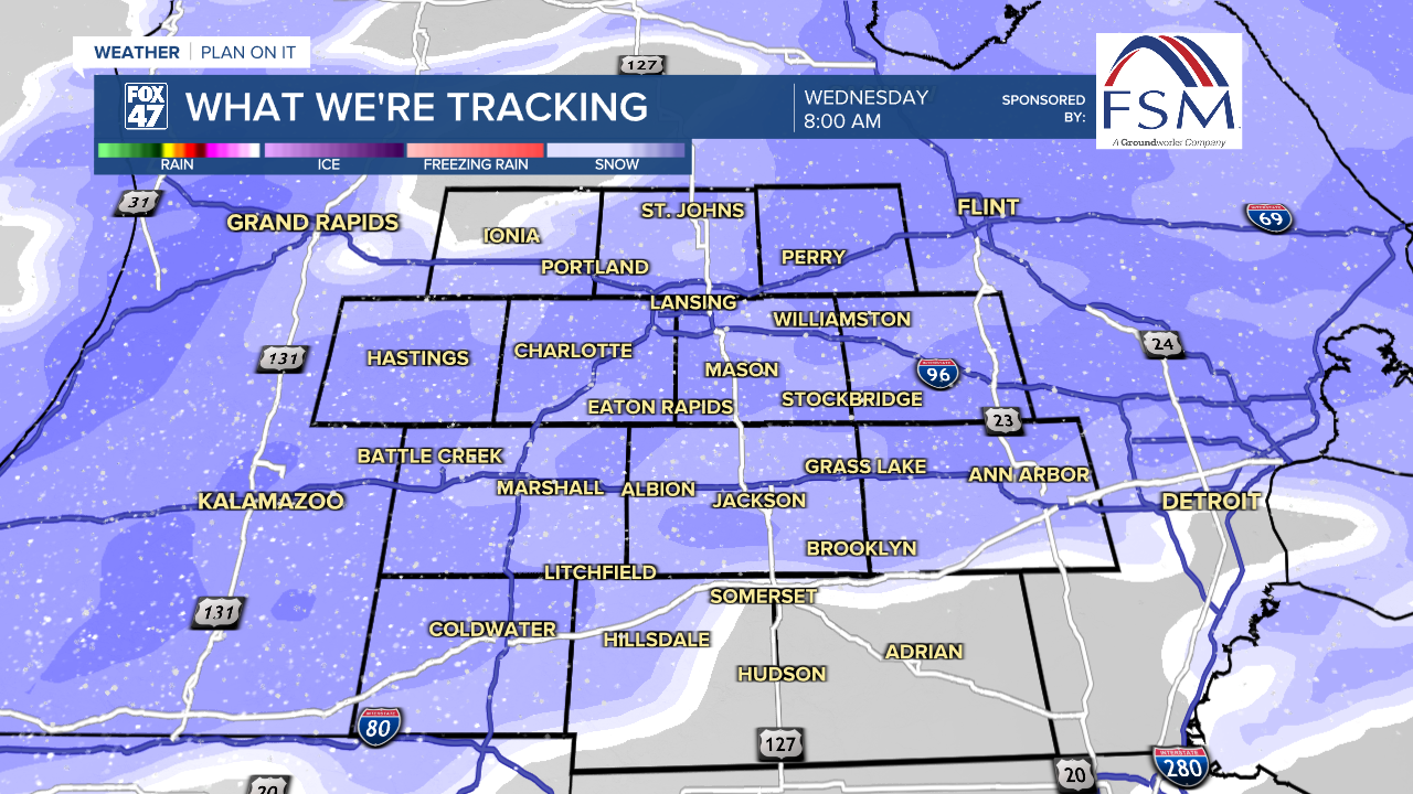
Moderate to heavy snow will continue throughout the morning commute on Wednesday, gradually tapering off after 10:00 AM. Even treated roads and interstates are likely to be snow-covered during this time, so you may want to push your travel to later in the day if you can. Scattered snow showers will linger into the evening, with highs climbing to the upper 20s.
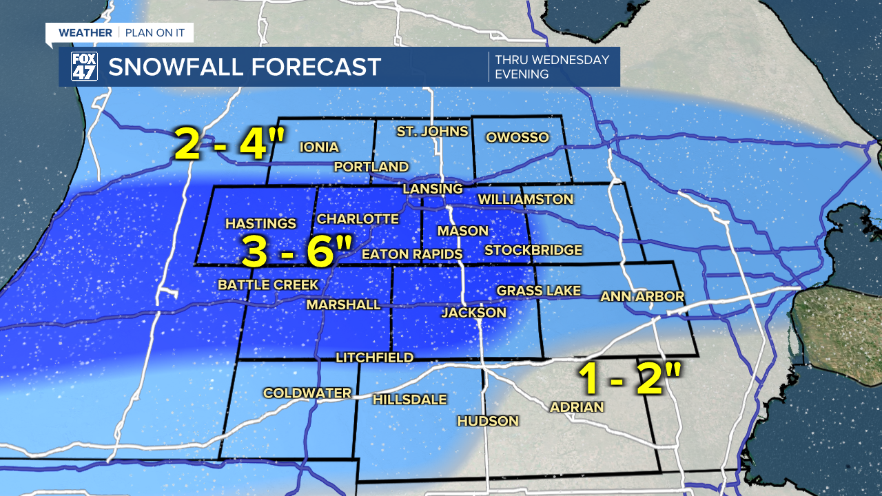
Snowfall totals by Wednesday evening will range from 3-6" for most neighborhoods between I-96 and I-94. Slightly lighter amounts from 2-4" are likely north of Lansing and across Hillsdale and Branch Counties.
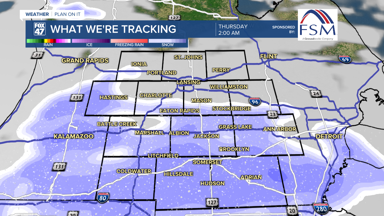
Another quick burst of snow is expected overnight Wednesday as a secondary disturbance sweeps across Michigan. This will mainly impact neighborhoods south of Lansing, putting down around 1" of additional snowfall before daybreak Thursday. Lows Wednesday night will fall to the middle teens.
Additional snow showers are likely Thursday, and to a lesser extent on Friday, but the bigger story will be the next wave of brutally cold air. Highs Thursday will hang on to the low 20s, but an Arctic cold front sweeping through later in the day will send lows spiraling below zero on Thursday night.
GET YOUR FOX 47 FORECAST HERE
Highs on Friday will be held to the single-digits as Arctic high pressure spills south from central Canada. A few snow showers will be possible, but the chance is expected to diminish as the day goes on. From there, with some slight clearing on Friday night, lows will dive close to -10 degrees. Neighborhoods away from Lansing and Jackson could see lows closer to -15, but thankfully winds are expected to diminish.
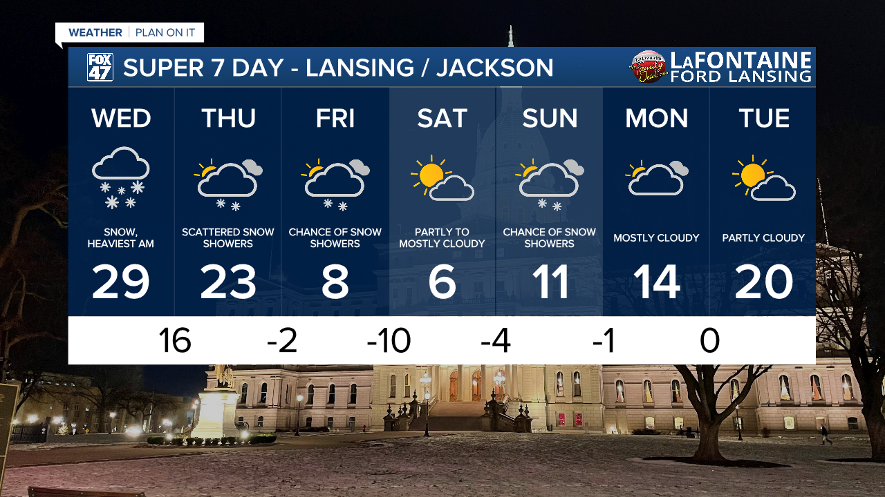
Highs remain in the single-digits on Saturday, with a mix of sun and clouds expected. Lows will fall below zero again overnight, followed by highs in the low teens Sunday as a few snow showers return to the region.
We'll begin to get a small hint of relief Monday and Tuesday as quieter weather returns, and highs start trending back toward the middle teens and low 20s. Even so, long-range trends suggest we could continue to see below-average temperatures into the first week of February. Do everything you can to stay warm in the coming days, and make sure your pets are kept in from the cold, too!
Want more FOX 47 News? Here's how you download our Roku app
You can also see the latest news from across our mid-Michigan neighborhoods by liking us on Facebook or following us on X.
