
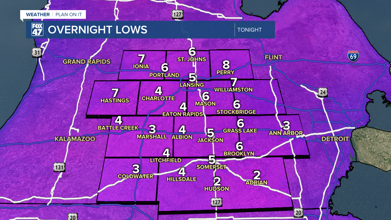
Lows tonight will wind up between zero and five degrees between midnight and 3:00 AM, followed by a rise of a few degrees as scattered clouds roll in late.

Winds will be light early on, but even a light SSW wind at 5-10 mph will force wind chills below zero by the time most of us are heading out the door in the morning. Make sure to dress in extra layer and cover up your extremities!
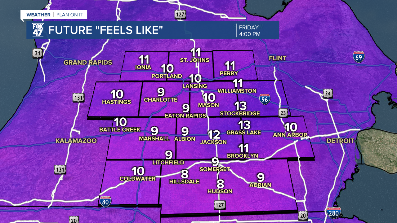
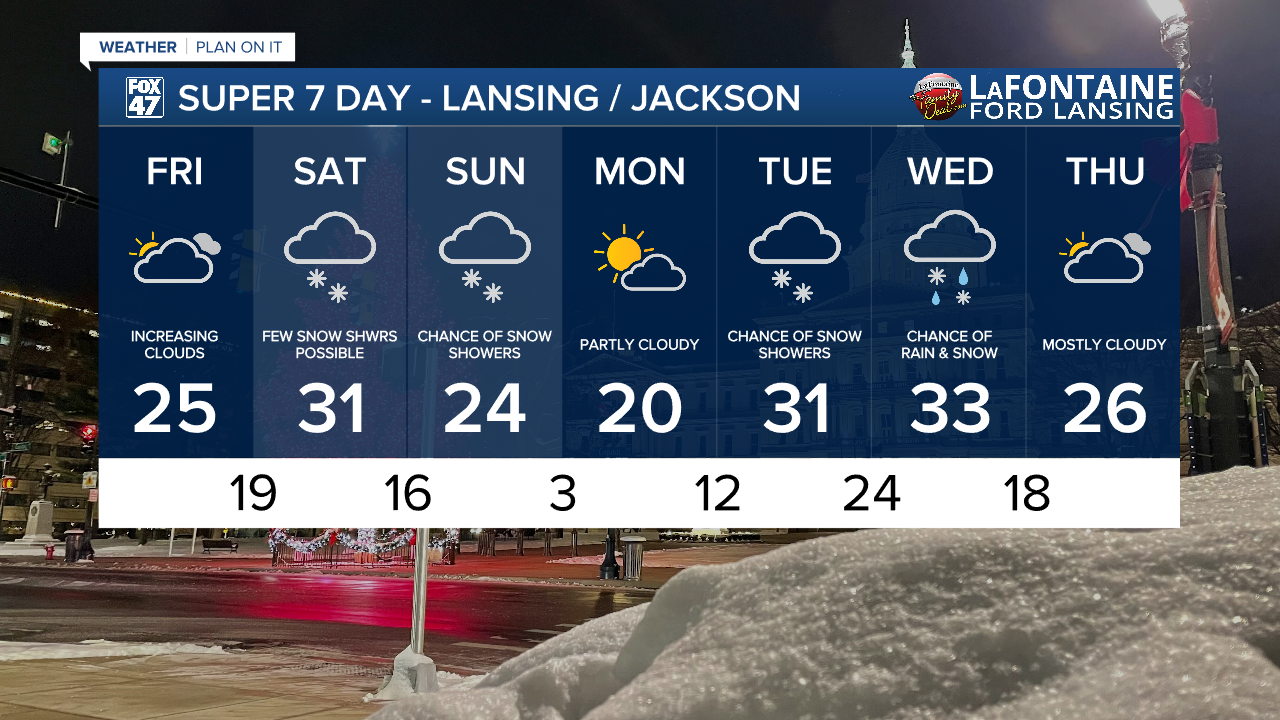
Partly cloudy skies will allow some sun through for the first half of Friday. Highs will find their way into the mid 20s in the afternoon, but increasing winds ahead of a new disturbance will work against us, with SSW winds picking up to 10-15 mph. Sub-zero wind chills in the morning will only manage to make it back to the low teens in the afternoon. Clouds will begin to increase closer to sunset, giving way to some scattered snow showers late Friday night.
GET YOUR FOX 47 FORECAST HERE
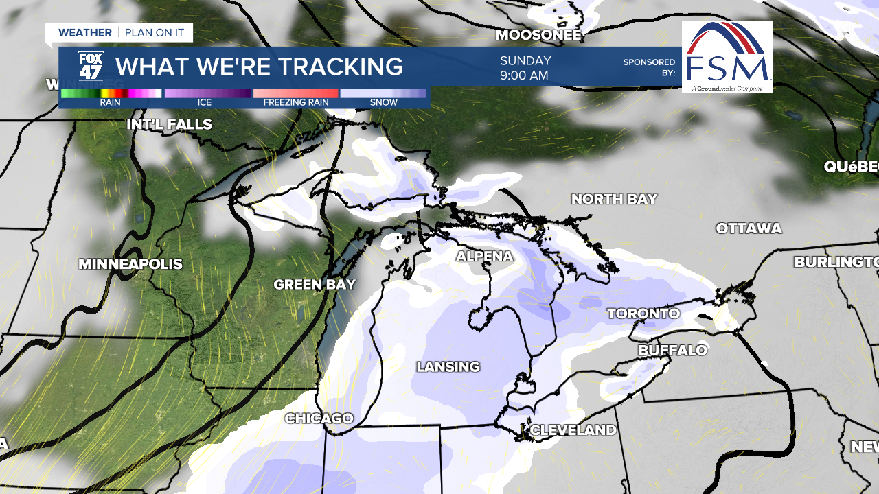
Hard pressed to call it a warmup, but temperatures will manage to climb back into the low 30s on Saturday. A few leftover snow showers from Friday night's disturbance will be possible, but the day will be quiet otherwise with mostly cloudy skies. A second disturbance now looks likely on Sunday, bringing a more significant wave of snow showers with it, and dragging highs back into the mid 20s.
Monday keeps it cold in the mid 20s, but with partly cloudy skies making a brief return. From there, chances appear to be increasing for temperatures to, at least briefly, climb above freezing next week. A pair of disturbances are currently expected to pass through the Great Lakes on Tuesday and again on Wednesday. Tuesday's will bring plain snow showers as highs remain in the low 30s, but current trends point to highs reaching the mid 30s on Wednesday, leading to more of a rain/snow mix.
Want more FOX 47 News? Here's how you download our Roku app
You can also see the latest news from across our mid-Michigan neighborhoods by liking us on Facebook or following us on X.
