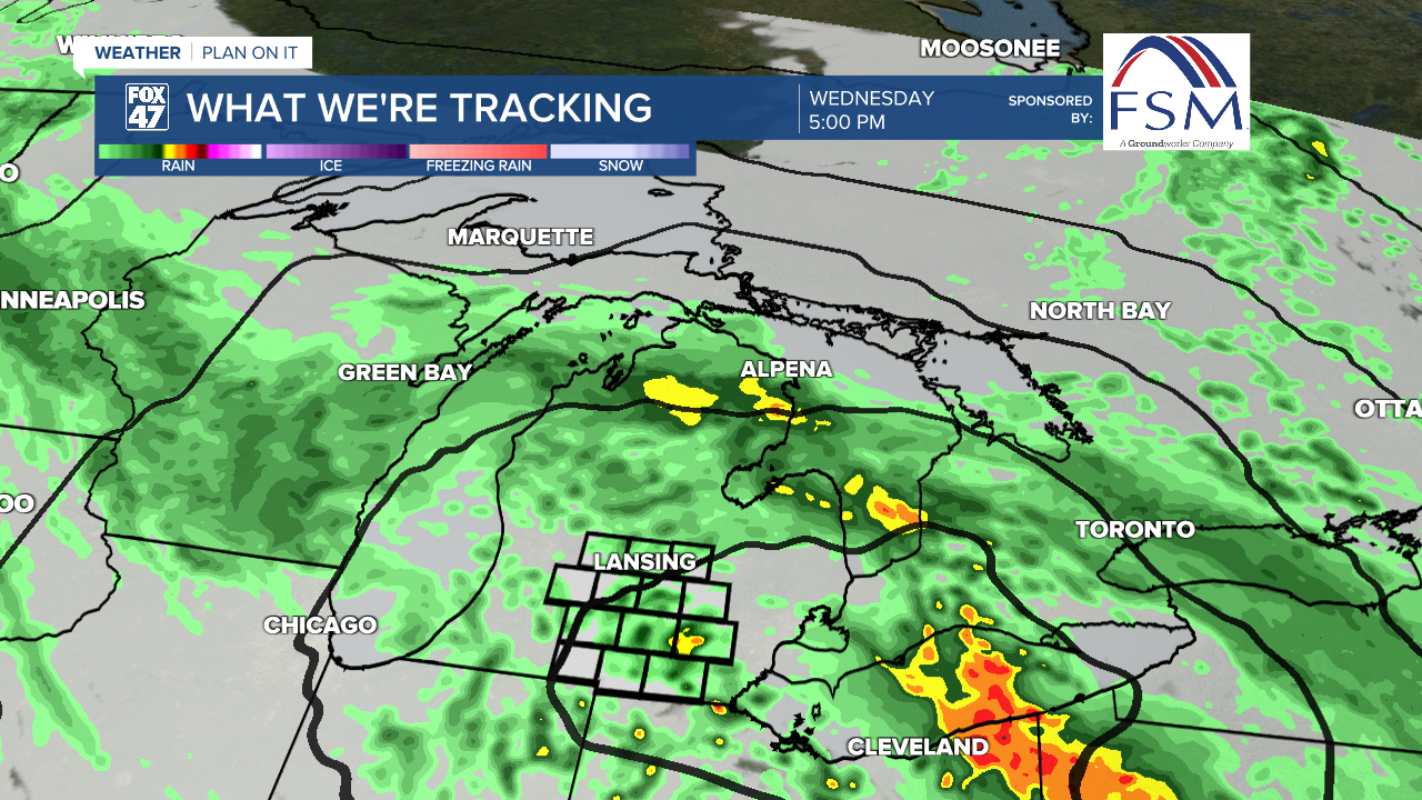
LANSING, Mich. — Showers continue today across our neighborhoods so make sure to grab the umbrella when heading outside. Lansing accumulated .57" of rainfall on Tuesday. That makes five days this month with daily rainfall exceeding .5".
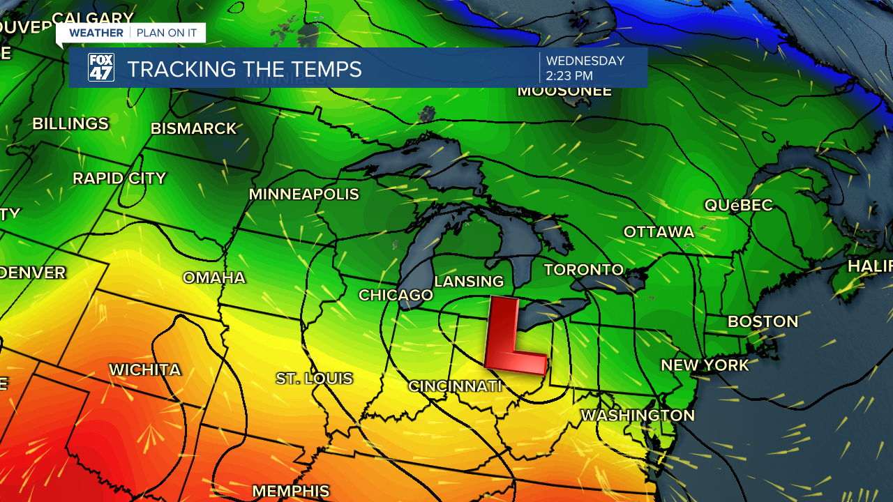
An area of low pressure will continue to track east just south of the state of Michigan. This setup keeps warmer air south of the state with showers staying pretty tame. We could see some areas of heavier rainfall rates as well as a rumble of thunder mainly to the south due to the transfer of moist air into our southern neighborhoods. No severe weather is expected for today, however.
WATCH THE FULL FORECAST BELOW
We are expecting a brief break from the rainfall in the mid to late morning hours today with the rainfall picking back up this afternoon. As the area of low pressure advances east of our neighborhoods, rain showers will become more broken and isolated. This trend will be in play for Thursday as temperatures will continue to stay below average with winds turning out of the north.
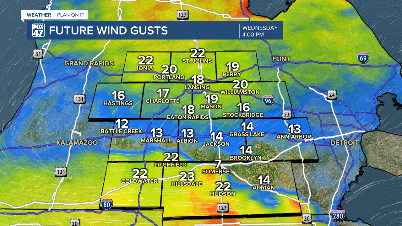
Speaking of our winds, gusts will be less elevated compared to yesterday. Northern neighborhoods could see gusts up to 20 mph this afternoon. Southern neighborhoods including Hillsdale still have a chance to see winds gust up to 30 mph today as that low track through the Michigan/Indiana/Ohio border. Winds will strengthen as they turn out of the north on Thursday allowing for renewed cooling conditions.
We will start to feel some relief as we head into the weekend. Temperatures will warm back into the 60's with drier conditions expected. However, precipitation is looking to return early next week. We will be watching closely.

Want to learn more about the Weather? Visit the FOX47News Website.
Stay in touch with us anytime, anywhere.
Sign up for newsletters emailed to your inbox.
Select from these options: Breaking News, Severe Weather, School Closings, Daily Headlines and Daily Forecasts.
