
LANSING, Mich. — Occasional showers and storms will continue overnight into Tuesday morning as a cold front slowly moves across the state. Temperatures will wind up in the upper 50s by daybreak.
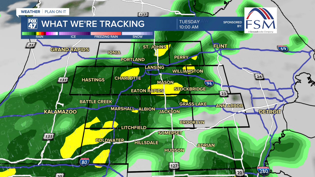
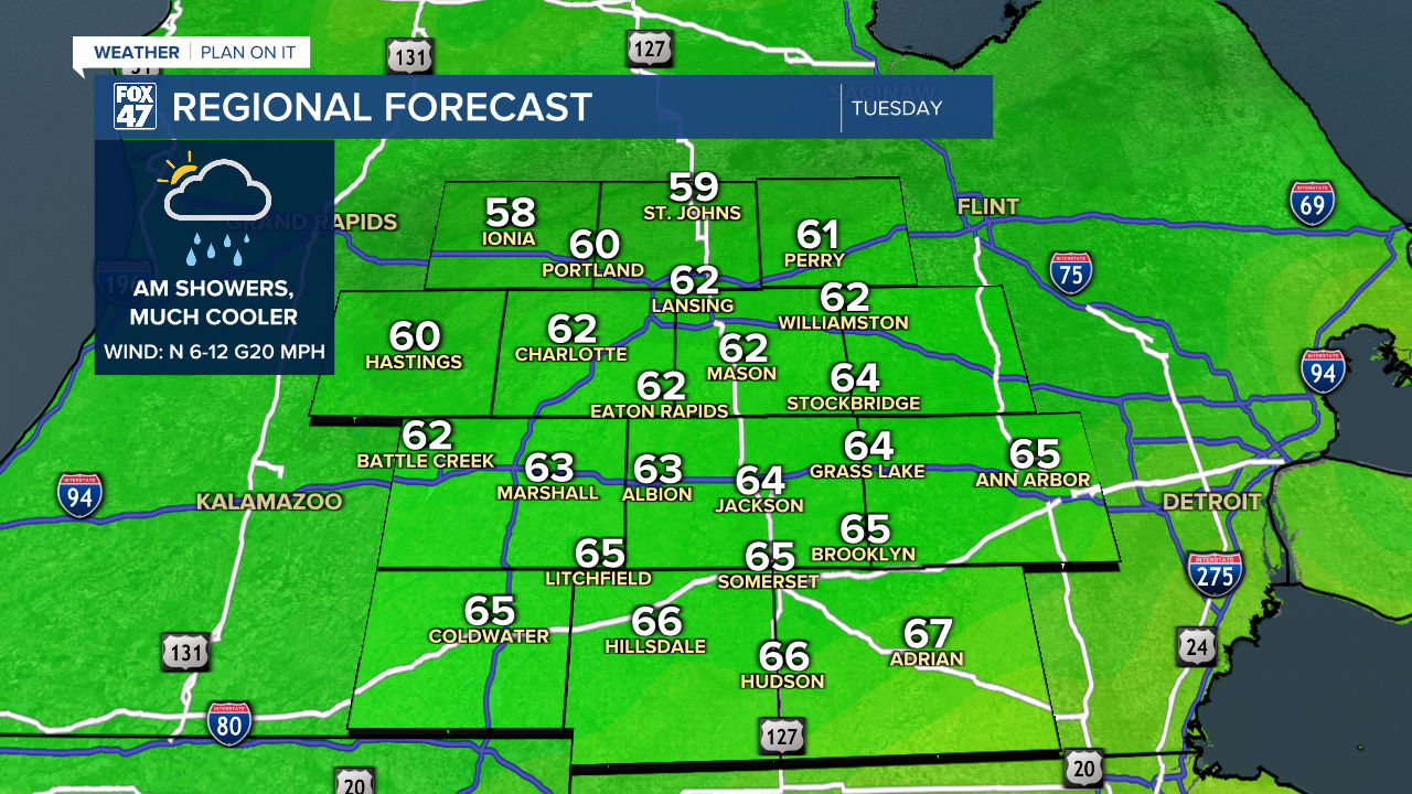
Expect a soggy commute on Tuesday morning, and make sure to take an umbrella with you. Showers and possibly a few thunderstorms will continue through midday, then taper off in the afternoon. Cloudy skies for the first half of the day will eventually give way to a bit of sunshine, but the bigger change will come with our temperatures. Readings are expected to hover in the upper 50s to low 60s throughout the day, marking a drop of 20 degrees or more compared to Monday!
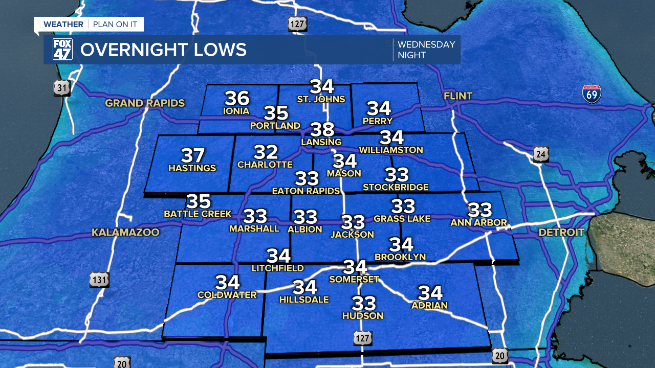
Mostly clear skies will lead into a cold Tuesday night, with lows taking a dive toward the upper 30s. High pressure takes control of our weather on Wednesday and locks in the Fall feeling. Highs Wednesday will only climb to around 60s degrees, followed by lows in the mid 30s Wednesday night. This will likely lead to the first widespread frost of the season, so be ready to protect your pets and plants!
Sunny weather stays in control Thursday and through the upcoming weekend, interrupted only by a weak disturbance that could bring a few showers to the area on Friday evening. Highs will start this stretch in the low 60s, gradually warming to the low 70s by Sunday and Monday. Lows will trend upward as well, climbing from the upper 30s Thursday night to the upper 40s by the end of the weekend.
GET YOUR FOX 47 FORECAST HERE
Want more FOX 47 News? Here's how you download our Roku app
You can also see the latest news from across our mid-Michigan neighborhoods by liking us on Facebook or following us on X.
