
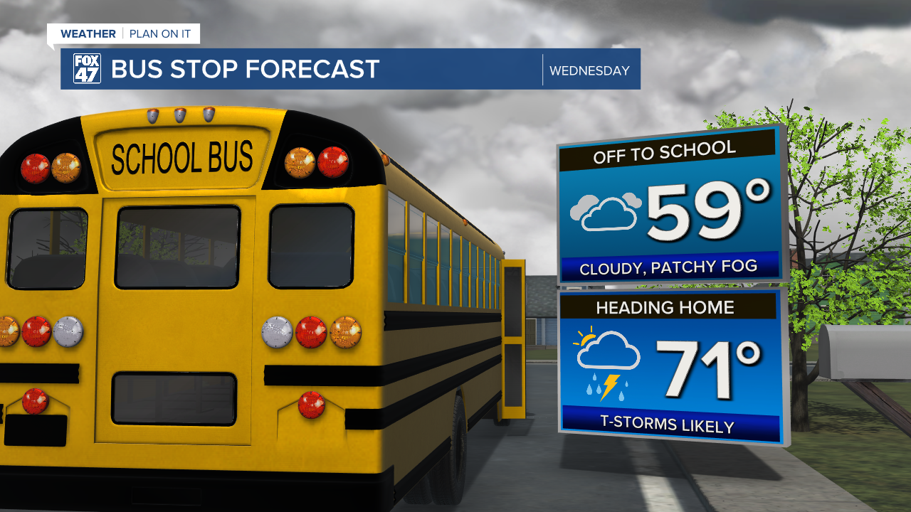
Skies will steadily become overcast after midnight, along with patchy fog beginning to develop after 3:00 AM. Be prepared for reduced visibility on the Wednesday morning commute, with overnight lows falling into the upper 50s. Winds will be light and variable.

We remain stuck in the same pattern on Wednesday as an upper-level low pressure system stalls over the region. Following morning clouds and any leftover fog, we'll see a few breaks of sun in the afternoon. This will help to fuel another round of scattered showers and thunderstorms, and could make for some wet travel on the evening commute. Temperatures will hold close to average for the first time in the past couple of weeks, with highs reaching the low 70s.

The upper-low will finally get on the move Thursday, but we'll keep the chance for a few more showers and storms around. Activity will be less numerous compared to Tuesday and Wednesday, but you'll want the umbrella all the same. Highs will remain near average in the low 70s.
GET YOUR FOX 47 FORECAST HERE
Clouds decrease on Friday, and then it's smooth sailing straight through the weekend. The returning sunshine will warm our temperatures back up a bit, reaching the upper 70s to close out the work week. We'll inch a little closer to 80 degrees on Saturday and Sunday, with mostly sunny skies setting up perfect weather for outdoor activities. Similar weather continues into Monday and Tuesday, as well.

Want more FOX 47 News? Here's how you download our Roku app
You can also see the latest news from across our mid-Michigan neighborhoods by liking us on Facebook or following us on X.
