
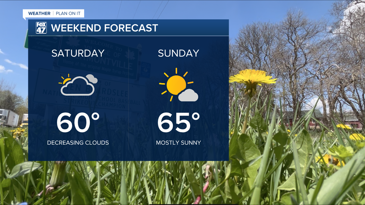
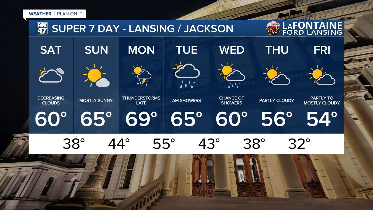
High pressure slowly takes the reins today, keeping us dry and gradually allowing sunshine to return. Clouds will decrease today after a cloudy start in the morning. Temperatures will take a dip behind Friday's cold front, but we'll still be looking at highs in the upper 50s to around 60. Expect a breezier day, with NNW winds picking up to 10-15 mph.
GET YOUR FOX 47 FORECAST HERE
Sunday lives up to its namesake, with mostly sunny skies expected for the second half of the weekend. Temperatures will remain comfortably mild in the mid 60s, making for a perfect day for outdoor plans!

Monday continues the mix of sun and clouds during the day, but a new storm system will bring our next round of thunderstorms late in the evening. Highs will warm up slightly, returning to around 70 degrees ahead of the storms, with some showers lingering into Tuesday morning.
Have a great weather picture or video to share? Send it our way and we may feature it on-air or online!

